1990s Maps of Dunkard Township, Pennsylvania
Explore 2 historic maps of Dunkard Township from the 1990s. These maps offer a rare glimpse into what life looked like during the 1990s — showing old roads, neighborhoods, homes, and landmarks that have changed or disappeared over time.
Whether you're researching your family's past, planning a metal detecting trip, or studying how Dunkard Township's landscape evolved across the 1990s, these high-resolution maps are a powerful tool for exploring the history of this region.
- Focus on a specific era: All maps on this page are from the 1990s, giving you a focused view of this time period.
- See what’s changed: Compare century-old streets, trails, and buildings to today's modern landscape using overlays and satellite layers.
- Research with precision: Use these maps for genealogy, historical research, land use analysis, or educational projects.
- View, download, or print: Maps are fully viewable online in high resolution, and can be downloaded or printed for your own records.
Start exploring Dunkard Township's history through authentic maps from the 1990s. This is your window into the past.
Dunkard Township, PA maps
(2)- 1994 Map of Morgantown North, 2000 Print
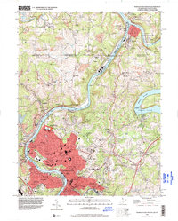 1994 Morgantown North2000 Print · USGSMorgantown and the Monongahela River valley are captured in the mid-1990s as the region solidified its role as a university and research center. Genealogists can locate family-named sites like Lazzell Cem and Everley Cem or trace the historic Mason and Dixon Line.
 - 1997 Map of Osage, 1999 Print
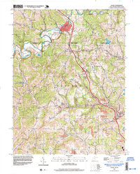 1997 Osage1999 Print · USGSCrossing the Pennsylvania and West Virginia border in the late nineties, this area showcases the transition from traditional agriculture to intensive mining. Researchers can trace family sites like Greeley Sch, Buckeye Ch, and the Cedar Grove Cem near Mount Morris.
End of results
Showing maps 1-2 of 2
Top cities near Dunkard Township
- Morgantown historical maps
- Luzerne Township historical maps
- Waynesburg historical maps
- Westover historical maps
- Masontown historical maps
- Springhill Township historical maps
See more
Top neighborhoods of Dunkard Township
- Wiley historical maps
- Bald Hill historical maps
- Walnut Hill historical maps
- West Point Marion historical maps
- Bobtown historical maps
- Dilliner historical maps
See more
Frequently asked questions
- What are the different types of historical maps available for Dunkard Township?
- What is the oldest map of Dunkard Township?
- Where can I purchase historical maps of Dunkard Township for my home or office?
- Where can I download high-res historical maps of Dunkard Township?
- Are there historical topographic maps available for Dunkard Township?
- Is there historical aerial imagery available for Dunkard Township?
- Where are historical maps of Dunkard Township sourced from?