Old Maps of Dunkard Township, Pennsylvania for Genealogy
Trace your family roots with 53 historic maps of Dunkard Township. These high-res maps reveal old neighborhoods, homesites, landmarks, and streets — helping you uncover where your ancestors lived and how the area evolved over time.
- Explore historic neighborhoods: Identify where your relatives may have lived in the 1800s or 1900s.
- Compare maps over time: Trace the changes in streets, buildings, and landmarks for multi-generational research.
- Perfect for genealogy & ancestry research: Used by family historians and researchers to map out lineage and migration.
These maps are an incredible resource for exploring your personal connection to Dunkard Township's past.
Dunkard Township, PA maps
(53)- 1900 Map of Masontown
 1900 Masontown1900 Print · USGSThe Monongahela River valley was a hub of transit and industry at the turn of the century, defined by its numerous ferry crossings and coal-country junctions. Researchers can trace historic river crossings like McCanns Ferry, follow the National Pike, and locate vanished rail stops at Ache Junction.
 - 1901 Map of Waynesburg, 1958 Print
 1901 Waynesburg1958 Print · USGSGreene County at the start of the twentieth century shows a landscape of deep valleys and rising townships connected by the South Fork of Tenmile Creek. Genealogists can trace family names through landmarks like Rees Mill, Gump, and the dual settlement of Kirby Newtown.
 - 1902 Map of Morgantown
 1902 Morgantown1902 Print · USGSMorgantown and the Monongahela River corridor appear here at the dawn of the twentieth century, captured during a period of industrial growth. Genealogists and historians can trace old iron industry sites like Clinton Furnace, river crossings at Ice's Ferry, and early rail routes.5 unique versions available
 - 1903 Map of Masontown
 1903 Masontown1903 Print · USGSThe Monongahela River valley at the turn of the century was a vital artery of ferries and river locks connecting Fayette and Greene Counties. Genealogists and local historians can trace family roots through riverfront landings and towns like Greensboro, Masontown, and Smithfield.4 unique versions available
 - 1904 Map of Blacksville
 1904 Blacksville1904 Print · USGSThe West Virginia and Pennsylvania border comes alive in this survey from the early twentieth century. Researchers can trace the river economy along the Monongahela at Lock No. 13 or locate rural homesteads near Fairview Amos P.O. and Blacksville.3 unique versions available
 - 1904 Map of Waynesburg
 1904 Waynesburg1904 Print · USGSGreene County was a landscape of deeply carved creek valleys and rural crossroads at the start of the twentieth century. Genealogists and local historians can trace early property settings near Waynesburg, Rees Mill, and the riverside borough of Rices Landing.5 unique versions available
 - 1923 Map of Blacksville, 1956 Print
 1923 Blacksville1956 Print · USGSMonongalia and Marion counties appear here during the early twentieth century as the coal and rail economy began to reshape the rural landscape. Researchers can find numerous family landmarks, from Town School and Olive Church to the industrial works at Montana Mines.
 - 1925 Map of Blacksville
 1925 Blacksville1925 Print · USGSMonongalia and Marion Counties are shown in the mid-1920s, a period when rural life centered on a vast network of neighborhood schools and churches. Genealogists can trace family roots through specific landmarks like Stumptown School, Montana Mines, and Monumental Church.4 unique versions available
 - 1925 Map of Morgantown
 1925 Morgantown1925 Print · USGSMorgantown and the Monongahela River valley are shown in the mid-1920s as industrial rail corridors and mountain settlements expanded. Trace old family schoolhouses, mining-era rail stops at Dellslow Sta, and the historic Laurel Iron Works near the Cheat River.2 unique versions available
 - 1931 Map of Masontown, 1957 Print
 1931 Masontown1957 Print · USGSFayette County’s industrial landscape is captured here during the 1930s, showing the high-water mark of the regional coal and coke era. Genealogists and historians can trace company towns and numbered mines like Tower Hill No 1 and Thompson No 2 alongside river crossings like Crows Ferry.
 - 1931 Map of Morgantown, 1962 Print
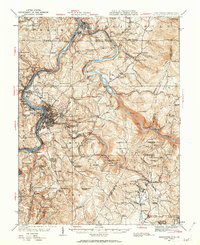 1931 Morgantown1962 Print · USGSMorgantown and the Monongahela River valley are shown here during the early twentieth-century peak of the regional rail-and-river economy. Genealogists can trace family names through numerous rural landmarks like Lazzell School, Burns Chapel, and Clinton Furnace.
 - 1933 Map of Morgantown
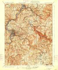 1933 Morgantown1933 Print · USGSMorgantown and the surrounding Monongalia County river valleys are captured here in the early 1930s during a period of industrial maturity. Genealogists and historians can trace family locations near Clinton Furnace, Maidsville PO and Sta, and McClure Chapel.3 unique versions available
 - 1935 Map of Masontown
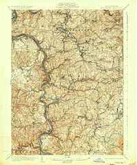 1935 Masontown1935 Print · USGSFayette and Greene Counties come alive in the 1930s as the river-and-rail economy of the Monongahela Valley reaches its peak. Genealogists can trace family roots through numerous country schools like Christopher Sch and historic sites such as Friendship Hill.2 unique versions available
 - 1948 Map of Cumberland
 1948 Cumberland1948 Print · USGSMid-century Appalachia and the Shenandoah Valley are shown in detail, documenting the industrial and transportation hubs of the tri-state area. Genealogists can trace family roots through settlements like Double Tollgate and Bunker Hill or along the Baltimore & Ohio RR.3 unique versions available
 - 1949 Map of Clarksburg
 1949 Clarksburg1949 Print · USGSThe upper Ohio River valley and the industrial heart of West Virginia come into focus during this post-war period. Genealogists and researchers can trace the rail corridors of the Baltimore and Ohio and locate centers like Fairmont, Grafton, and Waynesburg.
 - 1952 Map of Cumberland
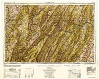 1952 Cumberland1952 Print · USGSThe Potomac Highlands and the Shenandoah Valley are revealed in this early 1950s survey of the Appalachian interior. Researchers can trace the river-and-rail corridors connecting Cumberland, Winchester, and the recreational waters of Deep Creek Lake.
 - 1956 Map of Cumberland, 1966 Print
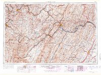 1956 Cumberland1966 Print · USGSThe tri-state Highlands in the mid-1950s show a landscape shaped by coal, timber, and the massive presence of the Baltimore & Ohio RR. Researchers can trace the industrial corridor from Cumberland through the Allegheny Mountains to mountain retreats like Deep Creek Lake.6 unique versions available
 - 1956 Map of Clarksburg, 1966 Print
 1956 Clarksburg1966 Print · USGSThe Ohio River valley and the industrial heart of West Virginia are seen here in the mid-1950s as rail and river commerce thrived. Researchers can trace historic transport lines like the Baltimore and Ohio RR and locate ancestral homes in Clarksburg, Moundsville, or Parkersburg.2 unique versions available
 - 1957 Map of Cumberland
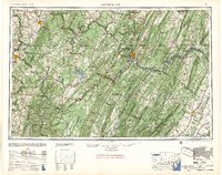 1957 Cumberland1957 Print · USGSThe Potomac River valley and the ridges of the Allegheny Front define this mid-century landscape at the intersection of Maryland, West Virginia, and Pennsylvania. Trace the steam-era rail lines of the Baltimore and Ohio RR or locate rural landmarks like St Stephens Church and Stony River Dam.
 - 1957 Map of Morgantown North, 1959 Print
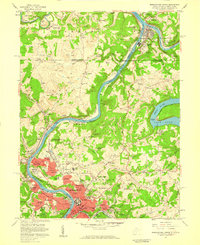 1957 Morgantown North1959 Print · USGSMonongalia County's river-and-rail economy is in full view during the late fifties, showing the growth of Morgantown and its industrial satellites. Genealogists and historians can trace family roots through Taylortown and Bertha Hill, or locate institutions like West Virginia University.4 unique versions available
 - 1958 Map of Osage, 1961 Print
 1958 Osage1961 Print · USGSThe West Virginia-Pennsylvania state line and the Monongahela River valley are shown in the late fifties, capturing a landscape shaped by mining and rail. Genealogists can trace family names through rural landmarks like Lemley Cem, Greeley Sch, and the community at Mount Morris.3 unique versions available
 - 1961 Map of Clarksburg
 1961 Clarksburg1961 Print · USGSThe mid-century industrial and river landscapes of West Virginia and Ohio are detailed here, centered on the Ohio River. Researchers can trace the Baltimore and Ohio rail lines connecting towns like Parkersburg, Clarksburg, and Monongah.
 - 1961 Map of Cumberland
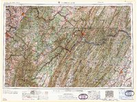 1961 Cumberland1961 Print · USGSThe tri-state highlands of Maryland, West Virginia, and Pennsylvania are shown in the mid-twentieth century as a complex landscape of ridges and river valleys. Researchers can trace the winding Potomac River and find old rail-and-river towns like Cumberland, Keyser, and Morgantown.
 - 1961 Map of Garards Fort, 1963 Print
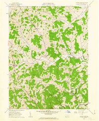 1961 Garards Fort1963 Print · USGSGreene County in the early sixties remains a patchwork of family cemeteries and coal shafts. Genealogists can trace ancestral sites like Morris Cem or the Asbury Ch, while others can find the exact locations of the Garards Fort Shaft and old Covered Bridge.4 unique versions available
 - 1962 Map of Cumberland
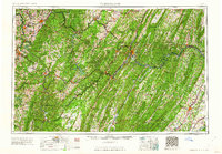 1962 Cumberland1962 Print · USGSThe central Appalachians meet at the height of the mid-century industrial era, showing the rugged topography between Morgantown and Winchester. Genealogists can trace family lands near Fort Necessity or along the vital Baltimore & Ohio RR corridors.
Showing maps 1-25 of 53
Top cities near Dunkard Township
- Morgantown historical maps
- Luzerne Township historical maps
- Waynesburg historical maps
- Westover historical maps
- Masontown historical maps
- Springhill Township historical maps
See more
Top neighborhoods of Dunkard Township
- West Point Marion historical maps
- Davistown historical maps
- Bobtown historical maps
- Dilliner historical maps
- Moffitt Sterling historical maps
- Newtown historical maps
See more
Frequently asked questions
- What are the different types of historical maps available for Dunkard Township?
- What is the oldest map of Dunkard Township?
- Where can I purchase historical maps of Dunkard Township for my home or office?
- Where can I download high-res historical maps of Dunkard Township?
- Are there historical topographic maps available for Dunkard Township?
- Is there historical aerial imagery available for Dunkard Township?
- Where are historical maps of Dunkard Township sourced from?