Old Maps of Cromwell Township, Pennsylvania
Explore 19 old maps of Cromwell Township, spanning from 1922 to today. These high-resolution historic maps reveal how streets, neighborhoods, landmarks, and natural features evolved over time — perfect for genealogy, metal detecting, research, and local history exploration.
What you can do with these maps:
- See how Cromwell Township changed over time: Compare historical maps to modern-day views to trace roads, homesites, rail lines & more.
- View detailed metadata: Each map includes creators, publishers, year, scale, and archive source.
- Overlay maps with satellite & LiDAR: Visualize the past alongside modern tools to explore terrain & human change.
- Trusted historical sources: Maps sourced from the USGS, Library of Congress, and other archives.
- Access maps your way: View online, download high-res files, or order prints for personal or research use.
Start exploring old maps of Cromwell Township to uncover forgotten places, hidden landmarks, and the deep history beneath your feet.
Cromwell Township, PA maps
(19)- 1922 Map of Mt Union
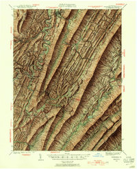
 1922 Mt Union1922 Print · USGSThe Juniata River valley in the early 1920s reveals a landscape shaped by the Pennsylvania RR and early motor routes like the Lincoln Highway. Genealogists can trace dozens of rural schoolhouses and vanished post offices, including Red Fork PO, Shirleysburg, and Lucy Furnace School.2 unique versions available
 - 1924 Map of Mt. Union
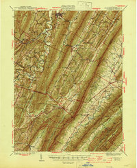
 1924 Mt. Union1924 Print · USGSMount Union and the central Juniata River valley are shown here in the mid-twenties as the rail-and-river economy flourished. Genealogists can locate dozens of named rural schools like Smoke School and old post offices such as Shade Valley P.O.4 unique versions available
 - 1939 Map of Orbisonia, 1954 Print
 1939 Orbisonia1954 Print · USGSOrbisonia and the surrounding mountain gaps are captured in the late thirties just as the modern turnpike was transforming the valley. Researchers can trace the narrow-gauge East Broad Top RR or find rural landmarks like Burnt Cabins and Jordan Cem.7 unique versions available
 - 1940 Map of Orbisonia
 1940 Orbisonia1940 Print · USGSCentral Pennsylvania's Ridge and Valley province is captured here just as the Pennsylvania Turnpike reached Burnt Cabins. Researchers can trace the narrow-gauge EAST BROAD TOP RR and locate family landmarks like Jordan Cem, Kuhns Mill, or St Marys Ch.2 unique versions available
 - 1944 Map of Orbisonia
 1944 Orbisonia1944 Print · USGSCentral Pennsylvania's ridge-and-valley landscape is shown here at the height of the narrow-gauge era just as modern highways arrived. Researchers can trace the East Broad Top RR through Rockhill, find legacy family sites like Kuhns Mill, and locate the Pennsylvania Turnpike near Burnt Cabins.3 unique versions available
 - 1944 Map of Mt. Union
 1944 Mt. Union1944 Print · USGSThe Juniata River valley and the ridges of Huntingdon and Mifflin counties are shown here at the peak of the rail era. Genealogists and historians can trace the locations of dozens of vanished schoolhouses like Lucy Furnace Sch and rural outposts like Atkinson Mills or Mapleton Depot.
 - 1950 Map of Harrisburg, 1952 Print
 1950 Harrisburg1952 Print · USGSMid-century Central Pennsylvania comes alive through its dense rail networks and river valley settlements during the post-war industrial era. Genealogists and historians can trace family roots through hubs like Harrisburg, locate Carlisle Barracks, or follow the Pennsylvania RR through the Lebanon Valley.
 - 1957 Map of Harrisburg
 1957 Harrisburg1957 Print · USGSMid-century Central Pennsylvania comes into focus as a bustling network of rail, river, and mountain ridges. Genealogists and historians can trace the development of the State Capitol and surrounding hubs like Middletown, Columbia, and Pottsville.7 unique versions available
 - 1959 Map of Butler Knob, 1960 Print
 1959 Butler Knob1960 Print · USGSThe ridge-and-valley country of Huntingdon County is captured here in the late fifties, showing a landscape defined by steep summits and tight-knit valley farms. Genealogists can locate family burial sites like Bare-Garver Cem and Schwartz Cem or trace rural congregations at Sugar Run Ch.3 unique versions available
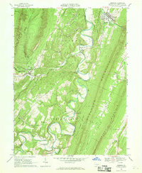
 - 1959 Map of Aughwick, 1961 Print
 1959 Aughwick1961 Print · USGSThe ridges and valleys of Huntingdon and Mifflin Counties are shown here during the late fifties as small farming and industrial communities like Shirleysburg and Kistler thrived. Researchers can find numerous historic burial sites, including McGarvey Cem, and landmarks such as the American Legion Country Club along the Juniata River.3 unique versions available
 - 1961 Map of Harrisburg
 1961 Harrisburg1961 Print · USGSCentral Pennsylvania is shown at a mid-century peak of industrial and military activity, from the Susquehanna water gaps to the fertile Dutch Country. Genealogists and historians can trace the rail corridors of the Pennsylvania RR and find landmarks like Carlisle Barracks or the Anthracite Coal Fields.2 unique versions available
 - 1964 Map of Harrisburg
 1964 Harrisburg1964 Print · USGSCentral Pennsylvania in the mid-fifties reveals a landscape shaped by ridge-and-valley geology and critical Cold War infrastructure. Researchers can trace the massive Indiantown Gap Military Reservation or the rail corridors of the Pennsylvania RR and Reading RR.
 - 1966 Map of Orbisonia, 1969 Print
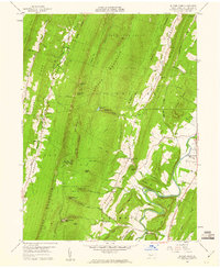
 1966 Orbisonia1969 Print · USGSIn the mid-sixties, the ridges of Huntingdon County remained a land of small settlements and rugged mountain gaps. Local historians can trace family roots through the IOOF Cem, the McKendree Ch, and the rural crossroads of Meadow Gap and Maddensville.3 unique versions available
 - 1966 Map of Shade Gap, 1969 Print
 1966 Shade Gap1969 Print · USGSRidge-and-valley terrain in the mid-1960s defines this part of Huntingdon and Franklin counties, where rural life followed the mountain gaps. Genealogists can locate family sites at Gilliland Cem, Path Valley Cem, and the village of Neelyton.4 unique versions available
 - 1984 Map of Carlisle, 1985 Print
 1984 Carlisle1985 Print · USGSSouth-central Pennsylvania is shown during the mid-eighties as a hub of military activity and mountain transit. Genealogists and historians can trace the development of Carlisle Barracks and Letterkenny Army Depot, alongside rail routes like Conrail.2 unique versions available
 - 2023 Map of Aughwick, 2023 Print
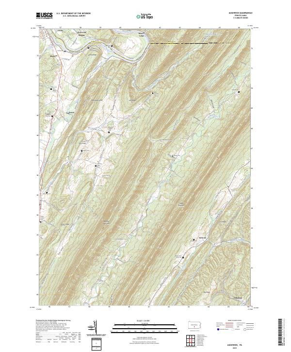 2023 Aughwick2023 Print · USGSHuntingdon County's ridge-and-valley landscape is mapped here in detail, showing the rural communities along the Juniata River and Aughwick Creek. Researchers can locate numerous family burial grounds including McGarvey Cem, Shope Cem, and the Otelia Mennonite Church Cem.
 - 2023 Map of Orbisonia, 2023 Print
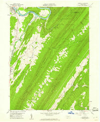
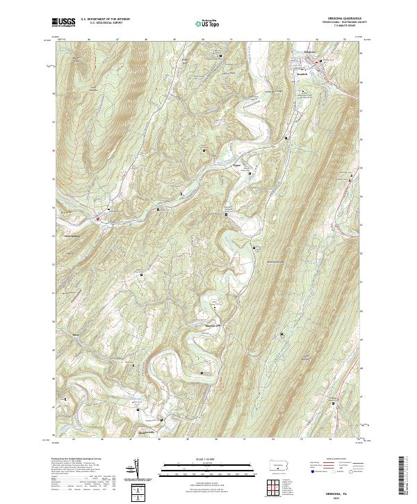 2023 Orbisonia2023 Print · USGSIn the valley between Jacks Mountain and Blacklog Mountain, this Huntingdon County landscape shows a network of ridge-top roads and creek-side settlements. Genealogists can trace family lines through the Orbisonia Cem, Ramsey Family Cem, and Booth Family Cem.
 - 2023 Map of Shade Gap, 2023 Print
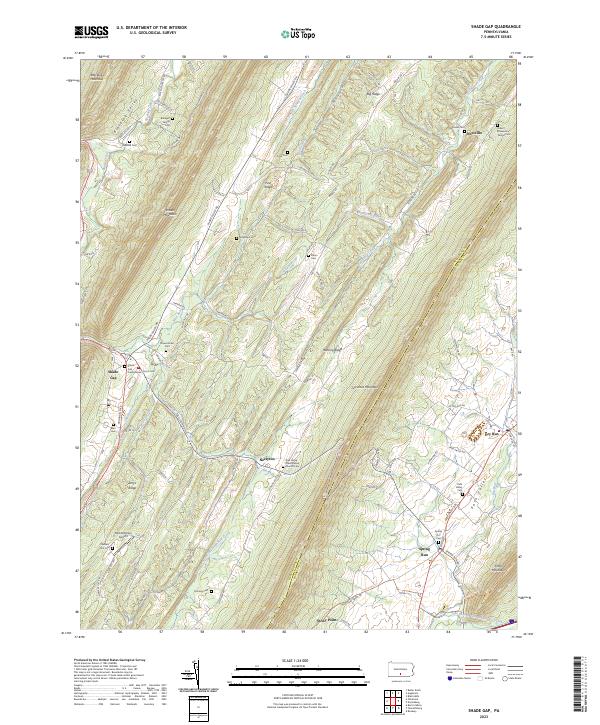 2023 Shade Gap2023 Print · USGSThe Huntingdon and Franklin county line runs through this landscape of steep ridges and narrow valleys in the twenty-first century. Genealogists can trace local history through numerous sites including the Bolinger Family Cem, Possumtown Cem, and Shade Gap Presbyterian Church.
 - 2023 Map of Butler Knob, 2023 Print
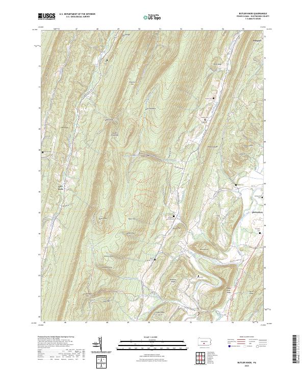 2023 Butler Knob2023 Print · USGSThe ridges and valleys of Huntingdon County are captured here in the early twenty-first century, showing a landscape defined by gaps and agricultural hollows. Genealogists can trace numerous local burial grounds including Dell Family Cem, Ricketts Cem, and Gilboa Cem.
End of results
Showing maps 1-19 of 19
Top cities near Cromwell Township
- Mount Union historical maps
- Lurgan Township historical maps
- Metal Township historical maps
- Todd Township historical maps
- Mapleton historical maps
- Three Springs historical maps
See more
Top neighborhoods of Cromwell Township
Frequently asked questions
- What are the different types of historical maps available for Cromwell Township?
- What is the oldest map of Cromwell Township?
- Where can I purchase historical maps of Cromwell Township for my home or office?
- Where can I download high-res historical maps of Cromwell Township?
- Are there historical topographic maps available for Cromwell Township?
- Is there historical aerial imagery available for Cromwell Township?
- Where are historical maps of Cromwell Township sourced from?