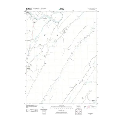
2010 Map of Aughwick
USGS Topo · Published 2010About this map
Shirleysburg and the surrounding river valleys of central Pennsylvania appear here in this modern era survey, characterized by deep-rooted family settlements and numerous burial grounds. The Juniata River winds through the northern portion of the quadrangle near Allenport, while Aughwick Creek and Blacklog Creek carve through the parallel ridges that define the local topography. This landscape is marked by its many distinct cemeteries, such as the Otelia Mennonite Church Cemetery and Saint Catherine Cemetery, which reflect the region's diverse cultural and religious history. The terrain transitions from the broader agricultural lands of Germany Valley to the steep, wooded slopes of Mine Bank Ridge and Big Ridge. Evidence of early industry remains visible through labels like Bell's Furnace Cemetery, while the modern community is represented by sites like the Bible to Youth Camp and the critical Mount Union Reservoir tucked into the northeastern hills.
Find a feature on this map
61 named features on this map. Tap any name to fly to it.
Don’t see what you’re looking for? This feature index may not catch every label — zoom into the map to look around manually.
Map Details
Editions of this 2010 Aughwick Map
This is the sole edition of this map. No revisions or reprints were ever made.
Other maps of this area

1919 · Mattawana
USGS Topo · 1:62,500

1922 · Mt Union
USGS Topo · 1:48,000

1923 · Shippensburg
USGS Topo · 1:62,500

1924 · Mt. Union
USGS Topo · 1:62,500

1936 · East Waterford
USGS Topo · 1:48,000

1939 · Orbisonia
USGS Topo · 1:62,500

1940 · Orbisonia
USGS Topo · 1:62,500

1941 · East Waterford
USGS Topo · 1:62,500

1943 · Shippensburg
USGS Topo · 1:62,500

1944 · Orbisonia
USGS Topo · 1:62,500