
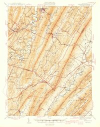
1940 Map of Orbisonia
USGS Topo · Published 1940About this map
The East Broad Top Rr winds through the narrow valleys of Huntingdon and Franklin Counties, serving as a primary corridor for the industrial and agricultural life of the region. This landscape is defined by the rigid parallel ridges of Jacks MTN, Shade Mountain, and Tuscarora Mountain, which channel development into tight agricultural basins like Path Valley and Amberson Valley. The map reveals a dense network of local institutions, including the Wood-Cutting Sch and Pleasant Bank Sch, reflecting the decentralized rural community structure of the late 1930s.
Find a feature on this map
104 named features on this map. Tap any name to fly to it.
Don’t see what you’re looking for? This feature index may not catch every label — zoom into the map to look around manually.
Map Details
Editions of this 1940 Orbisonia Map
2 editions found
Other maps of this area

1900 · Mercersburg
USGS Topo · 1:62,500

1901 · Huntingdon
USGS Topo · 1:62,500

1902 · Chambersburg
USGS Topo · 1:62,500

1902 · Mercersburg
USGS Topo · 1:62,500

1904 · Huntingdon
USGS Topo · 1:62,500

1919 · Mattawana
USGS Topo · 1:62,500

1922 · Mt Union
USGS Topo · 1:48,000

1923 · Shippensburg
USGS Topo · 1:62,500

1924 · Mt. Union
USGS Topo · 1:62,500

1925 · Needmore
USGS Topo · 1:48,000