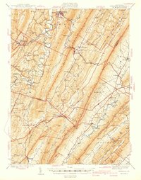
1940 Map of Orbisonia
USGS Topo · Published 1940About this map
Orbisonia and Rockhill anchor this 1940 survey of the Ridge-and-Valley Province, where the East Broad Top RR winds through the narrow gaps of Shade Mtn and Blacklog Mtn. The landscape is defined by parallel ridges and the intricate drainage of Aughwick Creek and Sideling Hill Creek. Settled valleys host a high density of rural institutions, from the specialized Wood-Cutting Sch and Laurel Grove Sch to local landmarks like Hoovers Mill and Kuhns Mill.
Find a feature on this map
114 named features on this map. Tap any name to fly to it.
Don’t see what you’re looking for? This feature index may not catch every label — zoom into the map to look around manually.
Map Details
Editions of this 1940 Orbisonia Map
2 editions found

Other maps of this area

1900 · Mercersburg
USGS Topo · 1:62,500

1901 · Huntingdon
USGS Topo · 1:62,500

1902 · Chambersburg
USGS Topo · 1:62,500

1902 · Mercersburg
USGS Topo · 1:62,500

1904 · Huntingdon
USGS Topo · 1:62,500

1919 · Mattawana
USGS Topo · 1:62,500

1922 · Mt Union
USGS Topo · 1:48,000

1923 · Shippensburg
USGS Topo · 1:62,500

1924 · Mt. Union
USGS Topo · 1:62,500

1925 · Needmore
USGS Topo · 1:48,000