Old Maps of Saltillo, Huntingdon County
Explore 19 old maps of Saltillo, spanning from 1930 to today. These high-resolution historic maps reveal how streets, neighborhoods, landmarks, and natural features evolved over time — perfect for genealogy, metal detecting, research, and local history exploration.
What you can do with these maps:
- See how Saltillo changed over time: Compare historical maps to modern-day views to trace roads, homesites, rail lines & more.
- View detailed metadata: Each map includes creators, publishers, year, scale, and archive source.
- Overlay maps with satellite & LiDAR: Visualize the past alongside modern tools to explore terrain & human change.
- Trusted historical sources: Maps sourced from the USGS, Library of Congress, and other archives.
- Access maps your way: View online, download high-res files, or order prints for personal or research use.
Start exploring old maps of Saltillo to uncover forgotten places, hidden landmarks, and the deep history beneath your feet.
Saltillo, Huntingdon County maps
(19)- 1930 Map of Broad Top, 1958 Print
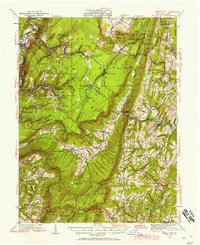 1930 Broad Top1958 Print · USGSCovers Saltillo, including Todd Township, Saxton, and other nearby areas2 unique versions available
 - 1933 Map of Broad Top
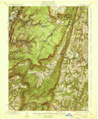 1933 Broad Top1933 Print · USGSCovers Saltillo, including Todd Township, Saxton, and other nearby areas3 unique versions available
 - 1939 Map of Orbisonia, 1954 Print
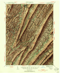 1939 Orbisonia1954 Print · USGSCovers Saltillo, including Metal Township, Three Springs, and other nearby areas7 unique versions available
 - 1940 Map of Orbisonia
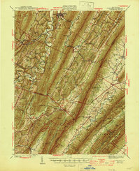
 1940 Orbisonia1940 Print · USGSCovers Saltillo, including Metal Township, Three Springs, and other nearby areas2 unique versions available
 - 1944 Map of Orbisonia
 1944 Orbisonia1944 Print · USGSCovers Saltillo, including Metal Township, Three Springs, and other nearby areas3 unique versions available
 - 1950 Map of Harrisburg, 1952 Print
 1950 Harrisburg1952 Print · USGSCovers Saltillo, including Lancaster, Harrisburg, and other nearby areas
 - 1953 Map of Pittsburgh
 1953 Pittsburgh1953 Print · USGSCovers Saltillo, including Pittsburgh, Penn Hills, and other nearby areas
 - 1954 Map of Pittsburgh
 1954 Pittsburgh1954 Print · USGSCovers Saltillo, including Pittsburgh, Penn Hills, and other nearby areas2 unique versions available
 - 1957 Map of Harrisburg
 1957 Harrisburg1957 Print · USGSCovers Saltillo, including Lancaster, Harrisburg, and other nearby areas7 unique versions available
 - 1958 Map of Pittsburgh
 1958 Pittsburgh1958 Print · USGSCovers Saltillo, including Pittsburgh, Penn Hills, and other nearby areas5 unique versions available
 - 1959 Map of Pittsburgh
 1959 Pittsburgh1959 Print · USGSCovers Saltillo, including Pittsburgh, Penn Hills, and other nearby areas
 - 1961 Map of Harrisburg
 1961 Harrisburg1961 Print · USGSCovers Saltillo, including Lancaster, Harrisburg, and other nearby areas2 unique versions available
 - 1964 Map of Pittsburgh
 1964 Pittsburgh1964 Print · USGSCovers Saltillo, including Pittsburgh, Penn Hills, and other nearby areas
 - 1964 Map of Harrisburg
 1964 Harrisburg1964 Print · USGSCovers Saltillo, including Lancaster, Harrisburg, and other nearby areas
 - 1966 Map of Orbisonia, 1969 Print
 1966 Orbisonia1969 Print · USGSCovers Saltillo, including Three Springs, Orbisonia, and other nearby areas3 unique versions available
 - 1968 Map of Saltillo, 1970 Print
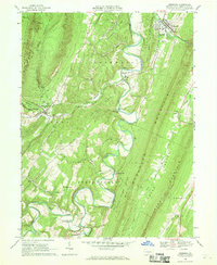
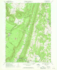 1968 Saltillo1970 Print · USGSCovers Saltillo, including Todd Township, Cass Township, and other nearby areas3 unique versions available
 - 1981 Map of Johnstown, 1983 Print
 1981 Johnstown1983 Print · USGSCovers Saltillo, including Altoona, Johnstown, and other nearby areas
 - 1984 Map of Carlisle, 1985 Print
 1984 Carlisle1985 Print · USGSCovers Saltillo, including Carlisle, Middlesex Township, and other nearby areas2 unique versions available
 - 1994 Map of Saltillo, 1997 Print
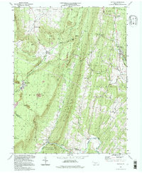 1994 Saltillo1997 Print · USGSCovers Saltillo, including Todd Township, Cass Township, and other nearby areas
End of results
Showing maps 1-19 of 19
Frequently asked questions
- What are the different types of historical maps available for Saltillo?
- What is the oldest map of Saltillo?
- Where can I purchase historical maps of Saltillo for my home or office?
- Where can I download high-res historical maps of Saltillo?
- Are there historical topographic maps available for Saltillo?
- Is there historical aerial imagery available for Saltillo?
- Where are historical maps of Saltillo sourced from?