
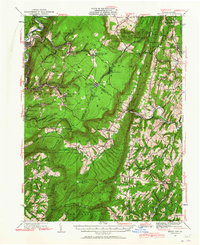
1930 Map of Broad Top
USGS Topo · Published 1958About this map
The Huntingdon and Broad Top Mountain RR winds through the coal-bearing ridges of south-central Pennsylvania, connecting the mining settlements of Broad Top City, Robertsdale, and Woodvale. This industrial corridor is defined by its extraction economy, evidenced by the Garlick Mine and the rugged topography of Broad Top and Carbon mountains. The rail lines follow narrow creek valleys like Shoup Run and Six Mile Run, while the southern reaches of the map show the emerging motorized era with the Lincoln Highway passing near Wells Tannery.
Find a feature on this map
117 named features on this map. Tap any name to fly to it.
Don’t see what you’re looking for? This feature index may not catch every label — zoom into the map to look around manually.
Map Details
Editions of this 1930 Broad Top Map
2 editions found
Other maps of this area

1900 · Mercersburg
USGS Topo · 1:62,500

1900 · Everett
USGS Topo · 1:62,500

1901 · Huntingdon
USGS Topo · 1:62,500

1902 · Everett
USGS Topo · 1:62,500

1902 · Mercersburg
USGS Topo · 1:62,500

1902 · Hollidaysburg
USGS Topo · 1:62,500

1903 · Hollidaysburg
USGS Topo · 1:62,500

1904 · Huntingdon
USGS Topo · 1:62,500

1922 · Mt Union
USGS Topo · 1:48,000

1924 · Mt. Union
USGS Topo · 1:62,500