Old Maps of Saltillo, Huntingdon County for Academic Research
Study the evolution of Saltillo with 19 high-resolution historic maps. Whether you're teaching, researching, or modeling changes in land use, these maps provide essential visual documentation of urban, environmental, and geographic change.
- Analyze long-term change: Track patterns in development, transportation, and natural features.
- Ideal for environmental or urban studies: Support academic projects with primary historical map data.
- Use in the classroom or lab: Educators and researchers rely on these maps to bring historical context to life.
These maps are a powerful tool for teaching, research, and visualizing how Saltillo has changed over the decades.
Saltillo, Huntingdon County maps
(19)- 1930 Map of Broad Top, 1958 Print
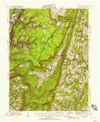 1930 Broad Top1958 Print · USGSCovers Saltillo, including Todd Township, Saxton, and other nearby areas2 unique versions available
 - 1933 Map of Broad Top
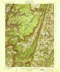 1933 Broad Top1933 Print · USGSCovers Saltillo, including Todd Township, Saxton, and other nearby areas3 unique versions available
 - 1939 Map of Orbisonia, 1954 Print
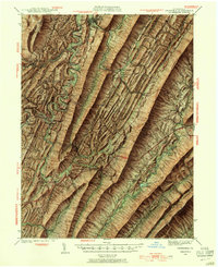 1939 Orbisonia1954 Print · USGSCovers Saltillo, including Metal Township, Three Springs, and other nearby areas7 unique versions available
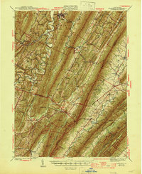
 - 1940 Map of Orbisonia
 1940 Orbisonia1940 Print · USGSCovers Saltillo, including Metal Township, Three Springs, and other nearby areas2 unique versions available
 - 1944 Map of Orbisonia
 1944 Orbisonia1944 Print · USGSCovers Saltillo, including Metal Township, Three Springs, and other nearby areas3 unique versions available
 - 1950 Map of Harrisburg, 1952 Print
 1950 Harrisburg1952 Print · USGSCovers Saltillo, including Lancaster, Harrisburg, and other nearby areas
 - 1953 Map of Pittsburgh
 1953 Pittsburgh1953 Print · USGSCovers Saltillo, including Pittsburgh, Penn Hills, and other nearby areas
 - 1954 Map of Pittsburgh
 1954 Pittsburgh1954 Print · USGSCovers Saltillo, including Pittsburgh, Penn Hills, and other nearby areas2 unique versions available
 - 1957 Map of Harrisburg
 1957 Harrisburg1957 Print · USGSCovers Saltillo, including Lancaster, Harrisburg, and other nearby areas7 unique versions available
 - 1958 Map of Pittsburgh
 1958 Pittsburgh1958 Print · USGSCovers Saltillo, including Pittsburgh, Penn Hills, and other nearby areas5 unique versions available
 - 1959 Map of Pittsburgh
 1959 Pittsburgh1959 Print · USGSCovers Saltillo, including Pittsburgh, Penn Hills, and other nearby areas
 - 1961 Map of Harrisburg
 1961 Harrisburg1961 Print · USGSCovers Saltillo, including Lancaster, Harrisburg, and other nearby areas2 unique versions available
 - 1964 Map of Pittsburgh
 1964 Pittsburgh1964 Print · USGSCovers Saltillo, including Pittsburgh, Penn Hills, and other nearby areas
 - 1964 Map of Harrisburg
 1964 Harrisburg1964 Print · USGSCovers Saltillo, including Lancaster, Harrisburg, and other nearby areas
 - 1966 Map of Orbisonia, 1969 Print
 1966 Orbisonia1969 Print · USGSCovers Saltillo, including Three Springs, Orbisonia, and other nearby areas3 unique versions available
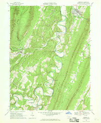
 - 1968 Map of Saltillo, 1970 Print
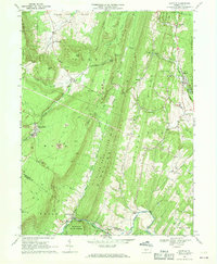 1968 Saltillo1970 Print · USGSCovers Saltillo, including Todd Township, Cass Township, and other nearby areas3 unique versions available
 - 1981 Map of Johnstown, 1983 Print
 1981 Johnstown1983 Print · USGSCovers Saltillo, including Altoona, Johnstown, and other nearby areas
 - 1984 Map of Carlisle, 1985 Print
 1984 Carlisle1985 Print · USGSCovers Saltillo, including Carlisle, Middlesex Township, and other nearby areas2 unique versions available
 - 1994 Map of Saltillo, 1997 Print
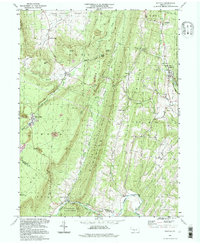 1994 Saltillo1997 Print · USGSCovers Saltillo, including Todd Township, Cass Township, and other nearby areas
End of results
Showing maps 1-19 of 19
Frequently asked questions
- What are the different types of historical maps available for Saltillo?
- What is the oldest map of Saltillo?
- Where can I purchase historical maps of Saltillo for my home or office?
- Where can I download high-res historical maps of Saltillo?
- Are there historical topographic maps available for Saltillo?
- Is there historical aerial imagery available for Saltillo?
- Where are historical maps of Saltillo sourced from?