Old Maps of Banks Township, Pennsylvania for Hiking & Exploration
Hike through history with 34 historic maps of Banks Township. Explore old trails, ghost towns, and forgotten backroads — perfect for outdoor adventurers and local explorers.
- Rediscover forgotten places: Map out old mining camps, roads, and footpaths that no longer exist on modern maps.
- Layer with modern tools: Combine with LiDAR or satellite views to plan hikes through historical terrain.
- Made for exploration: Popular among hikers, overlanders, and local history lovers.
Use these maps to find adventure and explore the hidden past of Banks Township.
Banks Township, PA maps
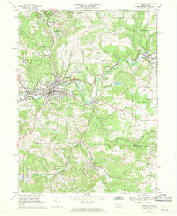
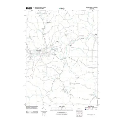
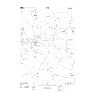
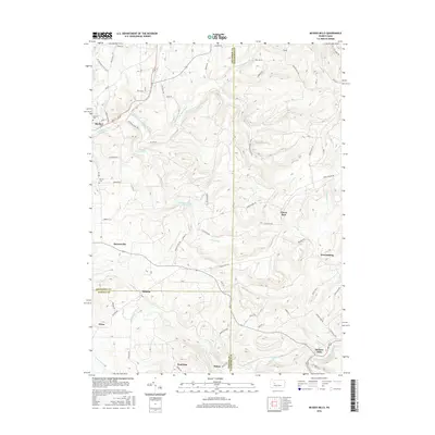
(34)- 1906 Map of Punxsutawney
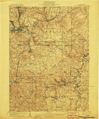 1906 Punxsutawney1906 Print · USGSPunxsutawney and the surrounding coal townships of the early 1900s are captured here at the height of the region's industrial growth. Genealogists and historians can trace the specific locations of historic post offices like Adrian and Gettysburg alongside family-named sites such as Bella Mills.4 unique versions available
 - 1939 Map of Punxsutawney, 1957 Print
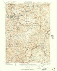 1939 Punxsutawney1957 Print · USGSPunxsutawney and the surrounding coal-and-rail country appear here in the years leading up to World War II. Genealogists and historians can trace defunct school districts like Harmony Thomas Sch, early rail junctions in Cloe, and burial sites at Fairview Cem.2 unique versions available
 - 1942 Map of Punxsutawney
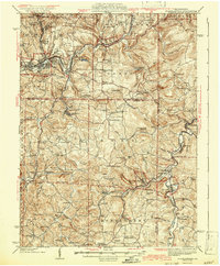 1942 Punxsutawney1942 Print · USGSWest-central Pennsylvania during the early war years reveals a landscape shaped by rail transport and deep-rooted rural communities. Researchers can trace the legacy of local education and industry through dozens of named sites like Harmony Thomas School, McGees Mills, and Bells Mills.2 unique versions available
 - 1943 Map of Punxsutawney
 1943 Punxsutawney1943 Print · USGSThe Pennsylvania coal country around the turn of the century and through the war years is captured in this detailed survey of Jefferson, Indiana, and Clearfield counties. Researchers can trace the rail-reliant economy through Findley Mills, Rossiter Junction, and landmarks like the St Lawrence Fire Tower.
 - 1953 Map of Pittsburgh
 1953 Pittsburgh1953 Print · USGSWestern Pennsylvania's industrial landscape at the start of the fifties shows the steel and rail corridors between Pittsburgh and Altoona. Trace family roots in river towns like Tarentum or follow the Pennsylvania Turnpike across Laurel Hill.
 - 1954 Map of Pittsburgh
 1954 Pittsburgh1954 Print · USGSWestern Pennsylvania in the early fifties remains a powerhouse of heavy industry and vital transit corridors. Genealogists and historians can trace the rail-and-river network connecting Pittsburgh, Johnstown, and Altoona via the Pennsylvania RR and the Lincoln Highway.2 unique versions available
 - 1958 Map of Pittsburgh
 1958 Pittsburgh1958 Print · USGSWestern Pennsylvania in the late fifties shows an industrial heartland defined by the confluence of the Allegheny River and Monongahela River. Researchers can trace the sprawling rail networks of the Pennsylvania RR and find established towns like Butler, Latrobe, and Windber.5 unique versions available
 - 1959 Map of Pittsburgh
 1959 Pittsburgh1959 Print · USGSWestern Pennsylvania in the late fifties is captured here at the height of its industrial era. Genealogists and historians can trace the riverfront growth of Pittsburgh, the rail works at Altoona, and the mountain gaps of Laurel Hill.
 - 1964 Map of Pittsburgh
 1964 Pittsburgh1964 Print · USGSWestern Pennsylvania in the late fifties and early sixties shows a landscape of powerful river industries and expanding highways. Genealogists and historians can trace the rail corridors of the Pennsylvania RR through industrial hubs like Johnstown, Altoona, and Nanty Glo.
 - 1968 Map of Burnside
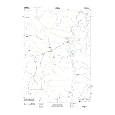
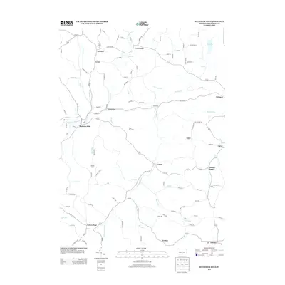
 1968 Burnside1968 Print · USGSThe West Branch Susquehanna River valley shows its industrial character in the late sixties, where rail lines and coal operations meet mountain settlements. Genealogists can trace family roots through sites like Sunderland Cemetery, Patchinville, and SS Peter and Paul Church.5 unique versions available
 - 1968 Map of Punxsutawney, 1970 Print
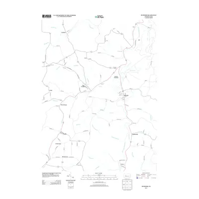
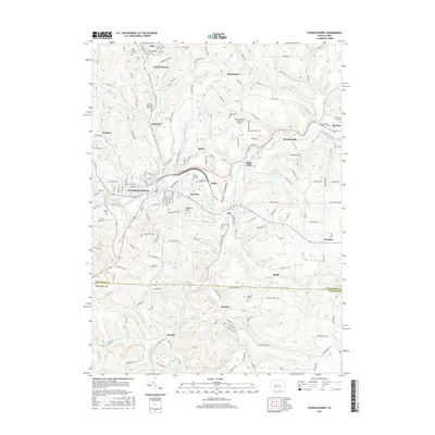
 1968 Punxsutawney1970 Print · USGSPunxsutawney and its surrounding coal-mining townships are captured in the late sixties, showing a landscape defined by rail lines and deep-valley settlements. Genealogists can locate family sites at Circle Hill Cem, Steffy Chapel, and Gobblers Knob.6 unique versions available
 - 1968 Map of Rochester Mills, 1970 Print
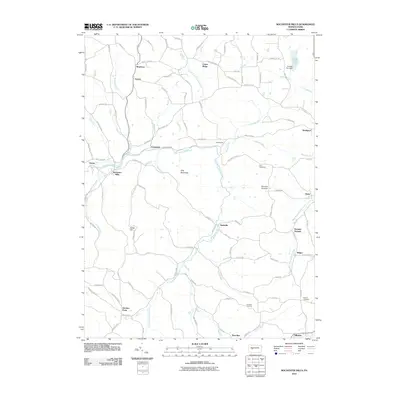
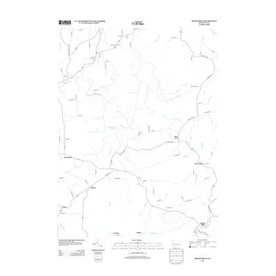
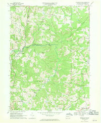 1968 Rochester Mills1970 Print · USGSIndiana County's rural heartland is captured here in the late sixties, showing a landscape defined by small hamlets and active resource extraction. Genealogists and local historians can trace family-named sites like Deckers Point, the Canoe-Grant Sch, and Montgomery Ch.5 unique versions available
 - 1968 Map of Mc Gees Mills, 1971 Print
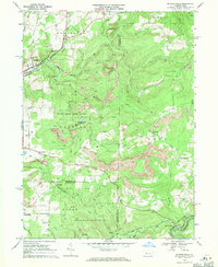 1968 Mc Gees Mills1971 Print · USGSThe West Branch Susquehanna River valley in the late sixties reveals a landscape shaped by coal mining, rail transport, and small upland farming. Researchers can locate the Covered Bridge at McGees Mills, the Punxsutawney Reservoir, and rural sites like Mt Pleasant Ch.5 unique versions available
 - 1984 Map of Tyrone, 1985 Print
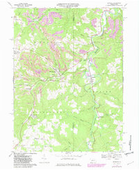
 1984 Tyrone1985 Print · USGSCentral Pennsylvania in the mid-eighties shows a rugged landscape defined by the industry of Altoona and the ridges of the Appalachians. Genealogists and historians can trace the rail corridors of CONRAIL and locate vanished family homes near Glendale Lake or within Sinking Valley.
 - 2010 Map of McGees Mills, 2010 Print
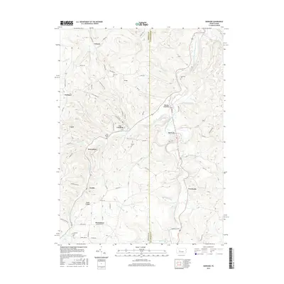
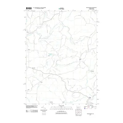 2010 McGees Mills2010 Print · USGSCovers Banks Township, including Sidney, Flora, and other nearby areas
 - 2010 Map of Rochester Mills, 2010 Print
 2010 Rochester Mills2010 Print · USGSCovers Banks Township, including Smithport, Enterprise, and other nearby areas
 - 2010 Map of Punxsutawney, 2010 Print
 2010 Punxsutawney2010 Print · USGSCovers Banks Township, including Punxsutawney, Winslow, and other nearby areas
 - 2010 Map of Burnside, 2010 Print
 2010 Burnside2010 Print · USGSCovers Banks Township, including Glen Campbell, Burnside, and other nearby areas
 - 2013 Map of McGees Mills, 2013 Print
 2013 McGees Mills2013 Print · USGSCovers Banks Township, including Sidney, Flora, and other nearby areas
 - 2013 Map of Burnside, 2013 Print
 2013 Burnside2013 Print · USGSCovers Banks Township, including Glen Campbell, Burnside, and other nearby areas
 - 2013 Map of Punxsutawney, 2013 Print
 2013 Punxsutawney2013 Print · USGSCovers Banks Township, including Punxsutawney, Winslow, and other nearby areas
 - 2013 Map of Rochester Mills, 2013 Print
 2013 Rochester Mills2013 Print · USGSCovers Banks Township, including Smithport, Enterprise, and other nearby areas
 - 2016 Map of Burnside, 2016 Print
 2016 Burnside2016 Print · USGSCovers Banks Township, including Glen Campbell, Burnside, and other nearby areas
 - 2016 Map of McGees Mills, 2016 Print
 2016 McGees Mills2016 Print · USGSCovers Banks Township, including Sidney, Flora, and other nearby areas
 - 2016 Map of Punxsutawney, 2016 Print
 2016 Punxsutawney2016 Print · USGSCovers Banks Township, including Punxsutawney, Winslow, and other nearby areas
Showing maps 1-25 of 34
Top cities near Banks Township
- Sandy Township historical maps
- Punxsutawney historical maps
- Northern Cambria historical maps
- Rayne Township historical maps
- Winslow historical maps
- Clymer historical maps
See more
Top neighborhoods of Banks Township
- Hillman historical maps
- Keal Run historical maps
- Lochvale historical maps
- Urey historical maps
- Urey historical maps
- Sidney historical maps
See more
Frequently asked questions
- What are the different types of historical maps available for Banks Township?
- What is the oldest map of Banks Township?
- Where can I purchase historical maps of Banks Township for my home or office?
- Where can I download high-res historical maps of Banks Township?
- Are there historical topographic maps available for Banks Township?
- Is there historical aerial imagery available for Banks Township?
- Where are historical maps of Banks Township sourced from?