Old Maps of Center Township, Pennsylvania for Genealogy
Trace your family roots with 25 historic maps of Center Township. These high-res maps reveal old neighborhoods, homesites, landmarks, and streets — helping you uncover where your ancestors lived and how the area evolved over time.
- Explore historic neighborhoods: Identify where your relatives may have lived in the 1800s or 1900s.
- Compare maps over time: Trace the changes in streets, buildings, and landmarks for multi-generational research.
- Perfect for genealogy & ancestry research: Used by family historians and researchers to map out lineage and migration.
These maps are an incredible resource for exploring your personal connection to Center Township's past.
Center Township, PA maps
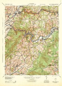
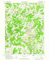
(25)- 1902 Map of Indiana
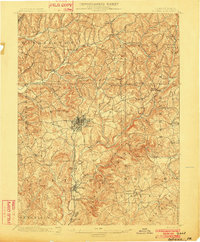 1902 Indiana1902 Print · USGSCovers Center Township, including Indiana, Rayne Township, and other nearby areas8 unique versions available
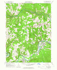
 - 1902 Map of Elders Ridge, 1957 Print
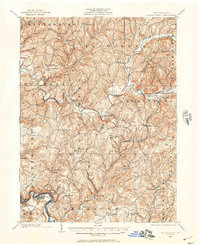 1902 Elders Ridge1957 Print · USGSCovers Center Township, including Black Lick Township, South Bend Township, and other nearby areas2 unique versions available
 - 1904 Map of Elders Ridge
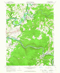
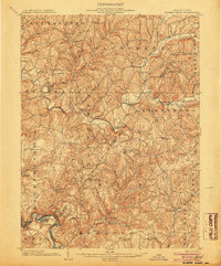 1904 Elders Ridge1904 Print · USGSCovers Center Township, including Black Lick Township, South Bend Township, and other nearby areas5 unique versions available
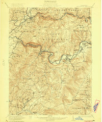
 - 1920 Map of New Florence, 1958 Print
 1920 New Florence1958 Print · USGSCovers Center Township, including Brush Valley Township, Black Lick Township, and other nearby areas
 - 1921 Map of New Florence
 1921 New Florence1921 Print · USGSCovers Center Township, including Brush Valley Township, Black Lick Township, and other nearby areas
 - 1922 Map of New Florence
 1922 New Florence1922 Print · USGSCovers Center Township, including Brush Valley Township, Black Lick Township, and other nearby areas5 unique versions available
 - 1944 Map of New Florence
 1944 New Florence1944 Print · USGSCovers Center Township, including Brush Valley Township, Black Lick Township, and other nearby areas
 - 1953 Map of Pittsburgh
 1953 Pittsburgh1953 Print · USGSCovers Center Township, including Pittsburgh, Penn Hills, and other nearby areas
 - 1954 Map of Pittsburgh
 1954 Pittsburgh1954 Print · USGSCovers Center Township, including Pittsburgh, Penn Hills, and other nearby areas2 unique versions available
 - 1958 Map of Pittsburgh
 1958 Pittsburgh1958 Print · USGSCovers Center Township, including Pittsburgh, Penn Hills, and other nearby areas5 unique versions available
 - 1959 Map of Pittsburgh
 1959 Pittsburgh1959 Print · USGSCovers Center Township, including Pittsburgh, Penn Hills, and other nearby areas
 - 1963 Map of Brush Valley, 1965 Print
 1963 Brush Valley1965 Print · USGSCovers Center Township, including Brush Valley Township, Rico, and other nearby areas4 unique versions available
 - 1963 Map of Indiana, 1965 Print
 1963 Indiana1965 Print · USGSCovers Center Township, including Indiana, Brush Valley Township, and other nearby areas4 unique versions available
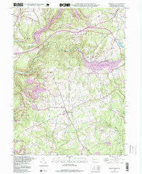
 - 1964 Map of Pittsburgh
 1964 Pittsburgh1964 Print · USGSCovers Center Township, including Pittsburgh, Penn Hills, and other nearby areas
 - 1964 Map of Bolivar, 1966 Print
 1964 Bolivar1966 Print · USGSCovers Center Township, including Brush Valley Township, Black Lick Township, and other nearby areas6 unique versions available
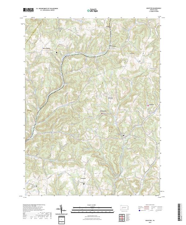
 - 1964 Map of Mc Intyre, 1966 Print
 1964 Mc Intyre1966 Print · USGSCovers Center Township, including Black Lick Township, South Bend Township, and other nearby areas4 unique versions available
 - 1964 Map of New Florence, 1966 Print
 1964 New Florence1966 Print · USGSCovers Center Township, including Brush Valley Township, New Florence, and other nearby areas6 unique versions available
 - 1983 Map of Indiana
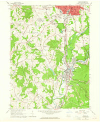
 1983 Indiana1983 Print · USGSCovers Center Township, including Penn Hills, Ross Township, and other nearby areas
 - 1986 Map of Pittsburgh East
 1986 Pittsburgh East1986 Print · USGSCovers Center Township, including Pittsburgh, Penn Hills, and other nearby areas3 unique versions available
 - 1998 Map of Brush Valley, 1999 Print
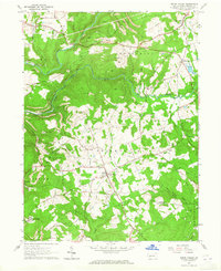
 1998 Brush Valley1999 Print · USGSCovers Center Township, including Brush Valley Township, Rico, and other nearby areas
 - 2023 Map of McIntyre, 2023 Print
 2023 McIntyre2023 Print · USGSCovers Center Township, including Black Lick Township, South Bend Township, and other nearby areas
 - 2023 Map of Bolivar, 2023 Print
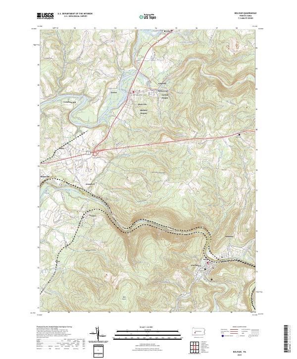 2023 Bolivar2023 Print · USGSCovers Center Township, including Brush Valley Township, Black Lick Township, and other nearby areas
 - 2023 Map of New Florence, 2023 Print
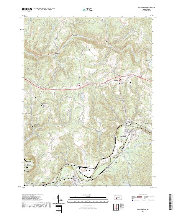 2023 New Florence2023 Print · USGSCovers Center Township, including Brush Valley Township, New Florence, and other nearby areas
 - 2023 Map of Brush Valley, 2023 Print
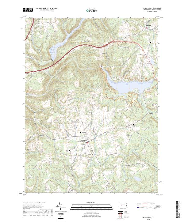 2023 Brush Valley2023 Print · USGSCovers Center Township, including Brush Valley Township, Cherryhill Township, and other nearby areas
 - 2023 Map of Indiana, 2023 Print
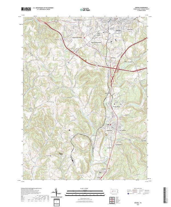 2023 Indiana2023 Print · USGSCovers Center Township, including Indiana, Brush Valley Township, and other nearby areas
End of results
Showing maps 1-25 of 25
Top cities near Center Township
- Indiana historical maps
- Latrobe historical maps
- Blairsville historical maps
- Rayne Township historical maps
- Derry historical maps
- Loyalhanna historical maps
See more
Top neighborhoods of Center Township
- Luciusboro historical maps
- Two Lick historical maps
- Coy historical maps
- Red Barn historical maps
- Aultman historical maps
- Coral historical maps
See more
Frequently asked questions
- What are the different types of historical maps available for Center Township?
- What is the oldest map of Center Township?
- Where can I purchase historical maps of Center Township for my home or office?
- Where can I download high-res historical maps of Center Township?
- Are there historical topographic maps available for Center Township?
- Is there historical aerial imagery available for Center Township?
- Where are historical maps of Center Township sourced from?