1960s Maps of Jefferson County, Pennsylvania
Explore 17 historic maps of Jefferson County from the 1960s. These maps offer a rare glimpse into what life looked like during the 1960s — showing old roads, neighborhoods, homes, and landmarks that have changed or disappeared over time.
Whether you're researching your family's past, planning a metal detecting trip, or studying how Jefferson County's landscape evolved across the 1960s, these high-resolution maps are a powerful tool for exploring the history of this region.
- Focus on a specific era: All maps on this page are from the 1960s, giving you a focused view of this time period.
- See what’s changed: Compare century-old streets, trails, and buildings to today's modern landscape using overlays and satellite layers.
- Research with precision: Use these maps for genealogy, historical research, land use analysis, or educational projects.
- View, download, or print: Maps are fully viewable online in high resolution, and can be downloaded or printed for your own records.
Start exploring Jefferson County's history through authentic maps from the 1960s. This is your window into the past.
Jefferson County, PA maps
(17)- 1964 Map of Pittsburgh
 1964 Pittsburgh1964 Print · USGSWestern Pennsylvania in the late fifties and early sixties shows a landscape of powerful river industries and expanding highways. Genealogists and historians can trace the rail corridors of the Pennsylvania RR through industrial hubs like Johnstown, Altoona, and Nanty Glo.
 - 1966 Map of Falls Creek, 1968 Print
 1966 Falls Creek1968 Print · USGSThe northern Pennsylvania coalfields and rail corridors are captured in the mid-1960s as industry shaped the landscape. Trace local heritage at Wildwood Cem, the old Adrian Furnace, and rail junctions like Erie Junction.5 unique versions available
 - 1966 Map of Hazen, 1968 Print
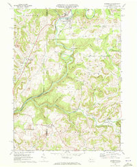
 1966 Hazen1968 Print · USGSJefferson County’s coal and rail landscape is captured here in the mid-1960s, showing a region defined by industrial extraction and small rural hamlets. Genealogists and local historians can trace family roots through sites like Warsaw Sch, Sugar Hill Station, and the rural community of Hormtown.4 unique versions available
 - 1966 Map of Du Bois, 1968 Print
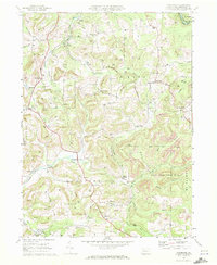
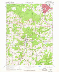 1966 Du Bois1968 Print · USGSThe Jefferson County coalfields are captured in the mid-1960s, showing a landscape defined by surface mining and rail transit. Researchers can trace the legacy of mining towns from Sykesville to Rathmel and locate family burial sites at Rumbarger Cem or Prospect Cem.6 unique versions available
 - 1966 Map of Reynoldsville, 1968 Print
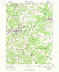
 1966 Reynoldsville1968 Print · USGSJefferson County mining communities thrive during the late sixties as rail lines connect rural outposts. Genealogists can trace family names at St Marys Cem, identify the streets of Reynoldsville, or locate the Tipple Mine near Panic.4 unique versions available
 - 1967 Map of Cooksburg, 1971 Print
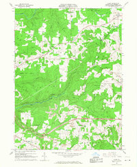
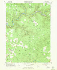
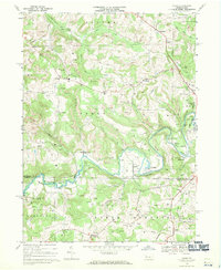
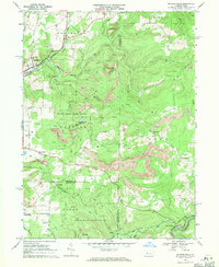
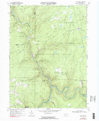
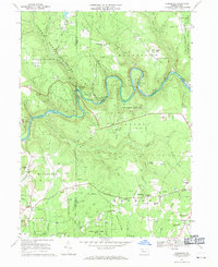 1967 Cooksburg1971 Print · USGSThe Clarion River winds through the heart of the Pennsylvania woods during the late sixties, marking the borders of three counties. Local historians can trace old community sites like Hottelville and Kahletown, or find family landmarks such as Troutman Cem and Shawkey Hill.5 unique versions available
 - 1967 Map of Sigel, 1971 Print
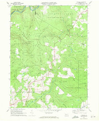
 1967 Sigel1971 Print · USGSJefferson and Forest counties meet along the Clarion River in the late sixties, where timber and energy production shaped the landscape. Genealogists can locate family landmarks like Mt Tabor Cem, the Edeburn Ch, and the remote Heitiff Pumping Station.5 unique versions available
 - 1968 Map of Punxsutawney, 1970 Print
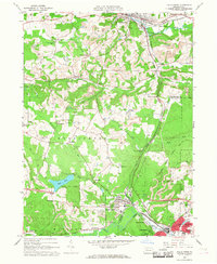
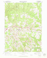
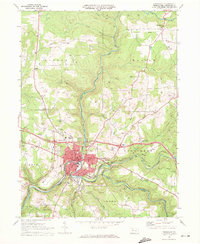
 1968 Punxsutawney1970 Print · USGSPunxsutawney and its surrounding coal-mining townships are captured in the late sixties, showing a landscape defined by rail lines and deep-valley settlements. Genealogists can locate family sites at Circle Hill Cem, Steffy Chapel, and Gobblers Knob.6 unique versions available
 - 1968 Map of Valier, 1970 Print
 1968 Valier1970 Print · USGSJefferson and Indiana Counties are captured in the late sixties as the local coal and gas economy shaped the hillsides. Researchers can trace family roots through numerous country cemeteries and churches, including White Church Cem, St Jacobs Ch, and Mapleview Sch.4 unique versions available
 - 1968 Map of Mc Gees Mills, 1971 Print
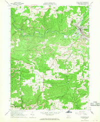
 1968 Mc Gees Mills1971 Print · USGSThe West Branch Susquehanna River valley in the late sixties reveals a landscape shaped by coal mining, rail transport, and small upland farming. Researchers can locate the Covered Bridge at McGees Mills, the Punxsutawney Reservoir, and rural sites like Mt Pleasant Ch.5 unique versions available
 - 1968 Map of Dayton, 1971 Print
 1968 Dayton1971 Print · USGSThe hills of Armstrong and Jefferson counties were deeply shaped by coal and rail during the late sixties. Researchers can trace the legacy of extractive industry and rural life through Strip Mines, the Dayton High Sch, and family landmarks like St James Cem.4 unique versions available
 - 1969 Map of Corsica, 1972 Print
 1969 Corsica1972 Print · USGSJefferson and Clarion Counties are captured here in the late sixties as the modern interstate system began reshaping rural Pennsylvania life. Researchers can trace family roots through Corsica and Roseville, locating specific sites like Pine Grove Cem and the Pleasant Hill Chapel.4 unique versions available
 - 1969 Map of Munderf, 1972 Print
 1969 Munderf1972 Print · USGSJefferson County was a landscape of dense timber and energy extraction in the late sixties, where state forests met active gas fields. Genealogists and researchers can trace local families through small settlements like Munderf, the remote Munderf Cem, and old crossroads at Schoffner Corner and Dutch Hill.3 unique versions available
 - 1969 Map of Summerville, 1972 Print
 1969 Summerville1972 Print · USGSJefferson and Clarion counties are shown in the late sixties as the region's rail and mining industries shaped the landscape. Genealogists and historians can trace family locations near Summerville, Bethlehem Cem, and the Content schoolhouse.3 unique versions available
 - 1969 Map of Coolspring, 1972 Print
 1969 Coolspring1972 Print · USGSJefferson County was a hub of resource extraction and rail activity in the late sixties. Genealogists and historians can trace the locations of family burial grounds and country parishes such as St Johns Cem, Hunters Grove Ch, and Stanton.5 unique versions available
 - 1969 Map of Brookville, 1972 Print
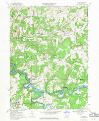
 1969 Brookville1972 Print · USGSJefferson County's river valleys and rail corridors are captured in detail during the late sixties. Researchers can trace family history through local landmarks like St Marys Cemetery, the County Home, and the old Brookville High School.3 unique versions available
 - 1969 Map of Hallton, 1972 Print
 1969 Hallton1972 Print · USGSElk County's deep woods and river valleys are captured here in the late sixties as the regional gas industry and national forest lands shaped the terrain. Researchers can locate the Maxwell Run Cem, the river settlement of Arroyo, and the remote Lookout Tower.2 unique versions available
End of results
Showing maps 1-17 of 17
Top cities of Jefferson County
- Punxsutawney historical maps
- Brookville historical maps
- Reynoldsville historical maps
- Brockway historical maps
- Warsaw Township historical maps
- Sykesville historical maps
See more
Frequently asked questions
- What are the different types of historical maps available for Jefferson County?
- What is the oldest map of Jefferson County?
- Where can I purchase historical maps of Jefferson County for my home or office?
- Where can I download high-res historical maps of Jefferson County?
- Are there historical topographic maps available for Jefferson County?
- Is there historical aerial imagery available for Jefferson County?
- Where are historical maps of Jefferson County sourced from?