2020s Maps of Tuscarora Township, Pennsylvania
Explore 4 historic maps of Tuscarora Township from the 2020s. These maps offer a rare glimpse into what life looked like during the 2020s — showing old roads, neighborhoods, homes, and landmarks that have changed or disappeared over time.
Whether you're researching your family's past, planning a metal detecting trip, or studying how Tuscarora Township's landscape evolved across the 2020s, these high-resolution maps are a powerful tool for exploring the history of this region.
- Focus on a specific era: All maps on this page are from the 2020s, giving you a focused view of this time period.
- See what’s changed: Compare century-old streets, trails, and buildings to today's modern landscape using overlays and satellite layers.
- Research with precision: Use these maps for genealogy, historical research, land use analysis, or educational projects.
- View, download, or print: Maps are fully viewable online in high resolution, and can be downloaded or printed for your own records.
Start exploring Tuscarora Township's history through authentic maps from the 2020s. This is your window into the past.
Tuscarora Township, PA maps
(4)- 2023 Map of Blain, 2023 Print
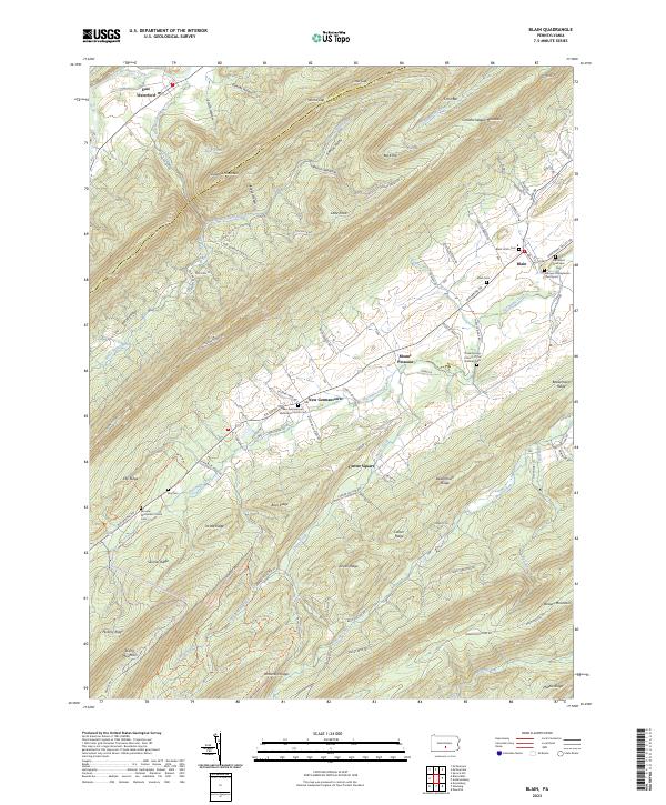 2023 Blain2023 Print · USGSPerry County's rural valley settlements and mountain ridges are documented here in the early twenty-first century. Genealogists can locate family burial plots at Blain Union Cem and Toboyne Presbyterian Churchyard near the banks of Shermans Creek.
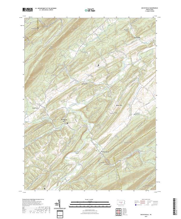
 - 2023 Map of McVeytown, 2023 Print
 2023 McVeytown2023 Print · USGSMifflin and Juniata Counties are captured here in the early twenty-first century, showing the enduring settlement patterns along the Juniata River. Family historians can locate several burial grounds, including Hartzler Cem and Byron Run Cem, alongside old rural centers like Peru Mills.
 - 2023 Map of Lewistown, 2023 Print
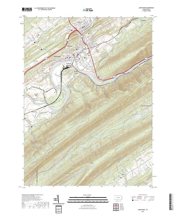 2023 Lewistown2023 Print · USGSLewistown and the Juniata River valley appear in high detail during the early 2020s, showing a landscape of river-fronting industry and steep ridges. Genealogists can locate family sites like Lind Memorial Cem and the Sacred Heart Cem or trace the old Vincent Tram Rd.
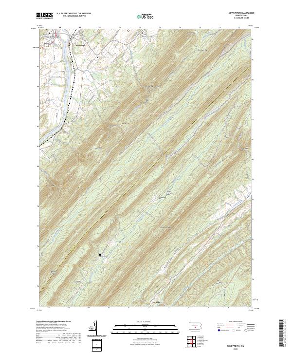
 - 2023 Map of McCoysville, 2023 Print
 2023 McCoysville2023 Print · USGSJuniata County in the 2020s remains a landscape of traditional mountain valleys and rural crossroads. Local researchers can locate family sites at the McCullochs Mills Cem, trace the waters of Tuscarora Creek, or explore the heights of Tuscarora Mountain.
End of results
Showing maps 1-4 of 4
Top cities near Tuscarora Township
- Lewistown historical maps
- Granville Township historical maps
- Decatur Township historical maps
- Saville Township historical maps
- Centre historical maps
- Burnham historical maps
See more
Top neighborhoods of Tuscarora Township
- Bunker Hill historical maps
- Honey Grove historical maps
- East Waterford historical maps
- McCoysville historical maps
- McCullochs Mills historical maps
- Reeds Gap historical maps
Frequently asked questions
- What are the different types of historical maps available for Tuscarora Township?
- What is the oldest map of Tuscarora Township?
- Where can I purchase historical maps of Tuscarora Township for my home or office?
- Where can I download high-res historical maps of Tuscarora Township?
- Are there historical topographic maps available for Tuscarora Township?
- Is there historical aerial imagery available for Tuscarora Township?
- Where are historical maps of Tuscarora Township sourced from?