1990s Maps of Archbald, Lackawanna County
Explore 7 historic maps of Archbald from the 1990s. These maps offer a rare glimpse into what life looked like during the 1990s — showing old roads, neighborhoods, homes, and landmarks that have changed or disappeared over time.
Whether you're researching your family's past, planning a metal detecting trip, or studying how Archbald's landscape evolved across the 1990s, these high-resolution maps are a powerful tool for exploring the history of this region.
- Focus on a specific era: All maps on this page are from the 1990s, giving you a focused view of this time period.
- See what’s changed: Compare century-old streets, trails, and buildings to today's modern landscape using overlays and satellite layers.
- Research with precision: Use these maps for genealogy, historical research, land use analysis, or educational projects.
- View, download, or print: Maps are fully viewable online in high resolution, and can be downloaded or printed for your own records.
Start exploring Archbald's history through authentic maps from the 1990s. This is your window into the past.
Archbald, Lackawanna County maps
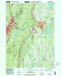
(7)- 1994 Map of Carbondale, 1995 Print
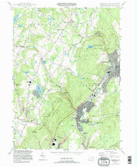 1994 Carbondale1995 Print · USGSThe Lackawanna River valley in the mid-nineties shows a transition from coal-era industry to modern conservation. Researchers can trace ancestral sites at Our Mother of Sorrows Cem or explore the geography of Archbald Pothole State Park and Finch Hill.
 - 1994 Map of Lake Ariel, 1995 Print
 1994 Lake Ariel1995 Print · USGSThe Lake Ariel region of Wayne County is captured here in the mid-1990s, showing a landscape defined by glacial ponds and small mountain hamlets. Researchers can trace family history through sites like Salem Cem, Wallenpaupack Mills, and the old rail paths of the Old RR Grade.
 - 1994 Map of Waymart, 1996 Print
 1994 Waymart1996 Print · USGSThe Moosic Mountains divide the industrial Lackawanna valley from the rural plateaus of Wayne County in the mid-1990s. Researchers can trace the anthracite heritage of Carbondale or find local landmarks like St Nicholas Seminary and Keen Lake.
 - 1994 Map of Olyphant, 1996 Print
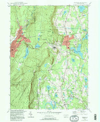
 1994 Olyphant1996 Print · USGSThe Lackawanna Valley boroughs show a dense 1990s landscape of industry and community institutions just north of Scranton. Researchers can trace local heritage through numerous religious sites and landmarks like Mt Carmel Cem, Bishop O'Hara High School, and Grassy Island.
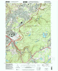
 - 1999 Map of Carbondale, 2001 Print
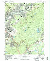
 1999 Carbondale2001 Print · USGSThe Lackawanna River valley shows its transition from coal country to a modern residential and industrial corridor at the close of the century. Trace the heritage of anthracite towns through Brookside Cemetery or the geological wonders of Archbald Pothole State Park.
 - 1999 Map of Waymart, 2001 Print
 1999 Waymart2001 Print · USGSWayne and Lackawanna counties appear here at the turn of the millennium, showing the transition from industrial valleys to mountain plateaus. Genealogists and historians can locate St Tikhons Seminary, the Russian Monastery, and several graveyards including South Canaan Cem.
 - 1999 Map of Olyphant, 2001 Print
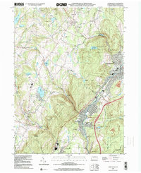
 1999 Olyphant2001 Print · USGSLackawanna County's coal-valley communities and upland reservoirs are captured here in the late twentieth century. Genealogists and local historians can trace family roots through numerous sites like St Michaels Cem, Mt Carmel Cem, and the neighborhoods of Smoketown or Jessup.
End of results
Showing maps 1-7 of 7
Frequently asked questions
- What are the different types of historical maps available for Archbald?
- What is the oldest map of Archbald?
- Where can I purchase historical maps of Archbald for my home or office?
- Where can I download high-res historical maps of Archbald?
- Are there historical topographic maps available for Archbald?
- Is there historical aerial imagery available for Archbald?
- Where are historical maps of Archbald sourced from?