Old Maps of Blakely, Lackawanna County
Explore 23 old maps of Blakely, spanning from 1889 to today. These high-resolution historic maps reveal how streets, neighborhoods, landmarks, and natural features evolved over time — perfect for genealogy, metal detecting, research, and local history exploration.
What you can do with these maps:
- See how Blakely changed over time: Compare historical maps to modern-day views to trace roads, homesites, rail lines & more.
- View detailed metadata: Each map includes creators, publishers, year, scale, and archive source.
- Overlay maps with satellite & LiDAR: Visualize the past alongside modern tools to explore terrain & human change.
- Trusted historical sources: Maps sourced from the USGS, Library of Congress, and other archives.
- Access maps your way: View online, download high-res files, or order prints for personal or research use.
Start exploring old maps of Blakely to uncover forgotten places, hidden landmarks, and the deep history beneath your feet.
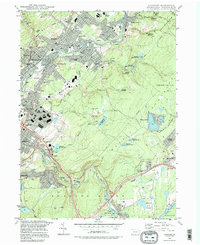
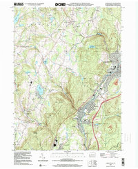
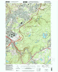
Blakely, Lackawanna County maps
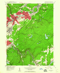
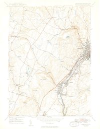
(23)- 1889 Map of Scranton, 1954 Print
 1889 Scranton1954 Print · USGSCovers Blakely, including Scranton, Dunmore, and other nearby areas
 - 1891 Map of Scranton
 1891 Scranton1891 Print · USGSCovers Blakely, including Scranton, Dunmore, and other nearby areas
 - 1892 Map of Dundaff
 1892 Dundaff1892 Print · USGSCovers Blakely, including Carbondale, Scott Township, and other nearby areas6 unique versions available
 - 1893 Map of Scranton
 1893 Scranton1893 Print · USGSCovers Blakely, including Scranton, Dunmore, and other nearby areas7 unique versions available
 - 1943 Map of Scranton
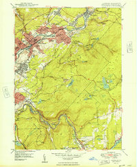
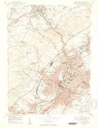
 1943 Scranton1943 Print · USGSCovers Blakely, including Scranton, Wilkes-Barre, and other nearby areas
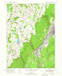
 - 1946 Map of Olyphant, 1960 Print
 1946 Olyphant1960 Print · USGSCovers Blakely, including Scranton, Archbald, and other nearby areas6 unique versions available
 - 1946 Map of Carbondale, 1966 Print
 1946 Carbondale1966 Print · USGSCovers Blakely, including Carbondale, Scott Township, and other nearby areas3 unique versions available
 - 1947 Map of Scranton, 1957 Print
 1947 Scranton1957 Print · USGSCovers Blakely, including Scranton, Dunmore, and other nearby areas4 unique versions available
 - 1948 Map of Olyphant
 1948 Olyphant1948 Print · USGSCovers Blakely, including Scranton, Archbald, and other nearby areas2 unique versions available
 - 1949 Map of Carbondale
 1949 Carbondale1949 Print · USGSCovers Blakely, including Carbondale, Scott Township, and other nearby areas2 unique versions available
 - 1950 Map of Scranton
 1950 Scranton1950 Print · USGSCovers Blakely, including Scranton, Dunmore, and other nearby areas2 unique versions available
 - 1950 Map of Scranton, 1952 Print
 1950 Scranton1952 Print · USGSCovers Blakely, including Ramapo, Clarkstown, and other nearby areas
 - 1953 Map of Scranton
 1953 Scranton1953 Print · USGSCovers Blakely, including Ramapo, Clarkstown, and other nearby areas
 - 1959 Map of Scranton
 1959 Scranton1959 Print · USGSCovers Blakely, including Ramapo, Clarkstown, and other nearby areas2 unique versions available
 - 1962 Map of Scranton, 1977 Print
 1962 Scranton1977 Print · USGSCovers Blakely, including Ramapo, Clarkstown, and other nearby areas2 unique versions available
 - 1965 Map of Scranton
 1965 Scranton1965 Print · USGSCovers Blakely, including Ramapo, Clarkstown, and other nearby areas2 unique versions available
 - 1986 Map of Scranton
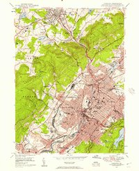
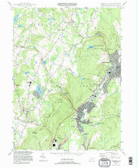
 1986 Scranton1986 Print · USGSCovers Blakely, including Scranton, Wilkes-Barre, and other nearby areas2 unique versions available
 - 1986 Map of Honesdale
 1986 Honesdale1986 Print · USGSCovers Blakely, including Vestal, Carbondale, and other nearby areas2 unique versions available
 - 1994 Map of Carbondale, 1995 Print
 1994 Carbondale1995 Print · USGSCovers Blakely, including Carbondale, Scott Township, and other nearby areas
 - 1994 Map of Scranton, 1996 Print
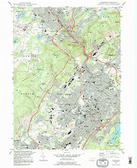 1994 Scranton1996 Print · USGSCovers Blakely, including Scranton, Dunmore, and other nearby areas
 - 1994 Map of Olyphant, 1996 Print
 1994 Olyphant1996 Print · USGSCovers Blakely, including Scranton, Archbald, and other nearby areas
 - 1999 Map of Carbondale, 2001 Print
 1999 Carbondale2001 Print · USGSCovers Blakely, including Carbondale, Scott Township, and other nearby areas
 - 1999 Map of Olyphant, 2001 Print
 1999 Olyphant2001 Print · USGSCovers Blakely, including Scranton, Archbald, and other nearby areas
End of results
Showing maps 1-23 of 23
Frequently asked questions
- What are the different types of historical maps available for Blakely?
- What is the oldest map of Blakely?
- Where can I purchase historical maps of Blakely for my home or office?
- Where can I download high-res historical maps of Blakely?
- Are there historical topographic maps available for Blakely?
- Is there historical aerial imagery available for Blakely?
- Where are historical maps of Blakely sourced from?