Old Maps of Blakely, Lackawanna County for Academic Research
Study the evolution of Blakely with 23 high-resolution historic maps. Whether you're teaching, researching, or modeling changes in land use, these maps provide essential visual documentation of urban, environmental, and geographic change.
- Analyze long-term change: Track patterns in development, transportation, and natural features.
- Ideal for environmental or urban studies: Support academic projects with primary historical map data.
- Use in the classroom or lab: Educators and researchers rely on these maps to bring historical context to life.
These maps are a powerful tool for teaching, research, and visualizing how Blakely has changed over the decades.
Blakely, Lackawanna County maps
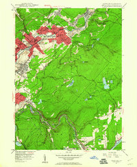
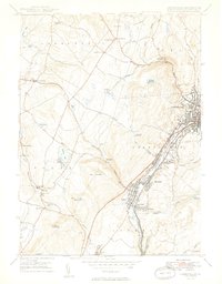
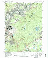
(23)- 1889 Map of Scranton, 1954 Print
 1889 Scranton1954 Print · USGSCovers Blakely, including Scranton, Dunmore, and other nearby areas
 - 1891 Map of Scranton
 1891 Scranton1891 Print · USGSCovers Blakely, including Scranton, Dunmore, and other nearby areas
 - 1892 Map of Dundaff
 1892 Dundaff1892 Print · USGSCovers Blakely, including Carbondale, Scott Township, and other nearby areas6 unique versions available
 - 1893 Map of Scranton
 1893 Scranton1893 Print · USGSCovers Blakely, including Scranton, Dunmore, and other nearby areas7 unique versions available
 - 1943 Map of Scranton
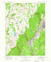
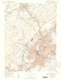
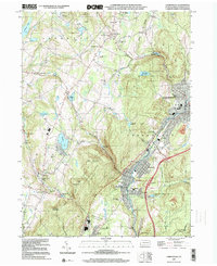
 1943 Scranton1943 Print · USGSCovers Blakely, including Scranton, Wilkes-Barre, and other nearby areas
 - 1946 Map of Olyphant, 1960 Print
 1946 Olyphant1960 Print · USGSCovers Blakely, including Scranton, Archbald, and other nearby areas6 unique versions available
 - 1946 Map of Carbondale, 1966 Print
 1946 Carbondale1966 Print · USGSCovers Blakely, including Carbondale, Scott Township, and other nearby areas3 unique versions available
 - 1947 Map of Scranton, 1957 Print
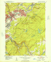
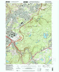
 1947 Scranton1957 Print · USGSCovers Blakely, including Scranton, Dunmore, and other nearby areas4 unique versions available
 - 1948 Map of Olyphant
 1948 Olyphant1948 Print · USGSCovers Blakely, including Scranton, Archbald, and other nearby areas2 unique versions available
 - 1949 Map of Carbondale
 1949 Carbondale1949 Print · USGSCovers Blakely, including Carbondale, Scott Township, and other nearby areas2 unique versions available
 - 1950 Map of Scranton
 1950 Scranton1950 Print · USGSCovers Blakely, including Scranton, Dunmore, and other nearby areas2 unique versions available
 - 1950 Map of Scranton, 1952 Print
 1950 Scranton1952 Print · USGSCovers Blakely, including Ramapo, Clarkstown, and other nearby areas
 - 1953 Map of Scranton
 1953 Scranton1953 Print · USGSCovers Blakely, including Ramapo, Clarkstown, and other nearby areas
 - 1959 Map of Scranton
 1959 Scranton1959 Print · USGSCovers Blakely, including Ramapo, Clarkstown, and other nearby areas2 unique versions available
 - 1962 Map of Scranton, 1977 Print
 1962 Scranton1977 Print · USGSCovers Blakely, including Ramapo, Clarkstown, and other nearby areas2 unique versions available
 - 1965 Map of Scranton
 1965 Scranton1965 Print · USGSCovers Blakely, including Ramapo, Clarkstown, and other nearby areas2 unique versions available
 - 1986 Map of Scranton
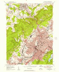
 1986 Scranton1986 Print · USGSCovers Blakely, including Scranton, Wilkes-Barre, and other nearby areas2 unique versions available
 - 1986 Map of Honesdale
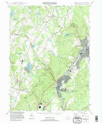
 1986 Honesdale1986 Print · USGSCovers Blakely, including Vestal, Carbondale, and other nearby areas2 unique versions available
 - 1994 Map of Carbondale, 1995 Print
 1994 Carbondale1995 Print · USGSCovers Blakely, including Carbondale, Scott Township, and other nearby areas
 - 1994 Map of Scranton, 1996 Print
 1994 Scranton1996 Print · USGSCovers Blakely, including Scranton, Dunmore, and other nearby areas
 - 1994 Map of Olyphant, 1996 Print
 1994 Olyphant1996 Print · USGSCovers Blakely, including Scranton, Archbald, and other nearby areas
 - 1999 Map of Carbondale, 2001 Print
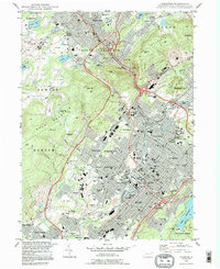
 1999 Carbondale2001 Print · USGSCovers Blakely, including Carbondale, Scott Township, and other nearby areas
 - 1999 Map of Olyphant, 2001 Print
 1999 Olyphant2001 Print · USGSCovers Blakely, including Scranton, Archbald, and other nearby areas
End of results
Showing maps 1-23 of 23
Frequently asked questions
- What are the different types of historical maps available for Blakely?
- What is the oldest map of Blakely?
- Where can I purchase historical maps of Blakely for my home or office?
- Where can I download high-res historical maps of Blakely?
- Are there historical topographic maps available for Blakely?
- Is there historical aerial imagery available for Blakely?
- Where are historical maps of Blakely sourced from?