Old Maps of Clifton Township, Pennsylvania for Academic Research
Study the evolution of Clifton Township with 62 high-resolution historic maps. Whether you're teaching, researching, or modeling changes in land use, these maps provide essential visual documentation of urban, environmental, and geographic change.
- Analyze long-term change: Track patterns in development, transportation, and natural features.
- Ideal for environmental or urban studies: Support academic projects with primary historical map data.
- Use in the classroom or lab: Educators and researchers rely on these maps to bring historical context to life.
These maps are a powerful tool for teaching, research, and visualizing how Clifton Township has changed over the decades.
Clifton Township, PA maps
(62)- 1889 Map of Scranton, 1954 Print
 1889 Scranton1954 Print · USGSThe industrial heart of the Lackawanna Valley is captured here during its late 19th-century boom, showing the dense rail networks and coal towns of the era. Genealogists can trace family roots through early street grids in Scranton and Dunmore or smaller settlements like Barberstown and Priceburg.
 - 1891 Map of Scranton
 1891 Scranton1891 Print · USGSThe Lackawanna Valley thrived at the peak of the coal era when rail lines and mine patches crowded the riverbanks. Genealogists and industrial historians can trace the early footprints of Scranton, Dunmore, and Old Forge alongside the Delaware and Hudson Canal Co R R.
 - 1893 Map of Scranton
 1893 Scranton1893 Print · USGSLackawanna County's anthracite heartland is shown in detail during the late nineteenth-century industrial boom. Genealogists and historians can trace the early street grids of Scranton and Dunmore or locate smaller settlements like Old Forge and Barber Town.7 unique versions available
 - 1919 Map of Pocono
 1919 Pocono1919 Print · USGSMonroe County was a critical military and rail corridor at the close of the Great War. Researchers can trace the massive Tobyhanna Military Reservation and the early rail-centered footprints of Mount Pocono, Tannerville, and Cresco.
 - 1921 Map of Pocono, 1962 Print
 1921 Pocono1962 Print · USGSThe Pocono Mountains at the start of the 1920s reveal a landscape of military training grounds, remote mountain schools, and early summer resorts. Trace the rail lines of the Wilkes-Barre and Eastern RR or locate rural landmarks like Cherry Lane Church and Beaver Brook School.
 - 1922 Map of Stoddartsville, 1958 Print
 1922 Stoddartsville1958 Print · USGSThe Pennsylvania Poconos at the turn of the century show a landscape of high timber ridges and early mountain resorts. Genealogists and hikers can trace the original paths to Stoddartsville, identify the old Fayette School, or follow the Wilkes-Barre and Eastern rail line.2 unique versions available
 - 1923 Map of Pocono
 1923 Pocono1923 Print · USGSMonroe County was evolving into a mountain retreat in the early twenties, connected by the Delaware Lackawanna and Western RR. Researchers can trace early resort life at Lake Naomi, find rural schools like Butz School, and locate the expansive Artillery Reservation.5 unique versions available
 - 1924 Map of Stoddartsville
 1924 Stoddartsville1924 Print · USGSUpper Carbon and Monroe counties are shown in the early twenties as a landscape of timbered hills and headwater streams. Genealogists can locate old rural landmarks like Bradys Switch, the Leonardsville settlement, and the Locust Ridge School.5 unique versions available
 - 1928 Map of Ariel, 1953 Print
 1928 Ariel1953 Print · USGSWayne County was undergoing a significant transformation in the late twenties as the waters of Lake Wallenpaupack rose. Genealogists and historians can trace local family roots through sites like Haags Mill, German Valley Sch, and the Erie RR corridor.4 unique versions available
 - 1932 Map of Ariel
 1932 Ariel1932 Print · USGSWayne and Pike counties are seen here in the early 1930s as the regional landscape adjusted to the presence of Lake Wallenpaupack. Trace family roots at Ammerman Sch or follow the Erie RR past Gravity and Lake Ariel.3 unique versions available
 - 1943 Map of Scranton
 1943 Scranton1943 Print · USGSNortheastern Pennsylvania’s coal and rail corridor comes to life in the 1940s, showcasing the dense urban industrial centers of the Wyoming Valley. Genealogists can locate family landmarks like the Fayette School and Locust Ridge School or trace the early paths of the DL & W and Erie railroads.
 - 1943 Map of Stoddartsville
 1943 Stoddartsville1943 Print · USGSThe Pocono Plateau at the height of the Second World War shows a landscape defined by river valleys and developing recreation preserves. Genealogists and local historians can trace rural schoolhouses and small settlements like Stoddartsville, Albrightsville, and the Fishery Sch.
 - 1943 Map of Pocono
 1943 Pocono1943 Print · USGSMonroe County was a well-established retreat and transportation hub in the early 1940s, centered around the Delaware Lackawanna and Western railroad. Researchers can trace old mountain roads and family-named landmarks like Camelback Mountain, Naomi Pines Sch, and the Mount Pocono Airport.
 - 1946 Map of Avoca, 1959 Print
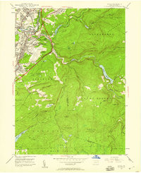 1946 Avoca1959 Print · USGSThe coal-rich Lackawanna Valley is shown here just after the war, as heavy industry and new aviation infrastructure transformed the landscape. Researchers can trace the extensive rail networks and local landmarks like the Consolidated Breaker, Belian Village, and Sacred Heart Cem.5 unique versions available
 - 1946 Map of Moscow, 1964 Print
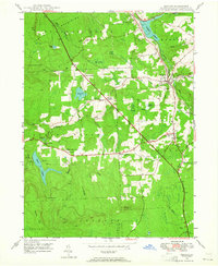 1946 Moscow1964 Print · USGSThe Moosic Mountains and industrial rail corridors define the Lackawanna County landscape shortly after the war. Researchers can trace rural settlement patterns through family-named junctions like Quinlan Corners, local institutions like Covington Sch, and the winding path of the Erie RR.5 unique versions available
 - 1949 Map of Avoca
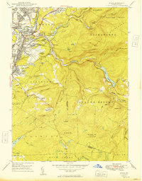 1949 Avoca1949 Print · USGSPost-war Luzerne and Lackawanna counties reveal a landscape of anthracite heritage and rising aviation. Trace family roots at Old Forge Cem, locate the Consolidated Breaker, or explore the rail networks around Hillside Junction.2 unique versions available
 - 1949 Map of Moscow
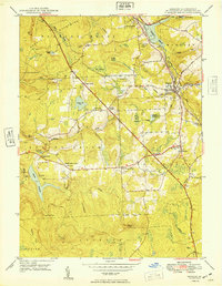 1949 Moscow1949 Print · USGSThe Moosic Mountains and the busy rail corridors of Lackawanna County are captured here in the late 1940s. Genealogists can trace family names and sites through Spring Brook Corners, the Welch Ch, and St Catherines Cem.
 - 1950 Map of Scranton, 1952 Print
 1950 Scranton1952 Print · USGSMid-century Northeast Pennsylvania and the Hudson Valley come alive in this survey of the tri-state region. Genealogists and historians can trace the dense rail networks of the Erie RR and DL&W RR between industrial hubs like Scranton and Wilkes-Barre.
 - 1953 Map of Scranton
 1953 Scranton1953 Print · USGSNortheastern Pennsylvania and the Catskills are shown in great detail during the early fifties, a time when rail lines and river valleys dictated the region's growth. Genealogists and historians can trace the industrial hearts of Scranton and Wilkes-Barre or locate remote landmarks like High Point and Lake Wallenpaupack.
 - 1959 Map of Scranton
 1959 Scranton1959 Print · USGSThe northern coalfields and the Hudson Valley meet in this mid-century survey of the Pennsylvania and New York borderlands. Genealogists and historians can trace the intricate rail networks of the Erie Railroad and the vast waters of Lake Wallenpaupack.2 unique versions available
 - 1959 Map of Pocono
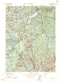 1959 Pocono1959 Print · USGSThe Pocono Mountains region is captured here in the late fifties, showcasing its evolution from a railway-dependent timber and ice landscape to a premier resort destination. Researchers can locate dozens of country schoolhouses like Maplewood Sch and trace the paths of the Erie RR through Hawley and Kimbles.
 - 1962 Map of Scranton, 1977 Print
 1962 Scranton1977 Print · USGSThe industrial heart of eastern Pennsylvania and the New York Catskills are captured here in the early sixties. Genealogists and historians can trace the dense valley settlements from Scranton to Wilkes-Barre and the rail lines of the Erie Lackawanna Railroad.2 unique versions available
 - 1965 Map of Scranton
 1965 Scranton1965 Print · USGSThe tri-state highlands of Pennsylvania, New York, and New Jersey come alive in the mid-sixties as industry and recreation converge. Trace the intricate rail lines of the Erie Lackawanna RR or locate landmarks like the U S Military Academy.2 unique versions available
 - 1965 Map of Sterling, 1967 Print
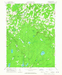 1965 Sterling1967 Print · USGSWayne and Lackawanna Counties are seen here in the mid-sixties as the ERIE-LACKAWANNA railroad still shaped the rural landscape. Genealogists can locate family sites near Freytown Cem, Madisonville, and the small settlement of Jericho.3 unique versions available
 - 1965 Map of Tobyhanna, 1967 Print
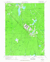 1965 Tobyhanna1967 Print · USGSMonroe County was a hub of military logistics and emerging lakeside communities in the mid-sixties. Researchers can trace the sprawling Tobyhanna Army Depot, the Erie Lackawanna rail line, and early developments at Stillwater Lake Estates.3 unique versions available
Showing maps 1-25 of 62
Top cities near Clifton Township
- Scranton historical maps
- Dunmore historical maps
- Plains Township historical maps
- Old Forge historical maps
- Tobyhanna historical maps
- Taylor historical maps
See more
Frequently asked questions
- What are the different types of historical maps available for Clifton Township?
- What is the oldest map of Clifton Township?
- Where can I purchase historical maps of Clifton Township for my home or office?
- Where can I download high-res historical maps of Clifton Township?
- Are there historical topographic maps available for Clifton Township?
- Is there historical aerial imagery available for Clifton Township?
- Where are historical maps of Clifton Township sourced from?