2020s Maps of Conoy Township, Pennsylvania
Explore 3 historic maps of Conoy Township from the 2020s. These maps offer a rare glimpse into what life looked like during the 2020s — showing old roads, neighborhoods, homes, and landmarks that have changed or disappeared over time.
Whether you're researching your family's past, planning a metal detecting trip, or studying how Conoy Township's landscape evolved across the 2020s, these high-resolution maps are a powerful tool for exploring the history of this region.
- Focus on a specific era: All maps on this page are from the 2020s, giving you a focused view of this time period.
- See what’s changed: Compare century-old streets, trails, and buildings to today's modern landscape using overlays and satellite layers.
- Research with precision: Use these maps for genealogy, historical research, land use analysis, or educational projects.
- View, download, or print: Maps are fully viewable online in high resolution, and can be downloaded or printed for your own records.
Start exploring Conoy Township's history through authentic maps from the 2020s. This is your window into the past.
Conoy Township, PA maps
(3)- 2023 Map of York Haven, 2023 Print
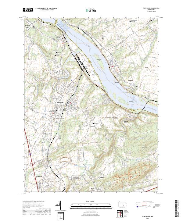 2023 York Haven2023 Print · USGSThe Susquehanna River corridor south of the state capital reflects centuries of settlement and industry in the early 2020s. Genealogists can trace family names at the Arnett Burial Site or Goods Mennonite Church Cem while historians study the site of Codorus Furnace.
 - 2023 Map of Middletown, 2023 Print
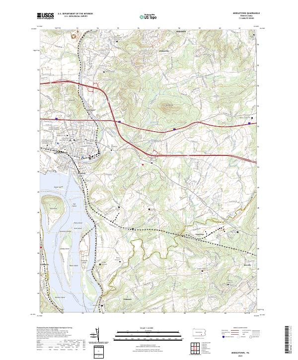 2023 Middletown2023 Print · USGSMiddletown and Royalton sit at the historic meeting of the Susquehanna and Swatara Creek in the early twenty-first century. Genealogists can trace family roots through numerous sites like the Old German Lutheran Burial Grounds, Nissley Graveyard, and the Gingrich Family Plot.
 - 2023 Map of Columbia West, 2023 Print
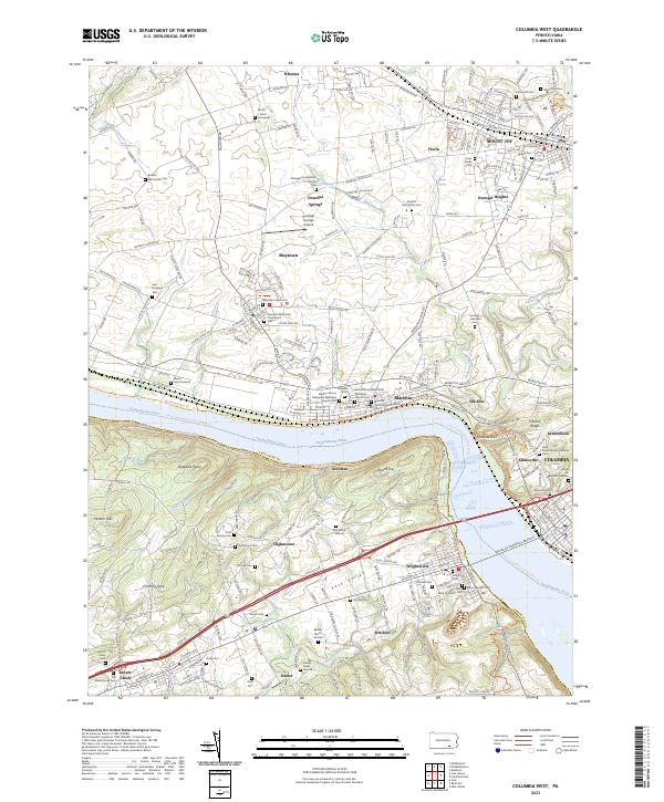 2023 Columbia West2023 Print · USGSThe riverfront corridor of the Susquehanna near Marietta and Mount Joy is captured in detail during the early 2020s. Trace local family history at Donegal Presbyterian Church or explore the rugged river bluffs at Chickies Rock.
End of results
Showing maps 1-3 of 3
Top cities near Conoy Township
- Harrisburg historical maps
- York historical maps
- Lebanon historical maps
- Colonial Park historical maps
- Hershey historical maps
- Elizabethtown historical maps
See more
Top neighborhoods of Conoy Township
- Bainbridge historical maps
- Locust Grove historical maps
- Stacktown historical maps
- Falmouth historical maps
- Billmeyer historical maps
Frequently asked questions
- What are the different types of historical maps available for Conoy Township?
- What is the oldest map of Conoy Township?
- Where can I purchase historical maps of Conoy Township for my home or office?
- Where can I download high-res historical maps of Conoy Township?
- Are there historical topographic maps available for Conoy Township?
- Is there historical aerial imagery available for Conoy Township?
- Where are historical maps of Conoy Township sourced from?