2020s Maps of Dallas Township, Pennsylvania
Explore 4 historic maps of Dallas Township from the 2020s. These maps offer a rare glimpse into what life looked like during the 2020s — showing old roads, neighborhoods, homes, and landmarks that have changed or disappeared over time.
Whether you're researching your family's past, planning a metal detecting trip, or studying how Dallas Township's landscape evolved across the 2020s, these high-resolution maps are a powerful tool for exploring the history of this region.
- Focus on a specific era: All maps on this page are from the 2020s, giving you a focused view of this time period.
- See what’s changed: Compare century-old streets, trails, and buildings to today's modern landscape using overlays and satellite layers.
- Research with precision: Use these maps for genealogy, historical research, land use analysis, or educational projects.
- View, download, or print: Maps are fully viewable online in high resolution, and can be downloaded or printed for your own records.
Start exploring Dallas Township's history through authentic maps from the 2020s. This is your window into the past.
Dallas Township, PA maps
(4)- 2023 Map of Harveys Lake, 2023 Print
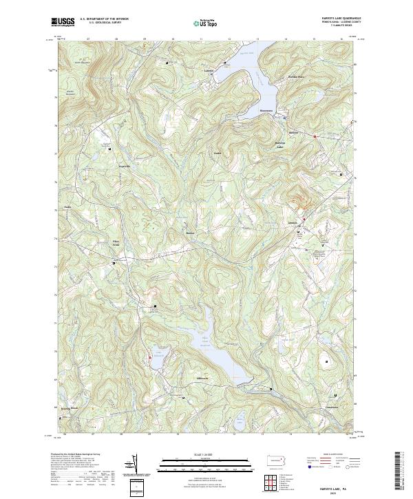 2023 Harveys Lake2023 Print · USGSHarveys Lake and the surrounding Back Mountain communities are captured in this recent survey of the Luzerne County highlands. Researchers can trace family history through numerous burial sites like Lehman Center Cem and Saint Anns Cem, or locate the Pennsylvania State University Wilkes-Barre campus.
 - 2023 Map of Noxen, 2023 Print
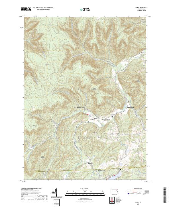 2023 Noxen2023 Print · USGSThe mountain valleys of Wyoming County are documented here in detail, showing the settlement patterns along Bowman Creek. Researchers can locate family burial sites like Orcutt's Grove Cem Dymond Section and trace old routes through Noxen and Stull.
 - 2023 Map of Kingston, 2023 Print
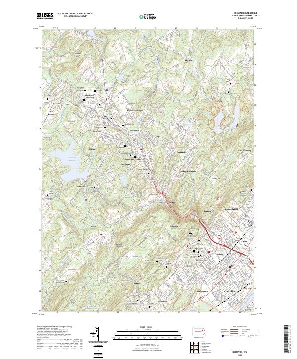 2023 Kingston2023 Print · USGSThe Wyoming Valley and Back Mountain regions are captured here in the early twenty-first century as suburban growth meets long-standing religious landmarks. Genealogists can locate family sites like the Lamoreaux Family Burying Ground or churches such as Saint John's Russian Orthodox Cem.
 - 2023 Map of Center Moreland, 2023 Print
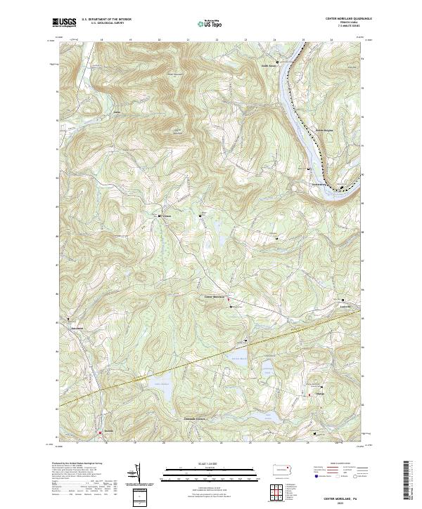 2023 Center Moreland2023 Print · USGSWyoming and Luzerne counties meet in this landscape of river valleys and mountain peaks at the start of the twenty-first century. Researchers can trace family sites at Orange Methodist Church or locate ancestral plots at Keeler Cem and Fitch Cem.
End of results
Showing maps 1-4 of 4
Top cities near Dallas Township
- Wilkes-Barre historical maps
- Kingston historical maps
- Nanticoke historical maps
- Plains Township historical maps
- Pittston historical maps
- Kingston Township historical maps
See more
Top neighborhoods of Dallas Township
- Fern Brook historical maps
- Ketcham historical maps
- Kunkle historical maps
- Demunds Corners historical maps
- Hays Corner historical maps
- Maplewood Heights historical maps
See more
Frequently asked questions
- What are the different types of historical maps available for Dallas Township?
- What is the oldest map of Dallas Township?
- Where can I purchase historical maps of Dallas Township for my home or office?
- Where can I download high-res historical maps of Dallas Township?
- Are there historical topographic maps available for Dallas Township?
- Is there historical aerial imagery available for Dallas Township?
- Where are historical maps of Dallas Township sourced from?