1900s (20th Century) Maps of Cogan House Township, Pennsylvania
Explore 21 historic maps of Cogan House Township from the 1900s (20th Century). These maps offer a rare glimpse into what life looked like during the 1900s — showing old roads, neighborhoods, homes, and landmarks that have changed or disappeared over time.
Whether you're researching your family's past, planning a metal detecting trip, or studying how Cogan House Township's landscape evolved across the 1900s, these high-resolution maps are a powerful tool for exploring the history of this region.
- Focus on a specific era: All maps on this page are from the 1900s, giving you a focused view of this time period.
- See what’s changed: Compare century-old streets, trails, and buildings to today's modern landscape using overlays and satellite layers.
- Research with precision: Use these maps for genealogy, historical research, land use analysis, or educational projects.
- View, download, or print: Maps are fully viewable online in high resolution, and can be downloaded or printed for your own records.
Start exploring Cogan House Township's history through authentic maps from the 1900s. This is your window into the past.
Cogan House Township, PA maps
(21)- 1921 Map of Trout Run, 1957 Print
 1921 Trout Run1957 Print · USGSThe Lycoming Creek valley in the 1920s served as a vital transit and industrial corridor north of Williamsport. Genealogists and local historians can trace family ties through dozens of named rural schools, including Beech Grove School and Chestnut Grove School, or locate early industry at Balls Mills.3 unique versions available
 - 1923 Map of Trout Run
 1923 Trout Run1923 Print · USGSLycoming County in the early 1920s shows a mountain landscape defined by small valley settlements and a dense network of country schools. You can trace family roots at Anthony Church or locate vanished industrial sites like the Nail Factory and Balls Mills.4 unique versions available
 - 1935 Map of Waterville, 1973 Print
 1935 Waterville1973 Print · USGSLycoming County at the dawn of the 1970s shows a landscape of deep valleys and rising ridges shaped by the Penn Central rail line. Researchers can trace the rural communities of Waterville and Tombs, locating local landmarks like Centennial Ch and Mt Pleasant Ch.
 - 1937 Map of Waterville
 1937 Waterville1937 Print · USGSThe Pine Creek valley and its logging railroad corridors come alive in this late 1930s survey of Lycoming County. Researchers can trace the era of the Civilian Conservation Corps at CCC Camp No 129 or locate family roots at English Center, Cammal, and Okome.5 unique versions available
 - 1943 Map of Waterville
 1943 Waterville1943 Print · USGSLycoming County mountain life in the early 1940s centers on the river junctions and rail sidings of the Pine Creek valley. Genealogists and hikers can trace old routes like the Silver Springs Road or find forgotten sites like Ross Siding, Carsontown, and Springer Sch.3 unique versions available
 - 1944 Map of Trout Run
 1944 Trout Run1944 Print · USGSLycoming County during the mid-forties reveals a landscape of high ridges and narrow creek valleys connected by the Pennsylvania RR. Genealogists and local historians can trace dozens of rural school sites like Steam Mill School or locate family landmarks such as Horner Hollow and the Salladasburg PO.
 - 1954 Map of Williamsport
 1954 Williamsport1954 Print · USGSNorth-central Pennsylvania in the mid-fifties is defined by the winding West Branch Susquehanna River and its industrial valley. Local historians can trace the massive Susquehanna Ordnance Depot and the extensive rail networks of the Pennsylvania Railroad.
 - 1960 Map of Williamsport
 1960 Williamsport1960 Print · USGSNorth-central Pennsylvania in the mid-twentieth century was a vital corridor of rail and river industry stretching from the New York line to the coal regions. Genealogists can trace the rail networks of the Pennsylvania RR and Lehigh Valley RR connecting towns like Williamsport, Towanda, and Lock Haven.
 - 1962 Map of Williamsport, 1966 Print
 1962 Williamsport1966 Print · USGSNorth-central Pennsylvania was a landscape of industrial river hubs and vast state woodlands in the early sixties. Researchers can trace the path of the Pennsylvania Railroad through Williamsport and explore the remote reaches of Bucktail State Park.5 unique versions available
 - 1965 Map of Williamsport
 1965 Williamsport1965 Print · USGSNorth-central Pennsylvania in the mid-1960s is defined by the industrial river towns and vast timberlands of the Allegheny Plateau. Researchers can trace historic rail lines like the Erie Lackawanna and Reading as they thread through Williamsport, Lock Haven, and Jersey Shore.
 - 1965 Map of White Pine, 1967 Print
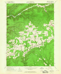 1965 White Pine1967 Print · USGSLycoming County highlands in the mid-1960s reveal a landscape of secluded mountain hollows and scattered upland farms. Genealogists can trace family footprints at Persun Cem and the Cogan House Sch, or locate old settlements like Steam Valley and White Pine.3 unique versions available
 - 1965 Map of Salladasburg, 1967 Print
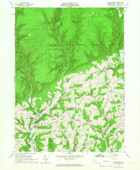 1965 Salladasburg1967 Print · USGSSalladasburg and the surrounding Lycoming County townships are documented here during the mid-sixties, showing a landscape defined by deep hollows and rural church life. Researchers can trace family sites at Anthony Cemetery, locate the St Johns Church, and see the extent of local industry at the Strip Mines.2 unique versions available
 - 1965 Map of Trout Run, 1967 Print
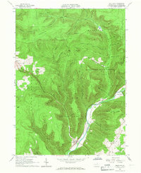 1965 Trout Run1967 Print · USGSLycoming County mountain life in the mid-sixties is centered on the rail-and-river corridor at Trout Run and Fields Station. Genealogists and historians can locate rural landmarks like Rose Valley Sch, Steam Valley Ch, and the winding Pennsylvania Railroad.3 unique versions available
 - 1965 Map of English Center, 1967 Print
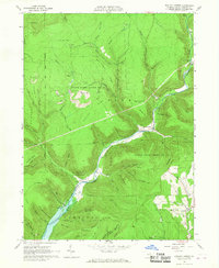 1965 English Center1967 Print · USGSLycoming County's rugged backcountry comes into focus during the mid-sixties as timbering and mining interests meet state conservation lands. Genealogists and historians can trace family locations at English Center or find the remote Carsontown Cem and Dowling Hill Cem.3 unique versions available
 - 1965 Map of Waterville, 1967 Print
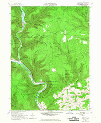 1965 Waterville1967 Print · USGSLycoming County’s deep gorges and forested ridges are captured here in the mid-sixties as the local creek-side settlements thrived. Researchers can trace family roots at Mt Pleasant Ch, follow the New York Central line through Waterville, or locate historic sites like Camp Kline.2 unique versions available
 - 1965 Map of Cogan Station, 1967 Print
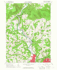 1965 Cogan Station1967 Print · USGSLycoming County enters a period of mid-century suburban expansion in the 1960s as the valley north of WILLIAMSPORT develops. Researchers can trace family sites at the Blooming Grove Meetinghouse, St Michaels Ch, and the sprawling Wildwood Cemetery.2 unique versions available
 - 1966 Map of Williamsport
 1966 Williamsport1966 Print · USGSThe Susquehanna Valley was a hub of transit and industry in the mid-seventies, where the river's West Branch connected major college towns and timberlands. Researchers can trace historical rail lines like the Reading or locate regional landmarks from Jersey Shore to Ricketts Glen State Park.
 - 1984 Map of Williamsport West, 1985 Print
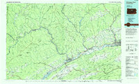 1984 Williamsport West1985 Print · USGSCentral Pennsylvania in the mid-eighties was a landscape of dense state forests and industrious river towns along the West Branch Susquehanna River. Trace the rail lines of Conrail through Renovo or locate the historic grounds of Lock Haven State College.2 unique versions available
 - 1994 Map of Waterville, 1999 Print
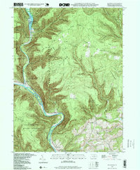 1994 Waterville1999 Print · USGSWaterville and the deep valleys of Lycoming County are captured in the late twentieth century as timber and recreation define the local economy. Genealogists and hikers can trace the Little Pine Creek drainage to find Mt Pleasant Ch, Cemetery Hollow, and Little Pine State Park.
 - 1994 Map of Cogan Station, 1999 Print
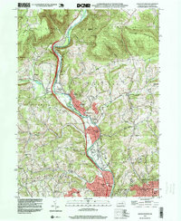 1994 Cogan Station1999 Print · USGSThe Lycoming Creek valley north of Williamsport comes into focus in the mid-1990s, showcasing a mix of mountain ridges and growing communities. Researchers can trace local history through features like Balls Mills, the Blooming Grove Meetinghouse, and St Michaels Ch.
 - 1994 Map of English Center, 1999 Print
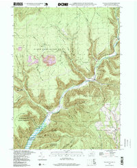 1994 English Center1999 Print · USGSLycoming County’s rugged northern highlands are captured here in the late twentieth century, showing a region defined by conservation lands and coal extraction. Genealogists and historians can locate the isolated Carsontown Cemetery and traces of mountain life in English Center or Brookside.
End of results
Showing maps 1-21 of 21
Top cities near Cogan House Township
- Williamsport historical maps
- South Williamsport historical maps
- Jersey Shore historical maps
- Kenmar historical maps
- Garden View historical maps
- Faxon historical maps
See more
Top neighborhoods of Cogan House Township
- Brookside historical maps
- Steam Valley historical maps
- White Pine historical maps
- Beech Grove historical maps
Frequently asked questions
- What are the different types of historical maps available for Cogan House Township?
- What is the oldest map of Cogan House Township?
- Where can I purchase historical maps of Cogan House Township for my home or office?
- Where can I download high-res historical maps of Cogan House Township?
- Are there historical topographic maps available for Cogan House Township?
- Is there historical aerial imagery available for Cogan House Township?
- Where are historical maps of Cogan House Township sourced from?