1990s Maps of Loyalsock Township, Pennsylvania
Explore 4 historic maps of Loyalsock Township from the 1990s. These maps offer a rare glimpse into what life looked like during the 1990s — showing old roads, neighborhoods, homes, and landmarks that have changed or disappeared over time.
Whether you're researching your family's past, planning a metal detecting trip, or studying how Loyalsock Township's landscape evolved across the 1990s, these high-resolution maps are a powerful tool for exploring the history of this region.
- Focus on a specific era: All maps on this page are from the 1990s, giving you a focused view of this time period.
- See what’s changed: Compare century-old streets, trails, and buildings to today's modern landscape using overlays and satellite layers.
- Research with precision: Use these maps for genealogy, historical research, land use analysis, or educational projects.
- View, download, or print: Maps are fully viewable online in high resolution, and can be downloaded or printed for your own records.
Start exploring Loyalsock Township's history through authentic maps from the 1990s. This is your window into the past.
Loyalsock Township, PA maps
(4)- 1994 Map of Montoursville South, 1996 Print
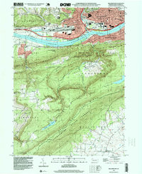
 1994 Montoursville South1996 Print · USGSLycoming County in the mid-1990s shows a complex landscape where the Susquehanna River valley meets the northern Appalachian ridges. Researchers can trace historic riverfront growth and institutional sites like the Allenwood Prison Camp and the Pennsylvania College of Technology.
 - 1994 Map of Cogan Station, 1999 Print
 1994 Cogan Station1999 Print · USGSThe Lycoming Creek valley north of Williamsport comes into focus in the mid-1990s, showcasing a mix of mountain ridges and growing communities. Researchers can trace local history through features like Balls Mills, the Blooming Grove Meetinghouse, and St Michaels Ch.
 - 1994 Map of Williamsport, 1999 Print
 1994 Williamsport1999 Print · USGSThe river valley around Williamsport comes into focus in the mid-1990s as it transitions from industrial hub to forested ridges. Genealogists and historians can locate family plots at Wildwood Cemetery or trace community roots near Elimsport and the Immaculate Conception Ch.
 - 1999 Map of Montoursville North, 2001 Print
 1999 Montoursville North2001 Print · USGSNorth of Montoursville at the end of the century, the winding Loyalsock Creek valley balances state forest lands with growing residential neighborhoods. Local researchers can trace family sites at Christian Hill Cem or locate historical landmarks like the Lysock View County Home and Warrensville.
End of results
Showing maps 1-4 of 4
Top cities near Loyalsock Township
- Williamsport historical maps
- South Williamsport historical maps
- Montoursville historical maps
- White Deer Township historical maps
- Kenmar historical maps
- Garden View historical maps
See more
Top neighborhoods of Loyalsock Township
- Penn Vale historical maps
- Heshbon Park historical maps
- Kenmar historical maps
- Faxon historical maps
- Lymehurst historical maps
Frequently asked questions
- What are the different types of historical maps available for Loyalsock Township?
- What is the oldest map of Loyalsock Township?
- Where can I purchase historical maps of Loyalsock Township for my home or office?
- Where can I download high-res historical maps of Loyalsock Township?
- Are there historical topographic maps available for Loyalsock Township?
- Is there historical aerial imagery available for Loyalsock Township?
- Where are historical maps of Loyalsock Township sourced from?