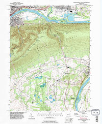
1994 Map of Montoursville South
USGS Topo · Published 1996About this map
The West Branch Susquehanna River carves a dramatic path through this 1994 survey, separating the urban development of Williamsport and Montoursville from the steep, forested slopes of Bald Eagle Mountain. The river serves as a corridor for the Conrail line and defines the lower boundaries of several townships including Brady and Gregg. Extensive public lands dominate the south, with the Tiadaghton State Forest and State Game Lands No 252 providing a sharp contrast to the industrial and academic clusters further north, such as the Pennsylvania College of Technology and the Williamsport-Lycoming County Airport.
Find a feature on this map
57 named features on this map. Tap any name to fly to it.
Don’t see what you’re looking for? This feature index may not catch every label — zoom into the map to look around manually.
Map Details
Editions of this 1994 Montoursville South Map
This is the sole edition of this map. No revisions or reprints were ever made.
Other maps of this area

1921 · Williamsport
USGS Topo · 1:48,000

1921 · Trout Run
USGS Topo · 1:62,500

1923 · Trout Run
USGS Topo · 1:62,500

1923 · Williamsport
USGS Topo · 1:62,500

1924 · Milton
USGS Topo · 1:62,500

1930 · Warrensville
USGS Topo · 1:62,500

1934 · Warrensville
USGS Topo · 1:62,500

1944 · Trout Run
USGS Topo · 1:62,500

1944 · Williamsport
USGS Topo · 1:62,500

1953 · Warrensville
USGS Topo · 1:62,500