Old Maps of Wolf Township, Pennsylvania
Explore 40 old maps of Wolf Township, spanning from 1924 to today. These high-resolution historic maps reveal how streets, neighborhoods, landmarks, and natural features evolved over time — perfect for genealogy, metal detecting, research, and local history exploration.
What you can do with these maps:
- See how Wolf Township changed over time: Compare historical maps to modern-day views to trace roads, homesites, rail lines & more.
- View detailed metadata: Each map includes creators, publishers, year, scale, and archive source.
- Overlay maps with satellite & LiDAR: Visualize the past alongside modern tools to explore terrain & human change.
- Trusted historical sources: Maps sourced from the USGS, Library of Congress, and other archives.
- Access maps your way: View online, download high-res files, or order prints for personal or research use.
Start exploring old maps of Wolf Township to uncover forgotten places, hidden landmarks, and the deep history beneath your feet.
Wolf Township, PA maps
(40)- 1924 Map of Milton
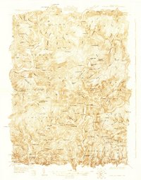
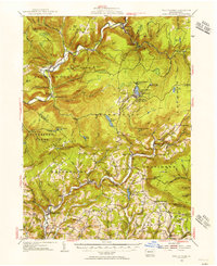
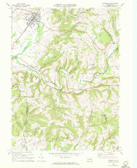
 1924 Milton1924 Print · USGSNorthumberland and Lycoming counties thrived along the river during the 1920s, dominated by a dense network of mountain ridges and rail corridors. Genealogists can locate dozens of rural landmarks, from the Old Furnace to the Stone Church and Pioneer School.4 unique versions available
 - 1927 Map of Eagles Mere
 1927 Eagles Mere1927 Print · USGSSullivan and Lycoming Counties were a network of mountain resorts and valley hamlets in the late twenties. Researchers can trace the grounds of the Ogdonia Clubhouse, locate the Mawrglen Post Office, and find remote rural schools like Glidewell Sch.
 - 1930 Map of Warrensville
 1930 Warrensville1930 Print · USGSLycoming County’s rugged valley and ridge landscape is captured here during the 1930s as small farming and timber communities thrived along the creek networks. Genealogists can trace family names at the County Farm or locate rural landmarks like Quaker Hill Sch, Fairfield Center, and the remote Coal Mine Hollow.3 unique versions available
 - 1932 Map of Eagle Mere
 1932 Eagle Mere1932 Print · USGSSullivan County mountain life comes alive in this early 1930s survey of the resort at Eagles Mere. Genealogists can trace family footprints at Bunker Hill Sch, the Swank Cem, or along the Williamsport and North Branch railroad.4 unique versions available
 - 1934 Map of Warrensville
 1934 Warrensville1934 Print · USGSLycoming County in the early thirties is a landscape of tight-knit valley settlements and steep ridges. Genealogists can trace family footprints across dozens of local landmarks like Wallis Run Ch, the Quaker Hill Sch, and the County Farm.3 unique versions available
 - 1935 Map of Hughesville
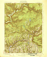
 1935 Hughesville1935 Print · USGSThe rural landscapes of Lycoming and Columbia counties are captured here in the mid-1930s, documenting a time when small schoolhouses and family farms still defined the region. Researchers can trace the Pennsylvania rail line and locate ancestral sites like Wintersteen Sch, Exchange, and Washingtonville.3 unique versions available
 - 1953 Map of Hughesville, 1956 Print
 1953 Hughesville1956 Print · USGSThe rural heart of Lycoming and Columbia Counties is captured here in the early fifties, showing a landscape defined by small townships and creek-side settlements. Researchers can locate vanished rural landmarks like Frenchtown Sch, Hendrickson Ch, and the streets of Washingtonville or Jerseytown.3 unique versions available
 - 1953 Map of Warrensville, 1956 Print
 1953 Warrensville1956 Print · USGSThe mountains and valleys of Lycoming County are shown in detail during the early fifties, from the railroad corridor at Bodines to the farms of Montoursville. Genealogists can locate family-named landmarks like Quaker Hill, the Church of the Assumption, and small hamlets such as Barbours or Hoppestown.2 unique versions available
 - 1953 Map of Eagles Mere, 1956 Print
 1953 Eagles Mere1956 Print · USGSThe Sullivan County highlands appear in the early 1950s as a landscape of mountain retreats and valley hamlets. Researchers can trace rural landmarks from Picture Rocks to Eagles Mere Park, including Rock Run Ch and the Mawrglen PO.3 unique versions available
 - 1953 Map of Milton, 1956 Print
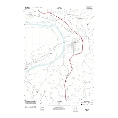
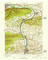 1953 Milton1956 Print · USGSThe Susquehanna Valley thrives during the early fifties, defined by its river-town industries and coal-hauling rail lines. Genealogists can trace family names through country landmarks like Stone Church, Old Furnace, and the U S Military Reservation.2 unique versions available
 - 1954 Map of Williamsport
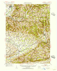
 1954 Williamsport1954 Print · USGSNorth-central Pennsylvania in the mid-fifties is defined by the winding West Branch Susquehanna River and its industrial valley. Local historians can trace the massive Susquehanna Ordnance Depot and the extensive rail networks of the Pennsylvania Railroad.
 - 1960 Map of Williamsport
 1960 Williamsport1960 Print · USGSNorth-central Pennsylvania in the mid-twentieth century was a vital corridor of rail and river industry stretching from the New York line to the coal regions. Genealogists can trace the rail networks of the Pennsylvania RR and Lehigh Valley RR connecting towns like Williamsport, Towanda, and Lock Haven.
 - 1962 Map of Williamsport, 1966 Print
 1962 Williamsport1966 Print · USGSNorth-central Pennsylvania was a landscape of industrial river hubs and vast state woodlands in the early sixties. Researchers can trace the path of the Pennsylvania Railroad through Williamsport and explore the remote reaches of Bucktail State Park.5 unique versions available
 - 1965 Map of Williamsport
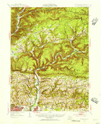
 1965 Williamsport1965 Print · USGSNorth-central Pennsylvania in the mid-1960s is defined by the industrial river towns and vast timberlands of the Allegheny Plateau. Researchers can trace historic rail lines like the Erie Lackawanna and Reading as they thread through Williamsport, Lock Haven, and Jersey Shore.
 - 1965 Map of Huntersville, 1967 Print
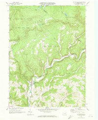
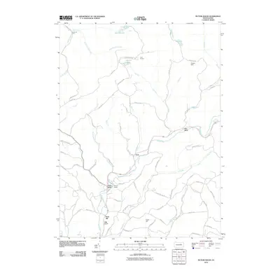
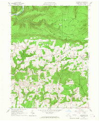 1965 Huntersville1967 Print · USGSLycoming County in the mid-1960s reveals a landscape transitioning from the steep timberlands of Tiadaghton State Forest to the farm valleys of Muncy. Genealogists and historians can trace community roots through the Grange Hall, Huntersville Trinity Cem, and old crossroads like Dewey Corner.4 unique versions available
 - 1965 Map of Muncy, 1967 Print
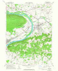 1965 Muncy1967 Print · USGSThe Susquehanna River valley near Muncy in the mid-1960s was a hub of rail transport and state infrastructure. Researchers can locate the State Correctional Institution, trace the Reading railroad corridor, or find family markers in Muncy Cemetery and Clinton Cemetery.4 unique versions available
 - 1966 Map of Williamsport
 1966 Williamsport1966 Print · USGSThe Susquehanna Valley was a hub of transit and industry in the mid-seventies, where the river's West Branch connected major college towns and timberlands. Researchers can trace historical rail lines like the Reading or locate regional landmarks from Jersey Shore to Ricketts Glen State Park.
 - 1968 Map of Hughesville, 1972 Print
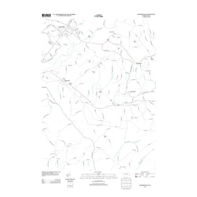
 1968 Hughesville1972 Print · USGSHughesville and its rural surroundings in Lycoming County appear here during the late sixties as a network of ridge-top farms and valley hamlets. Researchers can trace local heritage through sites like Moreland Community Ch, Pleasant Hill Cem, and the old Fairgrounds.3 unique versions available
 - 1970 Map of Picture Rocks, 1973 Print
 1970 Picture Rocks1973 Print · USGSThe Lycoming County highlands come into focus in the early seventies, centered on the mill-town origins of Picture Rocks and the winding Muncy Creek. Genealogists and researchers can trace rural homesteads near Tivoli, historic sites like Bryan Mill, and remote landmarks including Mapleton Ch.3 unique versions available
 - 1984 Map of Williamsport East, 1985 Print
 1984 Williamsport East1985 Print · USGSThe Susquehanna River valley and Allegheny highlands come together in this mid-eighties survey of central Pennsylvania. Trace family roots at Muncy Cem or locate institutional landmarks like Lycoming College and the State Correctional Institution at Retreat.2 unique versions available
 - 2010 Map of Hughesville, 2010 Print
 2010 Hughesville2010 Print · USGSCovers Wolf Township, including Moreland Township, Lewis Township, and other nearby areas
 - 2010 Map of Huntersville, 2010 Print
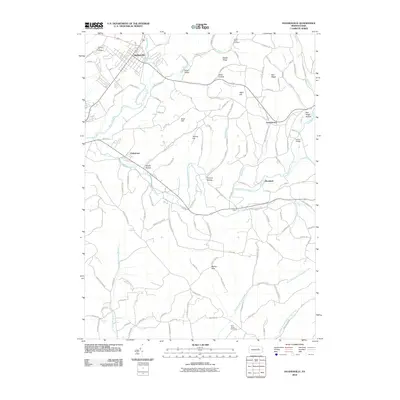
 2010 Huntersville2010 Print · USGSCovers Wolf Township, including Muncy Township, Upper Fairfield Township, and other nearby areas
 - 2010 Map of Muncy, 2010 Print
 2010 Muncy2010 Print · USGSCovers Wolf Township, including Lewis Township, Lime Bluff, and other nearby areas
 - 2010 Map of Picture Rocks, 2010 Print
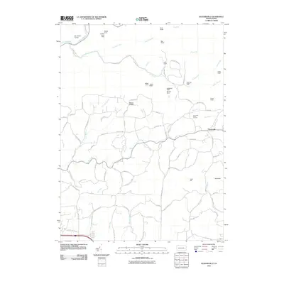
 2010 Picture Rocks2010 Print · USGSCovers Wolf Township, including Picture Rocks, Hillsgrove Township, and other nearby areas
 - 2013 Map of Hughesville, 2013 Print
 2013 Hughesville2013 Print · USGSCovers Wolf Township, including Moreland Township, Lewis Township, and other nearby areas
Showing maps 1-25 of 40
Top cities near Wolf Township
- Montoursville historical maps
- White Deer Township historical maps
- Greenwood Township historical maps
- Montgomery historical maps
- Moreland Township historical maps
- Millville historical maps
See more
Top neighborhoods of Wolf Township
Frequently asked questions
- What are the different types of historical maps available for Wolf Township?
- What is the oldest map of Wolf Township?
- Where can I purchase historical maps of Wolf Township for my home or office?
- Where can I download high-res historical maps of Wolf Township?
- Are there historical topographic maps available for Wolf Township?
- Is there historical aerial imagery available for Wolf Township?
- Where are historical maps of Wolf Township sourced from?