Old Maps of Lafayette Township, Pennsylvania
Explore 18 old maps of Lafayette Township, spanning from 1924 to today. These high-resolution historic maps reveal how streets, neighborhoods, landmarks, and natural features evolved over time — perfect for genealogy, metal detecting, research, and local history exploration.
What you can do with these maps:
- See how Lafayette Township changed over time: Compare historical maps to modern-day views to trace roads, homesites, rail lines & more.
- View detailed metadata: Each map includes creators, publishers, year, scale, and archive source.
- Overlay maps with satellite & LiDAR: Visualize the past alongside modern tools to explore terrain & human change.
- Trusted historical sources: Maps sourced from the USGS, Library of Congress, and other archives.
- Access maps your way: View online, download high-res files, or order prints for personal or research use.
Start exploring old maps of Lafayette Township to uncover forgotten places, hidden landmarks, and the deep history beneath your feet.
Lafayette Township, PA maps
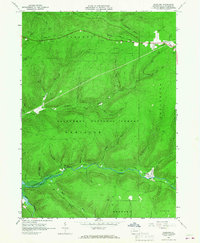
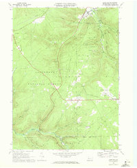
(18)- 1924 Map of Bradford
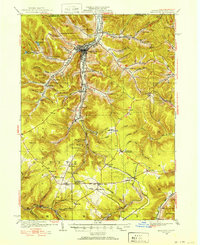 1924 Bradford1924 Print · USGSCovers Lafayette Township, including Bradford, Allegany, and other nearby areas2 unique versions available
 - 1926 Map of Bradford
 1926 Bradford1926 Print · USGSCovers Lafayette Township, including Bradford, Allegany, and other nearby areas4 unique versions available
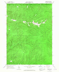
 - 1936 Map of Kinzua
 1936 Kinzua1936 Print · USGSCovers Lafayette Township, including Sheffield Township, Coldspring, and other nearby areas
 - 1941 Map of Kinzua
 1941 Kinzua1941 Print · USGSCovers Lafayette Township, including Sheffield Township, Coldspring, and other nearby areas3 unique versions available
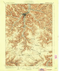
 - 1941 Map of Bradford, 1958 Print
 1941 Bradford1958 Print · USGSCovers Lafayette Township, including Bradford, Allegany, and other nearby areas2 unique versions available
 - 1944 Map of Bradford
 1944 Bradford1944 Print · USGSCovers Lafayette Township, including Bradford, Allegany, and other nearby areas
 - 1949 Map of Kinzua, 1954 Print
 1949 Kinzua1954 Print · USGSCovers Lafayette Township, including Sheffield Township, Coldspring, and other nearby areas4 unique versions available
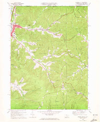
 - 1957 Map of Warren, 1964 Print
 1957 Warren1964 Print · USGSCovers Lafayette Township, including Saint Marys, Sandy Township, and other nearby areas4 unique versions available
 - 1958 Map of Warren
 1958 Warren1958 Print · USGSCovers Lafayette Township, including Saint Marys, Sandy Township, and other nearby areas
 - 1959 Map of Warren
 1959 Warren1959 Print · USGSCovers Lafayette Township, including Saint Marys, Sandy Township, and other nearby areas2 unique versions available
 - 1966 Map of Westline, 1967 Print
 1966 Westline1967 Print · USGSCovers Lafayette Township, including Wetmore Township, Hamlin Township, and other nearby areas4 unique versions available
 - 1966 Map of Stickney, 1968 Print
 1966 Stickney1968 Print · USGSCovers Lafayette Township, including Coldspring, Red House, and other nearby areas3 unique versions available
 - 1969 Map of Derricks City, 1972 Print
 1969 Derricks City1972 Print · USGSCovers Lafayette Township, including Bradford, Allegany, and other nearby areas3 unique versions available
 - 1969 Map of Cyclone, 1972 Print
 1969 Cyclone1972 Print · USGSCovers Lafayette Township, including McKean, Bingham, and other nearby areas2 unique versions available
 - 1969 Map of Lewis Run, 1972 Print
 1969 Lewis Run1972 Print · USGSCovers Lafayette Township, including Lewis Run, Taintor, and other nearby areas3 unique versions available
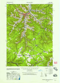
 - 1969 Map of Bradford, 1973 Print
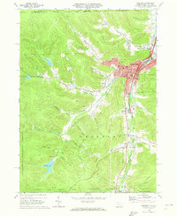 1969 Bradford1973 Print · USGSCovers Lafayette Township, including Bradford, Carrollton, and other nearby areas3 unique versions available
 - 1971 Map of Warren
 1971 Warren1971 Print · USGSCovers Lafayette Township, including Saint Marys, Sandy Township, and other nearby areas
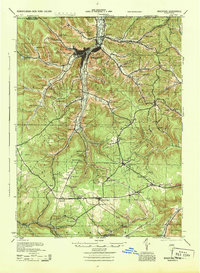
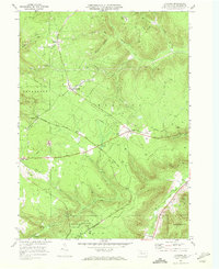
 - 1980 Map of Bradford, 1982 Print
 1980 Bradford1982 Print · USGSCovers Lafayette Township, including Saint Marys, Bradford, and other nearby areas
End of results
Showing maps 1-18 of 18
Top cities near Lafayette Township
- Bradford historical maps
- Allegany historical maps
- Kane historical maps
- Wetmore historical maps
- Carrollton historical maps
- Mount Jewett historical maps
See more
Top neighborhoods of Lafayette Township
- Westline historical maps
- Taintor historical maps
- Mount Alton historical maps
- Tallyho historical maps
- Riterville historical maps
- Timbuck historical maps
See more
Frequently asked questions
- What are the different types of historical maps available for Lafayette Township?
- What is the oldest map of Lafayette Township?
- Where can I purchase historical maps of Lafayette Township for my home or office?
- Where can I download high-res historical maps of Lafayette Township?
- Are there historical topographic maps available for Lafayette Township?
- Is there historical aerial imagery available for Lafayette Township?
- Where are historical maps of Lafayette Township sourced from?