2020s Maps of Wetmore Township, Pennsylvania
Explore 7 historic maps of Wetmore Township from the 2020s. These maps offer a rare glimpse into what life looked like during the 2020s — showing old roads, neighborhoods, homes, and landmarks that have changed or disappeared over time.
Whether you're researching your family's past, planning a metal detecting trip, or studying how Wetmore Township's landscape evolved across the 2020s, these high-resolution maps are a powerful tool for exploring the history of this region.
- Focus on a specific era: All maps on this page are from the 2020s, giving you a focused view of this time period.
- See what’s changed: Compare century-old streets, trails, and buildings to today's modern landscape using overlays and satellite layers.
- Research with precision: Use these maps for genealogy, historical research, land use analysis, or educational projects.
- View, download, or print: Maps are fully viewable online in high resolution, and can be downloaded or printed for your own records.
Start exploring Wetmore Township's history through authentic maps from the 2020s. This is your window into the past.
Wetmore Township, PA maps
(7)- 2023 Map of Ludlow, 2023 Print
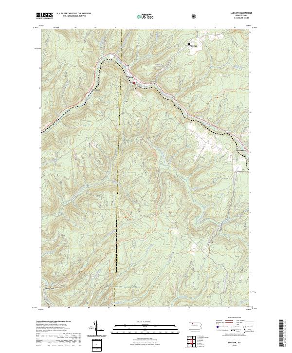 2023 Ludlow2023 Print · USGSThe timbered highlands of McKean County are captured here in the twenty-first century, showing the small settlements and mountain runs within the Allegheny National Forest. Researchers can trace the winding East Branch Tionesta Creek or locate local burials at Monah Cem and Gibbs Hill Cem.
 - 2023 Map of Wilcox, 2023 Print
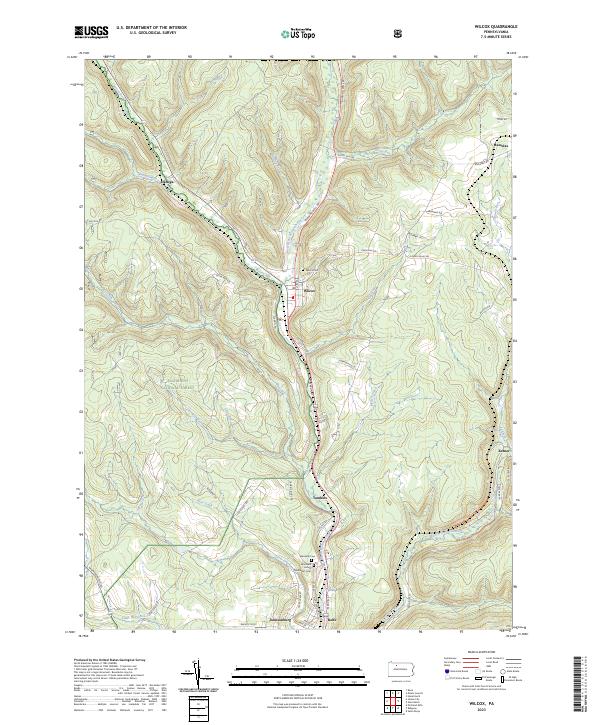 2023 Wilcox2023 Print · USGSElk County’s river valleys and forested uplands are captured in this modern survey of the Wilcox area. Researchers can trace family history through the Wilcox Cem and Wardville Cem or locate old settlements like Dahoga, Tambine, and Ketner.
 - 2023 Map of Westline, 2023 Print
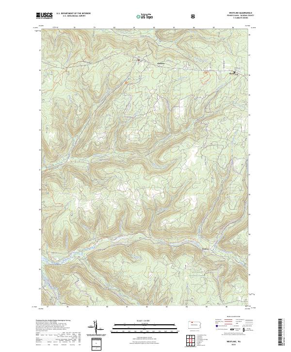 2023 Westline2023 Print · USGSMcKean County's highland forests and winding creek valleys are documented here in the early twenty-first century. Researchers can locate the mountain settlement of Westline, the Marshburg Cem, and the path of the North Country National Scenic Trl.
 - 2023 Map of Russell City, 2023 Print
 2023 Russell City2023 Print · USGSThe Allegheny National Forest is shown here at the intersection of four counties during the twenty-first century. Researchers can trace remote settlements and cemeteries such as Brookston, Pigs Ear, and the Brookston Cem amidst an extensive network of modern forest trails.
 - 2023 Map of Mount Jewett, 2023 Print
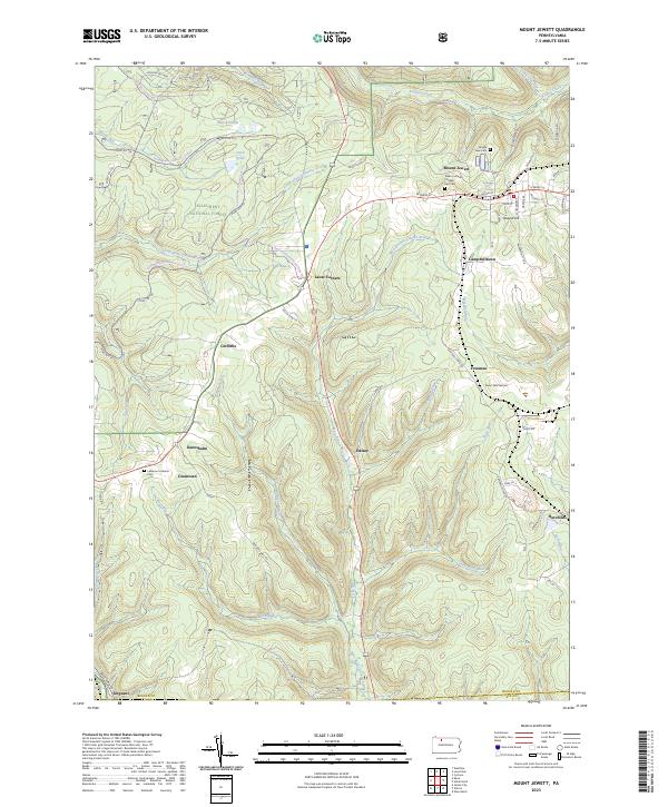 2023 Mount Jewett2023 Print · USGSThe borough of Mount Jewett and the surrounding woodlands of the Allegheny National Forest are shown here as they appear today. Researchers can trace family sites at Nebo Lutheran Chapel and Cem and old settlements like Kanesholm and Hutchins.
 - 2023 Map of James City, 2023 Print
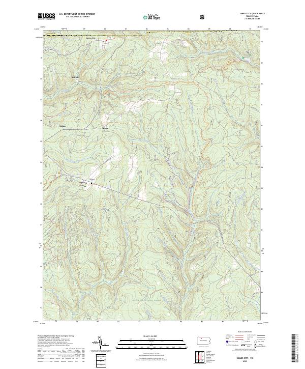 2023 James City2023 Print · USGSElk County's northern timberlands and small settlements are mapped here in the early twenty-first century as part of the Allegheny National Forest. Family historians can locate Highland Cem and trace old routes through James City, McKinley, and Nansen.
 - 2023 Map of Kane, 2023 Print
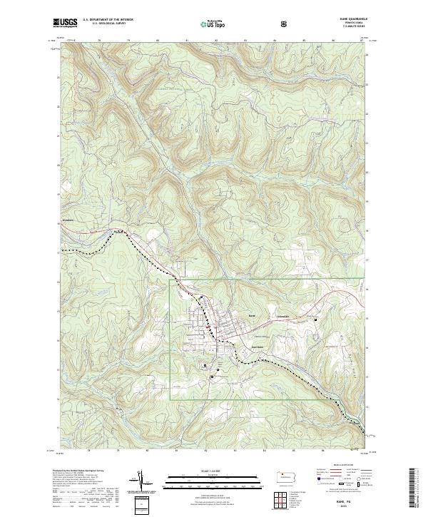 2023 Kane2023 Print · USGSThe high plateau of McKean County appears here in the early twenty-first century, centered on the borough of Kane and its surrounding forest lands. Researchers can trace local burial sites at Saint Callistus Cem or locate outlying settlements like Jo Jo, Wetmore, and Sergeant.
End of results
Showing maps 1-7 of 7
Top cities near Wetmore Township
- Saint Marys historical maps
- Kane historical maps
- Johnsonburg historical maps
- Lafayette Township historical maps
- Sheffield Township historical maps
- Wetmore historical maps
See more
Top neighborhoods of Wetmore Township
- Jo Jo historical maps
- Cartwrights Crossing historical maps
- East Kane historical maps
- Greendale historical maps
- Coontown historical maps
- Kanesholm historical maps
See more
Frequently asked questions
- What are the different types of historical maps available for Wetmore Township?
- What is the oldest map of Wetmore Township?
- Where can I purchase historical maps of Wetmore Township for my home or office?
- Where can I download high-res historical maps of Wetmore Township?
- Are there historical topographic maps available for Wetmore Township?
- Is there historical aerial imagery available for Wetmore Township?
- Where are historical maps of Wetmore Township sourced from?