2020s Maps of Armagh Township, Pennsylvania
Explore 7 historic maps of Armagh Township from the 2020s. These maps offer a rare glimpse into what life looked like during the 2020s — showing old roads, neighborhoods, homes, and landmarks that have changed or disappeared over time.
Whether you're researching your family's past, planning a metal detecting trip, or studying how Armagh Township's landscape evolved across the 2020s, these high-resolution maps are a powerful tool for exploring the history of this region.
- Focus on a specific era: All maps on this page are from the 2020s, giving you a focused view of this time period.
- See what’s changed: Compare century-old streets, trails, and buildings to today's modern landscape using overlays and satellite layers.
- Research with precision: Use these maps for genealogy, historical research, land use analysis, or educational projects.
- View, download, or print: Maps are fully viewable online in high resolution, and can be downloaded or printed for your own records.
Start exploring Armagh Township's history through authentic maps from the 2020s. This is your window into the past.
Armagh Township, PA maps
(7)- 2023 Map of Alfarata, 2023 Print
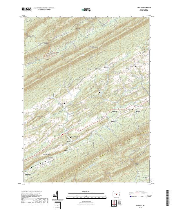 2023 Alfarata2023 Print · USGSThe ridge-and-valley landscape of Mifflin County comes alive in this survey of the communities south of Jacks Mountain. Genealogists can trace family footprints at Alfarata Lutheran Cem, Wagner Cem, and the small settlement of Paintersville.
 - 2023 Map of Weikert, 2023 Print
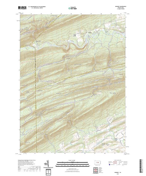 2023 Weikert2023 Print · USGSThe borderlands of Snyder and Union Counties come alive in this recent survey of the ridges along Penns Creek. Genealogists and historians can locate the Hironimus Union Cem and trace the small settlements of Weikert and Pardee.
 - 2023 Map of Spring Mills, 2023 Print
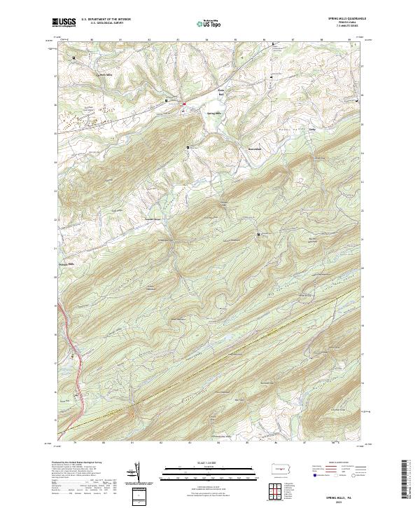 2023 Spring Mills2023 Print · USGSThe Ridge-and-Valley Appalachians of Centre and Mifflin counties are mapped here in the early twenty-first century. Genealogists and local historians can trace legacy sites like Farmers Mills, Potters Mills, and many rural burial grounds including Union Cem and Holy Cross Cem.
 - 2023 Map of Coburn, 2023 Print
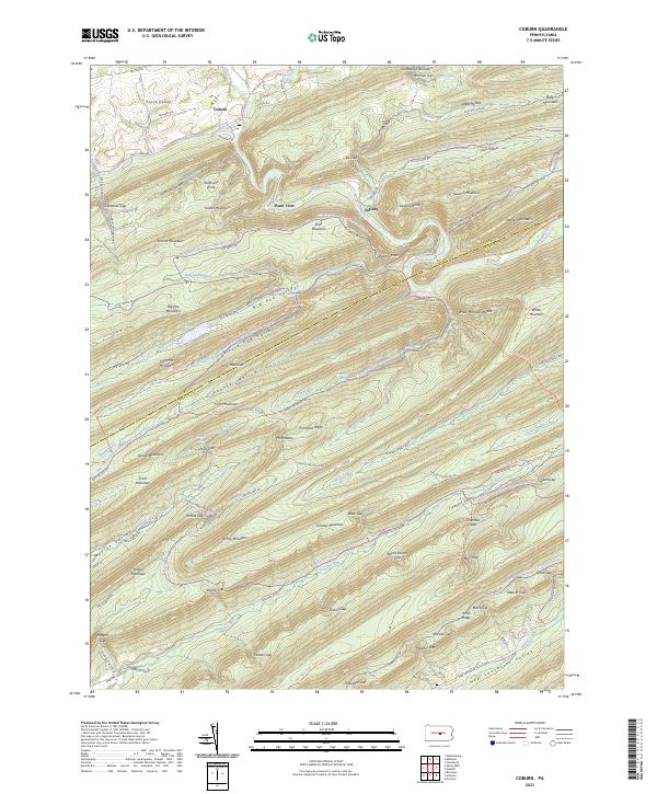 2023 Coburn2023 Print · USGSThe ridge-and-valley landscape of Centre and Mifflin counties comes into focus in this recent survey of the Bald Eagle State Forest. Local historians can trace the paths of Penns Creek and Elk Creek through Coburn or locate landmarks like Poe Lake and Stillhouse Knob.
 - 2023 Map of Centre Hall, 2023 Print
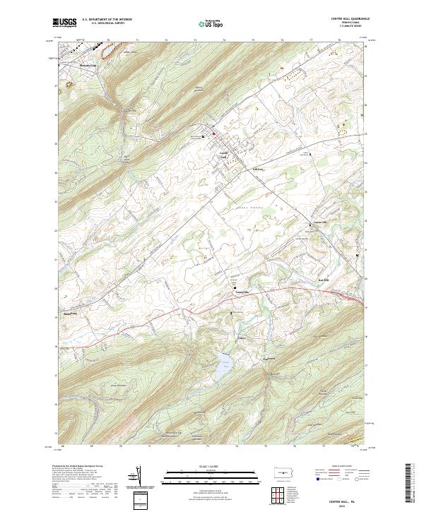 2023 Centre Hall2023 Print · USGSCentre County in the 2020s remains a landscape of deep limestone valleys and steep mountain gaps. Researchers can trace historic cemeteries like Reformed and Lutheran Cem and early settlements such as Tusseyville and Pleasant Gap.
 - 2023 Map of Burnham, 2023 Print
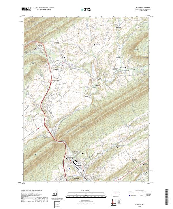 2023 Burnham2023 Print · USGSThe Kishacoquillas Valley of central Pennsylvania is captured here in a moment of continued rural tradition and residential growth. Genealogists can locate family sites at Back Mountain Road Amish Cem, Potlicker Flats, and the Vira Methodist Church Cem.
 - 2023 Map of Barrville, 2023 Print
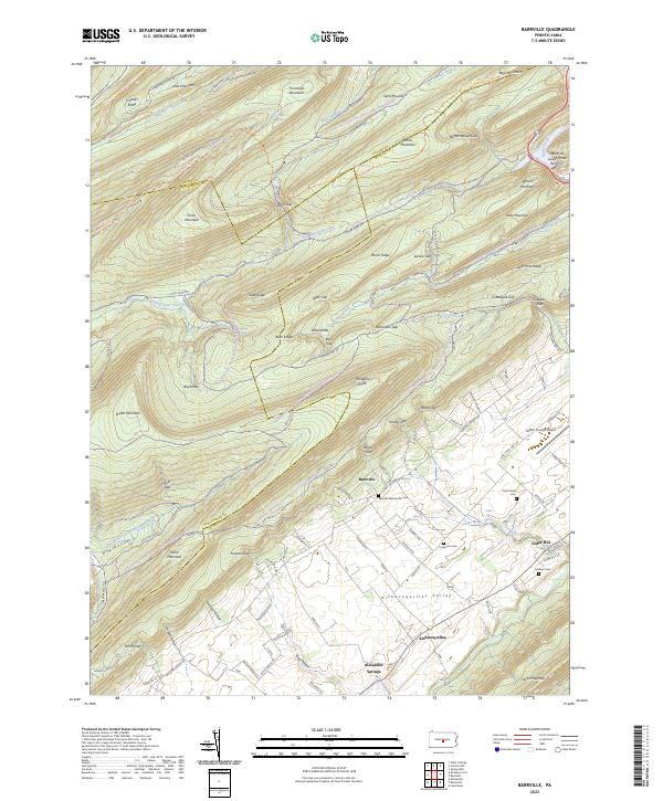 2023 Barrville2023 Print · USGSMifflin County's ridge-and-valley landscape is showcased in this contemporary survey of the Barrville area. Genealogists and local historians can locate family burial sites at Long Lane Cem and Hooleys Cem or trace the drainage of Tea Creek.
End of results
Showing maps 1-7 of 7
Top cities near Armagh Township
- Lewistown historical maps
- Granville Township historical maps
- Decatur Township historical maps
- Pleasant Gap historical maps
- Burnham historical maps
- Menno Township historical maps
See more
Top neighborhoods of Armagh Township
- Honey historical maps
- Knobville historical maps
- Shrader historical maps
- Siglerville historical maps
- Mount Pleasant historical maps
- Locke Mills historical maps
See more
Frequently asked questions
- What are the different types of historical maps available for Armagh Township?
- What is the oldest map of Armagh Township?
- Where can I purchase historical maps of Armagh Township for my home or office?
- Where can I download high-res historical maps of Armagh Township?
- Are there historical topographic maps available for Armagh Township?
- Is there historical aerial imagery available for Armagh Township?
- Where are historical maps of Armagh Township sourced from?