2020s Maps of Hamilton Township, Pennsylvania
Explore 4 historic maps of Hamilton Township from the 2020s. These maps offer a rare glimpse into what life looked like during the 2020s — showing old roads, neighborhoods, homes, and landmarks that have changed or disappeared over time.
Whether you're researching your family's past, planning a metal detecting trip, or studying how Hamilton Township's landscape evolved across the 2020s, these high-resolution maps are a powerful tool for exploring the history of this region.
- Focus on a specific era: All maps on this page are from the 2020s, giving you a focused view of this time period.
- See what’s changed: Compare century-old streets, trails, and buildings to today's modern landscape using overlays and satellite layers.
- Research with precision: Use these maps for genealogy, historical research, land use analysis, or educational projects.
- View, download, or print: Maps are fully viewable online in high resolution, and can be downloaded or printed for your own records.
Start exploring Hamilton Township's history through authentic maps from the 2020s. This is your window into the past.
Hamilton Township, PA maps
(4)- 2023 Map of Stroudsburg, 2023 Print
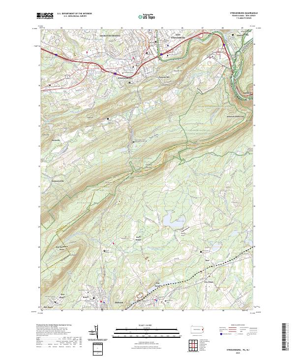 2023 Stroudsburg2023 Print · USGSThe Pocono foothills meet the Lehigh Valley in the early 2020s, showing a landscape defined by the Delaware Water Gap and rising university towns. Researchers can locate local landmarks like the Monroe County Courthouse, Minsi Lake, and the Shafer Schoolhouse Cem.
 - 2023 Map of Saylorsburg, 2023 Print
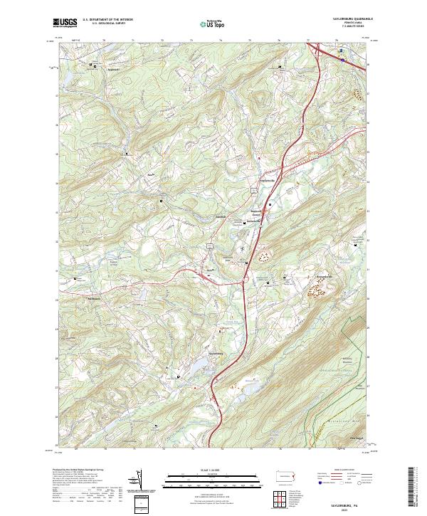 2023 Saylorsburg2023 Print · USGSMonroe County settlements and family burial grounds are meticulously documented in this contemporary survey of the Pennsylvania landscape. Researchers can locate ancestors at the Bossert-Heller Family Cem or trace the Kellersville Esker near Sciota.
 - 2023 Map of Wind Gap, 2023 Print
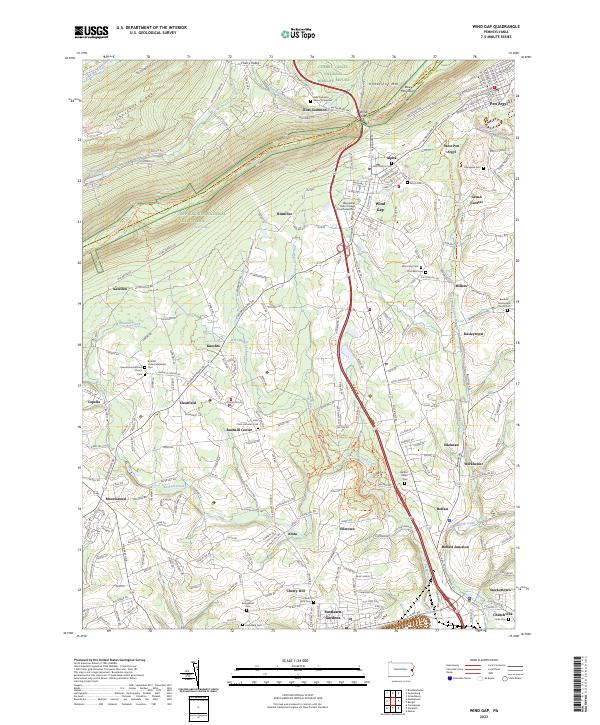 2023 Wind Gap2023 Print · USGSThe Lehigh Valley gap and surrounding townships are shown here as they appear in the early 2020s. Genealogists and historians can locate dozens of burial sites and churches, including Ross Common Manor Graveyard and Belfast Union Cem.
 - 2023 Map of Mount Pocono, 2023 Print
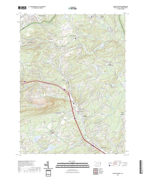 2023 Mount Pocono2023 Print · USGSMount Pocono and the surrounding Monroe County heights are shown in detail as they appeared in 2023. Genealogists and local historians can trace family locations through numerous sites like Keokee Chapel Cem, Meisertown, and Pocono Manor.
End of results
Showing maps 1-4 of 4
Top cities near Hamilton Township
- Easton historical maps
- East Stroudsburg historical maps
- Lopatcong Township historical maps
- Blairstown historical maps
- Stroudsburg historical maps
- Nazareth historical maps
See more
Top neighborhoods of Hamilton Township
- Blue Mountain Pines historical maps
- Sciota historical maps
- Sandhill historical maps
- Brainerd Center historical maps
- Kemmertown historical maps
- Snydersville historical maps
See more
Frequently asked questions
- What are the different types of historical maps available for Hamilton Township?
- What is the oldest map of Hamilton Township?
- Where can I purchase historical maps of Hamilton Township for my home or office?
- Where can I download high-res historical maps of Hamilton Township?
- Are there historical topographic maps available for Hamilton Township?
- Is there historical aerial imagery available for Hamilton Township?
- Where are historical maps of Hamilton Township sourced from?