2020s Maps of Pocono Pines, Tobyhanna Township
Explore 3 historic maps of Pocono Pines from the 2020s. These maps offer a rare glimpse into what life looked like during the 2020s — showing old roads, neighborhoods, homes, and landmarks that have changed or disappeared over time.
Whether you're researching your family's past, planning a metal detecting trip, or studying how Pocono Pines's landscape evolved across the 2020s, these high-resolution maps are a powerful tool for exploring the history of this region.
- Focus on a specific era: All maps on this page are from the 2020s, giving you a focused view of this time period.
- See what’s changed: Compare century-old streets, trails, and buildings to today's modern landscape using overlays and satellite layers.
- Research with precision: Use these maps for genealogy, historical research, land use analysis, or educational projects.
- View, download, or print: Maps are fully viewable online in high resolution, and can be downloaded or printed for your own records.
Start exploring Pocono Pines's history through authentic maps from the 2020s. This is your window into the past.
Pocono Pines, Tobyhanna Township maps
(3)- 2023 Map of Tobyhanna, 2023 Print
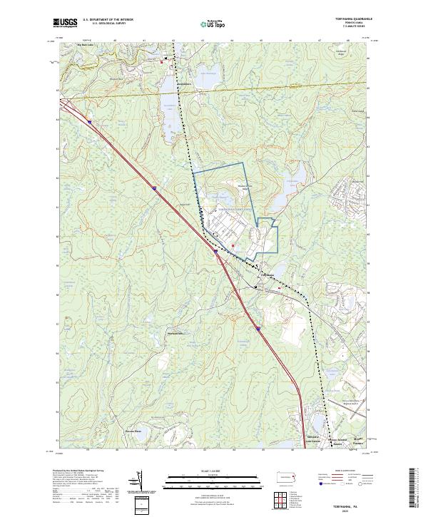 2023 Tobyhanna2023 Print · USGSThe Pennsylvania Poconos come into focus here, showing the military and recreational landscape surrounding the Tobyhanna Army Depot. Trace the development of Stillwater Lake Estates or locate ancestral sites at Lehigh Cem and Saint Ann Cem.
 - 2023 Map of Pocono Pines, 2023 Print
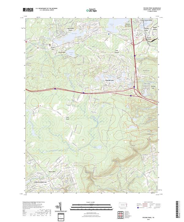 2023 Pocono Pines2023 Print · USGSMonroe County's highlands are shown in detail here during a period of significant residential expansion around its glacial waters. Researchers can trace established neighborhoods like Pocono Pines or locate landmarks such as the Pocono Lake Cem and Camelback Mtn.
 - 2023 Map of Blakeslee, 2023 Print
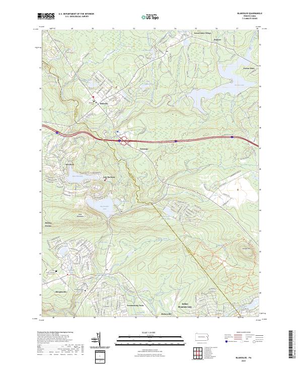 2023 Blakeslee2023 Print · USGSMonroe and Carbon Counties are captured here in a moment of continued growth within the Pocono plateau. Researchers can trace family sites at Blakeslee Cem and Old Albrightsville Cem or locate the historic Saint Paul's Lutheran Church.
End of results
Showing maps 1-3 of 3
Top cities near Pocono Pines
- Scranton historical maps
- Tobyhanna historical maps
- Moosic historical maps
- Mount Pocono historical maps
- Spring Brook Township historical maps
- Moscow historical maps
See more
Top neighborhoods of Pocono Pines
Frequently asked questions
- What are the different types of historical maps available for Pocono Pines?
- What is the oldest map of Pocono Pines?
- Where can I purchase historical maps of Pocono Pines for my home or office?
- Where can I download high-res historical maps of Pocono Pines?
- Are there historical topographic maps available for Pocono Pines?
- Is there historical aerial imagery available for Pocono Pines?
- Where are historical maps of Pocono Pines sourced from?