1990s Maps of Montgomery Township, Pennsylvania
Explore 6 historic maps of Montgomery Township from the 1990s. These maps offer a rare glimpse into what life looked like during the 1990s — showing old roads, neighborhoods, homes, and landmarks that have changed or disappeared over time.
Whether you're researching your family's past, planning a metal detecting trip, or studying how Montgomery Township's landscape evolved across the 1990s, these high-resolution maps are a powerful tool for exploring the history of this region.
- Focus on a specific era: All maps on this page are from the 1990s, giving you a focused view of this time period.
- See what’s changed: Compare century-old streets, trails, and buildings to today's modern landscape using overlays and satellite layers.
- Research with precision: Use these maps for genealogy, historical research, land use analysis, or educational projects.
- View, download, or print: Maps are fully viewable online in high resolution, and can be downloaded or printed for your own records.
Start exploring Montgomery Township's history through authentic maps from the 1990s. This is your window into the past.
Montgomery Township, PA maps
(6)- 1992 Map of Doylestown, 1995 Print
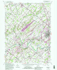 1992 Doylestown1995 Print · USGSBucks County at the start of the nineties reveals a landscape of growing towns and preserved open spaces along the Neshaminy Creek. Trace the footprints of historical communities like New Britain and Chalfont, or locate local landmarks like Beulah Chapel and the Warrington Airfield.
 - 1995 Map of Telford, 1996 Print
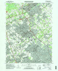 1995 Telford1996 Print · USGSThe boroughs of Telford and Souderton appear at a peak of late-century development along the Bucks and Montgomery county line. Genealogists and local historians can trace family-named sites and institutions like Lukins Cem, St Maria Goretti Sch, and the Schwenkfelder Ch.
 - 1997 Map of Telford, 2000 Print
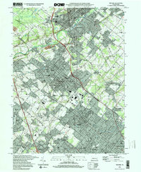 1997 Telford2000 Print · USGSSouderton and Telford are shown in the late nineties as established industrial and residential hubs along the Bucks and Montgomery county line. Researchers can trace institutional history through Grand View Hospital and old congregations like the Schwenkfelder Ch or Little Zion Ch.
 - 1999 Map of Doylestown, 2001 Print
 1999 Doylestown2001 Print · USGSBucks County at the close of the century shows a landscape where historic crossroads like Doylestown meet modern infrastructure. Researchers can trace local landmarks such as the County Home, Beulah Cem Chapel, and the Peace Valley Reservoir.
 - 1999 Map of Ambler, 2001 Print
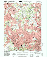 1999 Ambler2001 Print · USGSThe Montgomery County suburbs near the turn of the millennium show a landscape of high-density growth and institutional development. Trace local history through anchors like Ambler, the Graeme Historical Site, and the Willow Grove Naval Air Station.
 - 1999 Map of Lansdale, 2001 Print
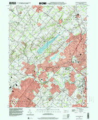
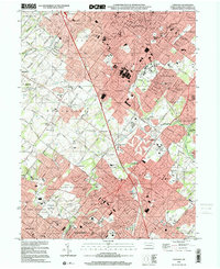 1999 Lansdale2001 Print · USGSMontgomery County at the turn of the millennium shows a bustling landscape of suburban growth and historical continuity. Researchers can trace family sites at Riverside Cemetery or Whitemarsh Cem, and locate institutions like Montgomery County Community College.
End of results
Showing maps 1-6 of 6
Top cities near Montgomery Township
- Philadelphia historical maps
- Abington Township historical maps
- Cheltenham Township historical maps
- Norristown historical maps
- Warminster Township historical maps
- Radnor Township historical maps
See more
Top neighborhoods of Montgomery Township
Frequently asked questions
- What are the different types of historical maps available for Montgomery Township?
- What is the oldest map of Montgomery Township?
- Where can I purchase historical maps of Montgomery Township for my home or office?
- Where can I download high-res historical maps of Montgomery Township?
- Are there historical topographic maps available for Montgomery Township?
- Is there historical aerial imagery available for Montgomery Township?
- Where are historical maps of Montgomery Township sourced from?