2020s Maps of Upper Hanover Township, Pennsylvania
Explore 4 historic maps of Upper Hanover Township from the 2020s. These maps offer a rare glimpse into what life looked like during the 2020s — showing old roads, neighborhoods, homes, and landmarks that have changed or disappeared over time.
Whether you're researching your family's past, planning a metal detecting trip, or studying how Upper Hanover Township's landscape evolved across the 2020s, these high-resolution maps are a powerful tool for exploring the history of this region.
- Focus on a specific era: All maps on this page are from the 2020s, giving you a focused view of this time period.
- See what’s changed: Compare century-old streets, trails, and buildings to today's modern landscape using overlays and satellite layers.
- Research with precision: Use these maps for genealogy, historical research, land use analysis, or educational projects.
- View, download, or print: Maps are fully viewable online in high resolution, and can be downloaded or printed for your own records.
Start exploring Upper Hanover Township's history through authentic maps from the 2020s. This is your window into the past.
Upper Hanover Township, PA maps
(4)- 2023 Map of Milford Square, 2023 Print
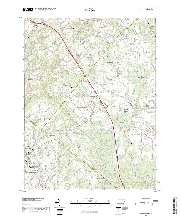 2023 Milford Square2023 Print · USGSUpper Bucks and Montgomery counties meet in this Pennsylvania survey, showcasing a landscape of rural hamlets and deep religious roots. Genealogists can trace family names at the Kraussdale Meeting House and Cem, Finland Mennonite Cem, and Stricker Cem.
 - 2023 Map of Perkiomenville, 2023 Print
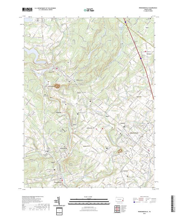 2023 Perkiomenville2023 Print · USGSMontgomery County’s river valleys and historic villages are detailed in this contemporary survey of the Perkiomen region. Genealogists can locate family burial sites at Old Goshenhoppen Cem, Salford Mennonite Cem, and Lederach Burial Ground.
 - 2023 Map of Sassamansville, 2023 Print
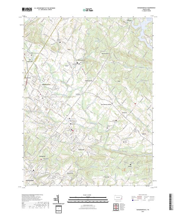 2023 Sassamansville2023 Print · USGSMontgomery County's rolling countryside appears here in the early twenty-first century, showing a landscape rooted in historic settlements and churchyards. Researchers can locate family landmarks like Bertolets Mennonite Church Cem, Sassamansville, and the Leidichs Burial Ground.
 - 2023 Map of East Greenville, 2023 Print
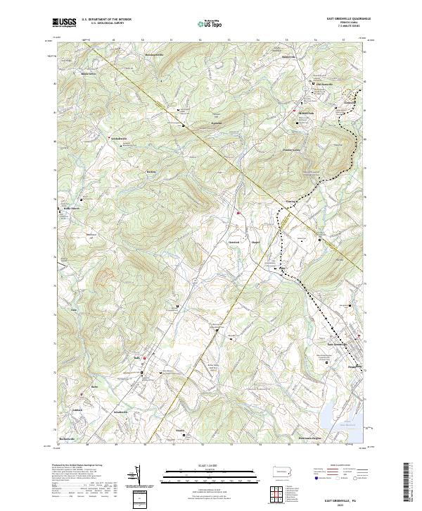 2023 East Greenville2023 Print · USGSThe tri-county border region of Berks, Lehigh, and Montgomery shows a landscape of deep-rooted settlements and intersecting creeks. Genealogists can trace family names and local history through numerous sites like Washington Schwenkfelder Cem and Huff Union Cem-North.
End of results
Showing maps 1-4 of 4
Top cities near Upper Hanover Township
- Allentown historical maps
- Bethlehem historical maps
- Pottstown historical maps
- Limerick Township historical maps
- Lansdale historical maps
- Skippack Township historical maps
See more
Top neighborhoods of Upper Hanover Township
- Fruitville historical maps
- Palm historical maps
- Perkiomen Heights historical maps
- Hillegass historical maps
- Kleinville historical maps
Frequently asked questions
- What are the different types of historical maps available for Upper Hanover Township?
- What is the oldest map of Upper Hanover Township?
- Where can I purchase historical maps of Upper Hanover Township for my home or office?
- Where can I download high-res historical maps of Upper Hanover Township?
- Are there historical topographic maps available for Upper Hanover Township?
- Is there historical aerial imagery available for Upper Hanover Township?
- Where are historical maps of Upper Hanover Township sourced from?