Old Maps of Lehigh Township, Pennsylvania for Academic Research
Study the evolution of Lehigh Township with 53 high-resolution historic maps. Whether you're teaching, researching, or modeling changes in land use, these maps provide essential visual documentation of urban, environmental, and geographic change.
- Analyze long-term change: Track patterns in development, transportation, and natural features.
- Ideal for environmental or urban studies: Support academic projects with primary historical map data.
- Use in the classroom or lab: Educators and researchers rely on these maps to bring historical context to life.
These maps are a powerful tool for teaching, research, and visualizing how Lehigh Township has changed over the decades.
Lehigh Township, PA maps
(53)- 1894 Map of Allentown
 1894 Allentown1894 Print · USGSThe Lehigh Valley's industrial heartland is caught in a moment of rapid Victorian-era growth along the river and canal corridor. Genealogists and local historians can trace the early footprints of Allentown and Nazareth, or locate vanished rail stops along the Lehigh Valley R.R. and Central R.R. of N.J.10 unique versions available
 - 1902 Map of Slatington
 1902 Slatington1902 Print · USGSLehigh County's industrial and quarrying heart comes into focus at the dawn of the 1900s. Researchers can trace the path of the Lehigh Canal and locate family landmarks like Peters Store, Jordan Church, and the Consolidated Quarries.5 unique versions available
 - 1914 Map of Wind Gap, 1956 Print
 1914 Wind Gap1956 Print · USGSNorthampton and Monroe Counties are captured here just before the First World War, dominated by the industrial rail corridor at Wind Gap. Genealogists can locate dozens of named schools like Michael Valley School and early quarries at Chapman Quarries.
 - 1916 Map of Wind Gap
 1916 Wind Gap1916 Print · USGSThe Pocono foothills and Blue Mountain ridge are captured here at the height of the steam-rail era. Genealogists can trace family names through dozens of rural landmarks like St. Joseph School, Haynes Mill, and the busy rail junction at Wind Gap.7 unique versions available
 - 1922 Map of Mauch Chunk, 1952 Print
 1922 Mauch Chunk1952 Print · USGSThe industrial Lehigh Valley thrives in the early 1920s, dominated by the winding river and two major competing railroad lines. Genealogists can locate old rural landmarks like the Larrytown Poor Farm, Indian Hills School, and the busy rail hub of Mauch Chunk.2 unique versions available
 - 1924 Map of Mauch Chunk
 1924 Mauch Chunk1924 Print · USGSCarbon County in the early twenties is a landscape of industrial power and rural mountain life, dominated by the winding Lehigh River. Genealogists and historians can trace family roots through numerous small schools like Lentz School and old settlements from Mauch Chunk to Palmerton.4 unique versions available
 - 1937 Map of Allentown West
 1937 Allentown West1937 Print · USGSLehigh County at the end of the Depression era reveals a dense network of rural schoolhouses and crossroads hamlets before post-war expansion. Genealogists can trace family names at James Peters Sch or Heidelberg Sch, and locate landmarks like Schantz Spr and Rising Sun.
 - 1939 Map of Allentown
 1939 Allentown1939 Print · USGSThe Lehigh Valley thrives as an industrial and aviation hub in the mid-1930s, where rail lines and early airfields meet historic Pennsylvania townships. Researchers can trace family roots through dozens of rural landmarks like Washington Sch, Christian Springs, and the Vera Cruz Sta.4 unique versions available
 - 1942 Map of Allentown West
 1942 Allentown West1942 Print · USGSLehigh County during the early war years displays a landscape of industrial river towns and agrarian crossroads. Researchers can locate dozens of country schools like Snyder Sch, historic landmarks like Cedar Crest College, and the sprawling Trexler Game Preserve.3 unique versions available
 - 1943 Map of Mauch Chunk
 1943 Mauch Chunk1943 Print · USGSThe Lehigh River corridor is captured here during the mid-forties, showing the vital rail and industry centers of Carbon County. Genealogists and researchers can trace dozens of rural schoolhouses and family-named landmarks like the Larrytown Poor Farm, St Pauls Ch, and Three O'clock Spring.
 - 1943 Map of Wind Gap
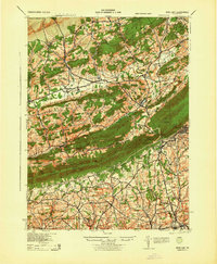 1943 Wind Gap1943 Print · USGSThe Pennsylvania countryside near the Monroe and Northampton county line is captured here during the wartime era. Researchers can trace the path of the Lehigh and New England railroad through the Wind Gap pass or locate local landmarks like St Joseph Sch and Ross Common.
 - 1943 Map of Bethlehem
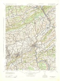 1943 Bethlehem1943 Print · USGSNorthampton and Lehigh counties hummed with industry and river commerce during the early war years. Researchers can trace the path of the Lehigh Valley RR, locate family-named landmarks like Chief Tatamy, and find rural schools such as Mexico School and Poplar Valley Sch.
 - 1944 Map of Newark, 1971 Print
 1944 Newark1971 Print · USGSThe industrial corridor from Philadelphia to New York was in a period of massive transition during the mid-forties. Genealogists and researchers can trace the rail lines of the Lehigh Valley RR, locate military installations like Picatinny Arsenal, and explore the early sprawl near Levittown.5 unique versions available
 - 1949 Map of Newark
 1949 Newark1949 Print · USGSThe industrial corridor between Philadelphia and New York comes alive in this post-war survey. Genealogists and historians can trace the massive rail networks of the Reading Railroad and locate major installations like Fort Dix or Picatinny Arsenal.2 unique versions available
 - 1956 Map of Newark
 1956 Newark1956 Print · USGSThe industrial heart of the Mid-Atlantic is captured here at the dawn of the highway era, tracing the dense corridors between Newark and Philadelphia. Genealogists and local historians can map the rail networks of the Reading RR or locate mid-century military life at Fort Dix Military Reservation.2 unique versions available
 - 1957 Map of Newark
 1957 Newark1957 Print · USGSThe industrial and military heart of the Mid-Atlantic is mapped during its post-war suburban boom. Genealogists and historians can trace the intricate rail corridors of the Reading Railroad and locate key landmarks from Princeton University to Fort Hancock.
 - 1957 Map of Allentown, 1960 Print
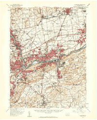 1957 Allentown1960 Print · USGSThe Lehigh Valley in the late fifties was a powerhouse of rail and industry centered on the river's winding path. Genealogists and local historians can trace the footprint of the State Hospital, early schools like Moravian College, and rural markers like Christ Springs Ch.3 unique versions available
 - 1957 Map of Alburtis, 1960 Print
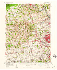 1957 Alburtis1960 Print · USGSLehigh County thrives at mid-century as a hub of heavy industry and suburban expansion along the winding Lehigh River. Trace the rail lines of the Ironton RR, find the early grounds of Dorney Park, or locate family sites near Laurys Station.3 unique versions available
 - 1960 Map of Newark
 1960 Newark1960 Print · USGSThe industrial heart of the Mid-Atlantic is shown at mid-century, stretching from the dense urban centers of Newark and Philadelphia to the Blue Mountain ridges. Researchers can trace historic rail lines, coastal defenses at Fort Hancock, and the riverfront growth of Trenton and Easton.3 unique versions available
 - 1960 Map of Palmerton, 1961 Print
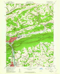 1960 Palmerton1961 Print · USGSPalmerton and the Lehigh Gap are captured at a mid-century industrial peak, framed by ridges and the busy river corridor. Genealogists and historians can trace family-named landmarks like Bassards Corner, the St Nicholas Ch, and the historic path of the Lehigh Canal.6 unique versions available
 - 1960 Map of Kunkletown, 1962 Print
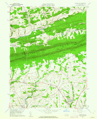 1960 Kunkletown1962 Print · USGSNorthampton and Monroe counties are divided by the steep ridge of Blue Mountain in the early 1960s, a landscape defined by valley farming and upland ridges. Genealogists can trace family names at Fairview Cem or locate rural hubs like Klecknersville and the industries at the Clay Pits.3 unique versions available
 - 1964 Map of Newark
 1964 Newark1964 Print · USGSGreater New Jersey and eastern Pennsylvania appear at the peak of their industrial and rail-centered development in the mid-sixties. Genealogists and historians can trace the paths of the Pennsylvania RR, identify mid-century landmarks like CAMP KILMER, or follow the Schuylkill River through READING.2 unique versions available
 - 1964 Map of Cementon, 1966 Print
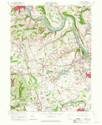 1964 Cementon1966 Print · USGSThe Lehigh Valley's industrial heart is captured here in the mid-1960s, showing a landscape shaped by river commerce and heavy quarrying. Genealogists and historians can trace the Lehigh Valley Railroad through Cementon or locate Old Union Cem and the Mary Immaculate Missionary College.3 unique versions available
 - 1964 Map of Catasauqua, 1966 Print
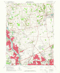 1964 Catasauqua1966 Print · USGSThe Lehigh Valley in the mid-sixties reveals a landscape of industrial river towns and emerging suburban developments near the regional airport. Genealogists and historians can trace family roots through numerous sites like Cedar Hill Memorial Park, Schoenersville, and the State Hospital Farm.6 unique versions available
 - 1976 Map of Palmerton, 1978 Print
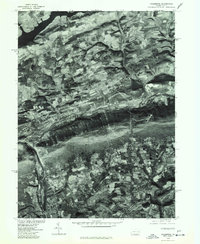 1976 Palmerton1978 Print · USGSPalmerton and the Lehigh Valley area appear in sharp detail in this mid-seventies orthophotoquad. Researchers can trace the industrial layout of Palmerton or the rural surroundings of Danielsville, Slatington, and Beltzville Lake.
Showing maps 1-25 of 53
Top cities near Lehigh Township
- Allentown historical maps
- Bethlehem historical maps
- Fullerton historical maps
- Lower Saucon Township historical maps
- Hanover Township historical maps
- Northampton historical maps
See more
Top neighborhoods of Lehigh Township
- Pennsville historical maps
- Walnutport Acres historical maps
- Slatefield historical maps
- Harpers historical maps
- Rockville historical maps
- Slate Valley historical maps
See more
Frequently asked questions
- What are the different types of historical maps available for Lehigh Township?
- What is the oldest map of Lehigh Township?
- Where can I purchase historical maps of Lehigh Township for my home or office?
- Where can I download high-res historical maps of Lehigh Township?
- Are there historical topographic maps available for Lehigh Township?
- Is there historical aerial imagery available for Lehigh Township?
- Where are historical maps of Lehigh Township sourced from?