Old Maps of Perry County, Pennsylvania for Hiking & Exploration
Hike through history with 176 historic maps of Perry County. Explore old trails, ghost towns, and forgotten backroads — perfect for outdoor adventurers and local explorers.
- Rediscover forgotten places: Map out old mining camps, roads, and footpaths that no longer exist on modern maps.
- Layer with modern tools: Combine with LiDAR or satellite views to plan hikes through historical terrain.
- Made for exploration: Popular among hikers, overlanders, and local history lovers.
Use these maps to find adventure and explore the hidden past of Perry County.
Perry County, PA maps
(176)- 1892 Map of Harrisburg
 1892 Harrisburg1892 Print · USGSThe Pennsylvania capital and the Susquehanna River corridor are captured here in the 1890s, revealing a landscape of mountain gaps and canal-era infrastructure. Genealogists can trace family roots through settlements like Wormleysburg, Linglestown, and the grounds of the State Lunatic Asylum.2 unique versions available
 - 1893 Map of Millersburg
 1893 Millersburg1893 Print · USGSThe Susquehanna River valley in the 1890s shows a landscape shaped by competing transport systems and mountain ridges. Trace the path of the Pennsylvania Canal through Liverpool or locate family roots in Millersburg and Elizabethville.7 unique versions available
 - 1899 Map of Harrisburg
 1899 Harrisburg1899 Print · USGSHarrisburg and the Susquehanna River valley are captured here in the 1890s as the railroad era reached its height alongside older waterways. Genealogists and historians can trace the paths of the Pennsylvania Canal and find local landmarks like Heckton Mills and the State Lunatic Asylum.15 unique versions available
 - 1907 Map of New Bloomfield
 1907 New Bloomfield1907 Print · USGSPerry County at the start of the twentieth century was a landscape of steep ridges and vital river junctions. Genealogists and historians can trace family locations in settlements like New Bloomfield or locate early industrial sites such as Juniata Furnace and Cove Forge.6 unique versions available
 - 1907 Map of Millerstown
 1907 Millerstown1907 Print · USGSThe Juniata River and Pennsylvania RR dominate this early twentieth-century survey of the central Pennsylvania ridge-and-valley country. Genealogists can trace family roots through numerous specific landmarks like Browns Mill Cocolamus PO, Gimbelings Mill, and St Peters Church.4 unique versions available
 - 1919 Map of Newville
 1919 Newville1919 Print · USGSCumberland County life in the late teens centers on the rail corridors and water mills between the mountains. Trace family roots at Newville or Pine Grove Furnace, and locate rural landmarks like Reiters Mill and Miller Church.6 unique versions available
 - 1919 Map of Mattawana
 1919 Mattawana1919 Print · USGSCentral Pennsylvania's ridge-and-valley network is captured here at the end of the Great War, showing a landscape defined by small mill towns and diverging rail lines. Genealogists can trace family names and ancestral homes in McCulloch Mills, E. Waterford, and Blairs Mills.
 - 1923 Map of Shippensburg
 1923 Shippensburg1923 Print · USGSShippensburg and its surrounding valley floor were defined by the rail lines and agricultural networks of the early twentieth century. Genealogists can locate dozens of country schools and churches, including Brookside School, Lurgan Sta, and the State Normal School campus.3 unique versions available
 - 1924 Map of Harrisburg
 1924 Harrisburg1924 Print · USGSThe Susquehanna River corridor at the state capital reveals a landscape of industrial river gaps and ridge-line valleys in the 1920s. Genealogists and historians can trace the paths of the Pennsylvania Canal and find landmarks like the State Lunatic Asylum and Fort Hunter.
 - 1925 Map of Mifflintown
 1925 Mifflintown1925 Print · USGSJuniata County in the mid-1920s is a landscape of river-oriented towns and remote mountain gaps. Genealogists and historians can trace family roots through numerous local landmarks like Peach Blossom School, Jericho Mills, and the village of Mifflintown.
 - 1930 Map of Loysville, 1953 Print
 1930 Loysville1953 Print · USGSPerry County's rural heartland is meticulously detailed in the 1930s, showing a landscape of ridge-and-valley farms and forest camps. Genealogists can trace family roots through numerous local landmarks like St Paul Ch, Academia Sch, and Loysville.
 - 1933 Map of Loysville
 1933 Loysville1933 Print · USGSPerry County's rural heartland is shown in detail during the early 1930s, when isolated valleys were still dotted with one-room schoolhouses and family farms. Genealogists can trace family footprints through sites like Fort Robinson, Cisna Run, and the numerous local schools like Oak Grove Sch.3 unique versions available
 - 1934 Map of Mifflintown, 1962 Print
 1934 Mifflintown1962 Print · USGSThe Juniata River valley and the ridges of the Pennsylvania heartland appear here in the mid-1930s. Researchers can trace the path of the Pennsylvania RR through Mifflintown or locate family landmarks like Raubs Mills, Seawra Cave, and Church Hill Sch.
 - 1936 Map of East Waterford
 1936 East Waterford1936 Print · USGSThe ridge-and-valley corridor of Juniata and Perry Counties is captured here in the mid-1930s, showing a landscape defined by narrow mountain gaps and small milling hubs. Researchers can trace ancestral roots through dozens of rural schools and churches, including McCulloughs Mills, Honey Grove, and Fairview Ch and Sch.2 unique versions available
 - 1937 Map of Mifflintown
 1937 Mifflintown1937 Print · USGSJuniata County in the mid-1930s shows a landscape of tight-knit valley communities and mountain gaps along the Juniata River. Genealogists and historians can trace family locations near dozens of rural landmarks, including Oakland Mills, Port Royal, and the Old Port Sch.3 unique versions available
 - 1941 Map of East Waterford
 1941 East Waterford1941 Print · USGSThe Ridge-and-Valley province of Central Pennsylvania appears here in the years before the war, dominated by the great parallel spans of Tuscarora Mountain. Genealogists can locate family sites among numerous rural institutions like Pine Glen Ch, McCullochs Mills, and the CCC Camp at East Waterford.3 unique versions available
 - 1943 Map of Millerstown
 1943 Millerstown1943 Print · USGSMid-Pennsylvania ridge-and-valley life is captured here during the 1940s as the Juniata River corridor serves the Pennsylvania Railroad. Genealogists and historians can locate numerous rural landmarks like Beers Foundry, Arbogast Church, and the Hiester Valley School.
 - 1943 Map of Millersburg
 1943 Millersburg1943 Print · USGSDauphin and Northumberland counties appear here during the mid-1940s, defined by the river-and-rail economy along the Susquehanna River. Researchers can trace the heritage of small valley towns through landmarks like St Johns Church, Morning Glory School, and the Limestone Quarries.
 - 1943 Map of Harrisburg
 1943 Harrisburg1943 Print · USGSThe Pennsylvania capital and its surrounding Susquehanna riverfront are seen here during the war years. Researchers can trace the extensive rail networks and find local landmarks like Fort Hunter, Good Hope Mills, and Wenrichs Ch.3 unique versions available
 - 1943 Map of New Bloomfield
 1943 New Bloomfield1943 Print · USGSPerry County's ridge-and-valley landscape is captured here during the Second World War as the rail-and-river corridor remained vital to the region. Genealogists can locate family landmarks like Hustons Mill, Mecks Corner, and the old Wila P O post office.
 - 1943 Map of Shippensburg, 1965 Print
 1943 Shippensburg1965 Print · USGSCumberland and Franklin Counties are captured here during the Second World War as modern infrastructure began to pierce the ridges. Researchers can trace family roots through dozens of rural landmarks like State Normal Sch, Orrstown, and the Union Ch.
 - 1945 Map of Newville
 1945 Newville1945 Print · USGSCumberland County at the end of the war shows a landscape where the new turnpike crosses a valley of established farms and mills. Researchers can trace family-named sites like Elliotts Mill, the Greythorne Walnut Bottom PO, and schools like Bluehill Sch.
 - 1945 Map of Shippensburg
 1945 Shippensburg1945 Print · USGSCumberland and Franklin counties meet at the base of the ridges in the mid-1940s, just as modern infrastructure begins to reshape the valley. Genealogists and historians can trace numerous rural schoolhouses like Clay Hill Sch and early infrastructure like the Kittatinny Tunnel and State Normal Sch.
 - 1947 Map of Harrisburg West
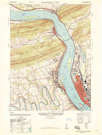 1947 Harrisburg West1947 Print · USGSThe Susquehanna River corridor near Harrisburg is captured here just after the war, showing the massive rail infrastructure and mountain gaps that define the region. Genealogists and local historians can locate the Enola yards, Good Hope Mills, and family burial sites like Chestnut Grove Cemetery.3 unique versions available
 - 1947 Map of Halifax
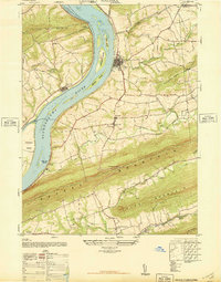 1947 Halifax1947 Print · USGSThe Susquehanna River valley emerges in the post-war era as a landscape of mountain ridges and fertile river islands. Genealogists can locate family landmarks like Jacobs Church, the Shamokin School, and old riverside settlements from New Buffalo to Speeceville.3 unique versions available
Showing maps 1-25 of 176
Top cities of Perry County
- Saville Township historical maps
- Newport historical maps
- New Bloomfield historical maps
- Millerstown historical maps
- Blain historical maps
- Landisburg historical maps
See more
Frequently asked questions
- What are the different types of historical maps available for Perry County?
- What is the oldest map of Perry County?
- Where can I purchase historical maps of Perry County for my home or office?
- Where can I download high-res historical maps of Perry County?
- Are there historical topographic maps available for Perry County?
- Is there historical aerial imagery available for Perry County?
- Where are historical maps of Perry County sourced from?