Old Maps of Lackawaxen Township, Pennsylvania for Genealogy
Trace your family roots with 68 historic maps of Lackawaxen Township. These high-res maps reveal old neighborhoods, homesites, landmarks, and streets — helping you uncover where your ancestors lived and how the area evolved over time.
- Explore historic neighborhoods: Identify where your relatives may have lived in the 1800s or 1900s.
- Compare maps over time: Trace the changes in streets, buildings, and landmarks for multi-generational research.
- Perfect for genealogy & ancestry research: Used by family historians and researchers to map out lineage and migration.
These maps are an incredible resource for exploring your personal connection to Lackawaxen Township's past.
Lackawaxen Township, PA maps
(68)- 1913 Map of Milford, 1958 Print
 1913 Milford1958 Print · USGSBefore the Tri-State area was suburbanized, this early twentieth-century survey captures the rugged river economy of the Delaware valley. Genealogists can trace family roots at McCartys Corner or locate vanished rural schoolhouses like the McCain School and Woodtown School.
 - 1915 Map of Milford
 1915 Milford1915 Print · USGSThe Delaware River valley at the tri-state border comes alive in this pre-war survey, capturing a world of riverside rail stations and remote mountain schoolhouses. Genealogists can locate family landmarks like McCarthys Corner or trace rural education at the Yale Forest School and Quicktown School.7 unique versions available
 - 1920 Map of Damascus, 1956 Print
 1920 Damascus1956 Print · USGSThe Upper Delaware River valley at the start of the 1920s shows a landscape of river-fronting hamlets and upland dairy farms. Genealogists can locate numerous rural schoolhouses and churches, such as Kester School, Smith Hill Church, and the Oil Pumping Station at Cochecton.2 unique versions available
 - 1922 Map of White Lake
 1922 White Lake1922 Print · USGSSullivan County's lake-strewn highlands appear here in the early twenties, showing a landscape defined by small mountain hamlets and rural school districts. Genealogists can trace family names through landmarks like Stewart Cemetery, Bauer's Mill, and Mount Hope School.6 unique versions available
 - 1923 Map of Damascus
 1923 Damascus1923 Print · USGSThe Delaware River valley thrived as a corridor for rail and industry in the early twenties. Genealogists and historians can trace family-named landmarks like Stanton Corner or locate vanished infrastructure like the Oil Pumping Station and Nobody Station School.5 unique versions available
 - 1935 Map of Hawley, 1955 Print
 1935 Hawley1955 Print · USGSThe Pocono Mountains and the massive shoreline of Lake Wallenpaupack dominate this mid-century survey of northeastern Pennsylvania. Local historians can trace the Erie rail line through Hawley and Rowland or locate the High Knob Fire Tower and rural Blooming Grove School.2 unique versions available
 - 1938 Map of Hawley
 1938 Hawley1938 Print · USGSThe Pocono Mountains and the southern reaches of the Lackawaxen River appear here in the late thirties. Genealogists and local historians can trace the rural communities of Blooming Grove and Greeley or locate the Paupack Ch and numerous family-named swamps.3 unique versions available
 - 1942 Map of White Lake, 1957 Print
 1942 White Lake1957 Print · USGSSullivan County’s landscape of ponds and mountain ridges is detailed here in the early 1940s as the area’s agricultural roots met a growing resort era. Researchers can trace the Newburgh And Cochecton Turnpike past the Stewart Cem and vanished local schools like Birch Ridge Sch.
 - 1943 Map of Honesdale
 1943 Honesdale1943 Print · USGSThe northern Poconos and the Upper Delaware River valley appear here during the early war years, showing a network of mountain hamlets and riverfront rail towns. Genealogists can trace family roots through numerous remote institutions like Kingsbury Hill Church, Peakville P O, and the Hiawatha School.
 - 1943 Map of White Lake, 1960 Print
 1943 White Lake1960 Print · USGSThe Sullivan County uplands appear in the mid-1940s as a landscape of rural schoolhouses and mountain resorts. Genealogists can trace family roots through sites like the Dutch Settlement, Tylertown Sch, and Beaver Brook Corners.2 unique versions available
 - 1943 Map of Monticello, 1964 Print
 1943 Monticello1964 Print · USGSSullivan County in the early 1940s is shown at a peak of its rural development before mid-century modernization changed the landscape. Genealogists and researchers can trace local roots through numerous district schools like the Bushville School and family landmarks such as the Stewart Cem or the industrial Dye Works.
 - 1944 Map of Milford
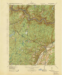 1944 Milford1944 Print · USGSThe tri-state Delaware River valley was a network of river-bound hamlets and upland schools during the 1940s. Genealogists and local historians can trace family locations through named sites like Dark Swamp Sch, Mongaup Sta, and Quicktown.
 - 1944 Map of Damascus
 1944 Damascus1944 Print · USGSUpper Delaware River communities in Wayne and Pike Counties appear here during the mid-forties, caught between the river's bends and the rising hills. Researchers can locate numerous rural schoolhouses and industrial sites, from the Oil Pumping Station to Skinners Falls and White Mills.
 - 1944 Map of White Lake
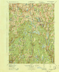 1944 White Lake1944 Print · USGSSullivan County was a landscape of small schools and highland waters in the mid-1940s. Genealogists and historians can trace the old road to Dutch Settlement or locate Neweiden Church and the Pintler Cem near the shores of White Lake.
 - 1950 Map of Scranton, 1952 Print
 1950 Scranton1952 Print · USGSMid-century Northeast Pennsylvania and the Hudson Valley come alive in this survey of the tri-state region. Genealogists and historians can trace the dense rail networks of the Erie RR and DL&W RR between industrial hubs like Scranton and Wilkes-Barre.
 - 1953 Map of Scranton
 1953 Scranton1953 Print · USGSNortheastern Pennsylvania and the Catskills are shown in great detail during the early fifties, a time when rail lines and river valleys dictated the region's growth. Genealogists and historians can trace the industrial hearts of Scranton and Wilkes-Barre or locate remote landmarks like High Point and Lake Wallenpaupack.
 - 1959 Map of Scranton
 1959 Scranton1959 Print · USGSThe northern coalfields and the Hudson Valley meet in this mid-century survey of the Pennsylvania and New York borderlands. Genealogists and historians can trace the intricate rail networks of the Erie Railroad and the vast waters of Lake Wallenpaupack.2 unique versions available
 - 1959 Map of Pocono
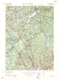 1959 Pocono1959 Print · USGSThe Pocono Mountains region is captured here in the late fifties, showcasing its evolution from a railway-dependent timber and ice landscape to a premier resort destination. Researchers can locate dozens of country schoolhouses like Maplewood Sch and trace the paths of the Erie RR through Hawley and Kimbles.
 - 1962 Map of Scranton, 1977 Print
 1962 Scranton1977 Print · USGSThe industrial heart of eastern Pennsylvania and the New York Catskills are captured here in the early sixties. Genealogists and historians can trace the dense valley settlements from Scranton to Wilkes-Barre and the rail lines of the Erie Lackawanna Railroad.2 unique versions available
 - 1965 Map of Scranton
 1965 Scranton1965 Print · USGSThe tri-state highlands of Pennsylvania, New York, and New Jersey come alive in the mid-sixties as industry and recreation converge. Trace the intricate rail lines of the Erie Lackawanna RR or locate landmarks like the U S Military Academy.2 unique versions available
 - 1965 Map of Shohola, 1967 Print
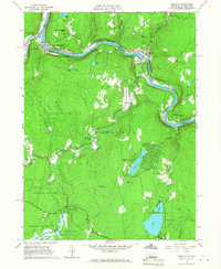 1965 Shohola1967 Print · USGSThe Delaware River valley in the mid-sixties shows the rugged meeting of river and rail along the Erie Lackawanna. Trace local history at Minisink Battlefield Memorial or find family sites at German Hill Cem and Shohola Sch.5 unique versions available
 - 1966 Map of Hawley, 1967 Print
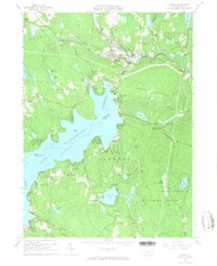 1966 Hawley1967 Print · USGSIn the mid-1960s, the recreation-heavy landscape of the Wayne and Pike county border was defined by the massive Lake Wallenpaupack. Genealogists and historians can trace local ties through the Paupack Cem, small rural settlements like Tafton, and the Erie-Lackawanna rail corridor.3 unique versions available
 - 1966 Map of Rowland, 1967 Print
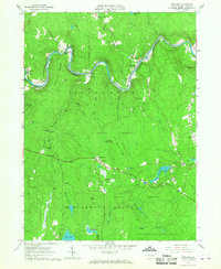 1966 Rowland1967 Print · USGSThe Lackawaxen River valley and the Erie-Lackawanna RR corridor are captured here during the mid-sixties. Researchers can trace historic Pike County settlements like Glen Eyre, find the Pillar of Fire community, and locate Mt Moriah Cem.4 unique versions available
 - 1967 Map of Eldred, 1969 Print
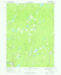 1967 Eldred1969 Print · USGSSullivan County upland life is preserved here in the late sixties, from the village of Eldred to the Tenmile River valley. Trace local history at the Central Sch, Beaver Brook Cem, or the Meadowbrook Landing Strip among the many lakes.2 unique versions available
 - 1967 Map of White Mills, 1970 Print
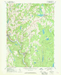 1967 White Mills1970 Print · USGSWayne County in the late 1960s shows a landscape of river-valley industry and upland summer camps. Researchers can trace the Erie Lackawanna rail line through White Mills or locate local landmarks like the Drive-in Theater and St Josephs Ch.4 unique versions available
Showing maps 1-25 of 68
Top cities near Lackawaxen Township
- Honesdale historical maps
- Blooming Grove Township historical maps
- Bethel historical maps
- Damascus Township historical maps
- Shohola Township historical maps
- Lumberland historical maps
See more
Top neighborhoods of Lackawaxen Township
- Forest Lake Park historical maps
- Masthope historical maps
- Masthope Rapids historical maps
- Baoba historical maps
- Glen Eyre historical maps
- Kimble historical maps
See more
Frequently asked questions
- What are the different types of historical maps available for Lackawaxen Township?
- What is the oldest map of Lackawaxen Township?
- Where can I purchase historical maps of Lackawaxen Township for my home or office?
- Where can I download high-res historical maps of Lackawaxen Township?
- Are there historical topographic maps available for Lackawaxen Township?
- Is there historical aerial imagery available for Lackawaxen Township?
- Where are historical maps of Lackawaxen Township sourced from?