2020s Maps of Abbott Township, Pennsylvania
Explore 6 historic maps of Abbott Township from the 2020s. These maps offer a rare glimpse into what life looked like during the 2020s — showing old roads, neighborhoods, homes, and landmarks that have changed or disappeared over time.
Whether you're researching your family's past, planning a metal detecting trip, or studying how Abbott Township's landscape evolved across the 2020s, these high-resolution maps are a powerful tool for exploring the history of this region.
- Focus on a specific era: All maps on this page are from the 2020s, giving you a focused view of this time period.
- See what’s changed: Compare century-old streets, trails, and buildings to today's modern landscape using overlays and satellite layers.
- Research with precision: Use these maps for genealogy, historical research, land use analysis, or educational projects.
- View, download, or print: Maps are fully viewable online in high resolution, and can be downloaded or printed for your own records.
Start exploring Abbott Township's history through authentic maps from the 2020s. This is your window into the past.
Abbott Township, PA maps
(6)- 2023 Map of Short Run, 2023 Print
 2023 Short Run2023 Print · USGSPotter County's deep forest interior is shown here in the 2020s, featuring the remote junctions of the Susquehannock Trail System Tri. Trace the narrow valley roads to Gravel Lick, Short Run, and the high ridges of Bunnell Ridge and Elk Lick Knob.
 - 2023 Map of Cherry Springs, 2023 Print
 2023 Cherry Springs2023 Print · USGSPotter County in the early twenty-first century is characterized by deep forest hollows and small mountain hamlets. Genealogists and hikers can trace old routes to Corbett, Mount Brodhead, and family-named features like Jacob Hollow.
 - 2023 Map of Lee Fire Tower, 2023 Print
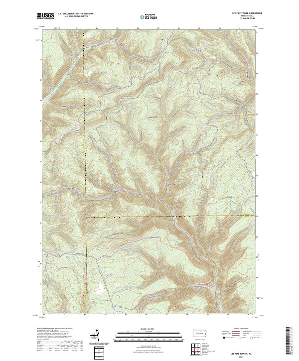 2023 Lee Fire Tower2023 Print · USGSNorthern Pennsylvania’s high forest country is captured here where three counties meet. Trace historic industrial paths through Gas Well Hollow, follow the winding Slate Run Rd, or locate the remote crossing at Francis-Leetonia.
 - 2023 Map of Marshlands, 2023 Print
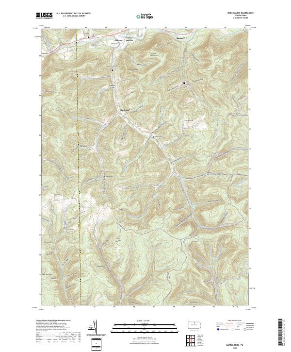 2023 Marshlands2023 Print · USGSThe northern valleys of Tioga County appear here just as modern forestry and recreation patterns have matured. You can trace early family sites at the Watrous Family Burial Ground and find small settlements like Marshlands and Gaines Junction along the creek.
 - 2023 Map of Oleona, 2023 Print
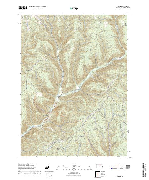 2023 Oleona2023 Print · USGSThe Kettle Creek valley in Potter County remains a landscape of deep timber and winding forest roads in this modern survey. Genealogists and outdoorsmen can trace ancestral land features like Williams Hollow, the settlement of Oleona, and the extensive Susquehannock Trail System Trl.
 - 2023 Map of Galeton, 2023 Print
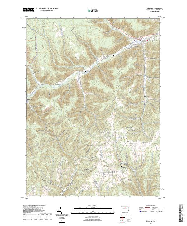 2023 Galeton2023 Print · USGSPotter County's rugged plateau is captured here in the modern era, centered on the historic river town of Galeton. Genealogists can locate family burial sites at Hurd Cem and Saint Germain Cem or trace the remote settlement at Burrows.
End of results
Showing maps 1-6 of 6
Top cities near Abbott Township
- Galeton historical maps
- Sweden Township historical maps
- Clymer Township historical maps
- Gaines Township historical maps
- Hector Township historical maps
- Leidy Township historical maps
See more
Top neighborhoods of Abbott Township
Frequently asked questions
- What are the different types of historical maps available for Abbott Township?
- What is the oldest map of Abbott Township?
- Where can I purchase historical maps of Abbott Township for my home or office?
- Where can I download high-res historical maps of Abbott Township?
- Are there historical topographic maps available for Abbott Township?
- Is there historical aerial imagery available for Abbott Township?
- Where are historical maps of Abbott Township sourced from?