Old Maps of Blythe Township, Pennsylvania
Explore 45 old maps of Blythe Township, spanning from 1889 to today. These high-resolution historic maps reveal how streets, neighborhoods, landmarks, and natural features evolved over time — perfect for genealogy, metal detecting, research, and local history exploration.
What you can do with these maps:
- See how Blythe Township changed over time: Compare historical maps to modern-day views to trace roads, homesites, rail lines & more.
- View detailed metadata: Each map includes creators, publishers, year, scale, and archive source.
- Overlay maps with satellite & LiDAR: Visualize the past alongside modern tools to explore terrain & human change.
- Trusted historical sources: Maps sourced from the USGS, Library of Congress, and other archives.
- Access maps your way: View online, download high-res files, or order prints for personal or research use.
Start exploring old maps of Blythe Township to uncover forgotten places, hidden landmarks, and the deep history beneath your feet.
Blythe Township, PA maps
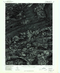
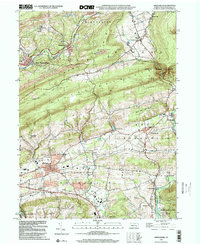
(45)- 1889 Map of Pottsville, 1964 Print
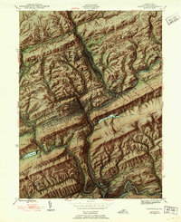
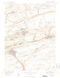
 1889 Pottsville1964 Print · USGSAnthracite coal country and the complex rail networks of the late nineteenth century dominate this survey of the Schuylkill River valley. Genealogists and industrial historians can trace the early footprints of Pottsville, Schuylkill Haven, and the numerous rail branches serving New Philadelphia and Port Carbon.
 - 1891 Map of Pottsville
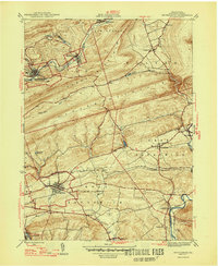
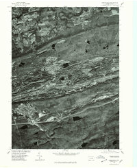
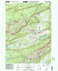
 1891 Pottsville1891 Print · USGSSchuylkill County enters its industrial height in the 1890s, when anthracite coal and iron rails reshaped the mountains. Trace the dense rail networks of the Philadelphia and Reading Railroad connecting Pottsville, St. Clair, and Schuylkill Haven.10 unique versions available
 - 1892 Map of Mahanoy
 1892 Mahanoy1892 Print · USGSSchuylkill and Luzerne counties are captured here at a peak of industrial development during the 1890s coal era. Researchers can trace the massive rail networks serving Shenandoah, Mahanoy City, and lost junctions like Silver Brook Junction.
 - 1893 Map of Mahanoy, 1898 Print
 1893 Mahanoy1898 Print · USGSSchuylkill and Luzerne counties are shown at the height of the coal era, revealing a landscape etched by mining and rail commerce. Genealogists and industrial historians can trace the specific neighborhoods of Shenandoah, Mahanoy City, and the railway junctions at Tamanend and Delano.7 unique versions available
 - 1944 Map of Pottsville
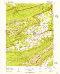
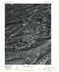
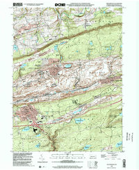
 1944 Pottsville1944 Print · USGSThe anthracite region of Pennsylvania shows its industrial density during the 1940s, with coal-dependent settlements lining the mountain valleys. Genealogists and historians can trace the rail networks of the Reading and Lehigh lines through Pottsville, St Clair, and East Mines.10 unique versions available
 - 1944 Map of Orwigsburg, 1958 Print
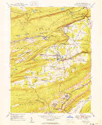
 1944 Orwigsburg1958 Print · USGSSchuylkill County during the mid-forties reveals a landscape split between coal-valley industry and fertile lowland farming. Genealogists can locate family-named landmarks like Breiner Sch or trace the early postal routes through New Philadelphia Silver Creek P O.6 unique versions available
 - 1947 Map of Orwigsburg
 1947 Orwigsburg1947 Print · USGSSchuylkill County in the years following the war shows a landscape shaped by coal-country railroads and river valleys. Researchers can trace the Reading rail lines connecting New Philadelphia Silver Creek P O, Orwigsburg, and local landmarks like Kunkles Dam.2 unique versions available
 - 1949 Map of Delano
 1949 Delano1949 Print · USGSSchuylkill County at the peak of its rail-and-coal era shows a landscape defined by steep ridges and vital transit junctions. Genealogists can trace family roots through St Nicholas Cem, rural schoolhouses like Lakeside Sch, and coal settlements such as Grier City and Park Crest.2 unique versions available
 - 1950 Map of Shenandoah
 1950 Shenandoah1950 Print · USGSSchuylkill County’s coal heartland is revealed at its mid-century peak, showing the dense rail and mining infrastructure of the anthracite region. Genealogy researchers can trace family sites from Shenandoah to Mahanoy City, locating landmarks like The Peddlars Grave and Old White Ch.2 unique versions available
 - 1950 Map of Harrisburg, 1952 Print
 1950 Harrisburg1952 Print · USGSMid-century Central Pennsylvania comes alive through its dense rail networks and river valley settlements during the post-war industrial era. Genealogists and historians can trace family roots through hubs like Harrisburg, locate Carlisle Barracks, or follow the Pennsylvania RR through the Lebanon Valley.
 - 1954 Map of Delano, 1956 Print
 1954 Delano1956 Print · USGSSchuylkill County at the height of its rail-and-mine era reveals an intricate landscape of industrial junctions and valley settlements. Genealogists and historians can trace the footprint of community life at the St Peters Ch, Primrose Mine, and the Lakeside Sch.5 unique versions available
 - 1955 Map of Shenandoah, 1956 Print
 1955 Shenandoah1956 Print · USGSAnthracite coal country comes alive in the mid-fifties, showing the dense rail networks and industrial settlements of the Schuylkill valley. Trace family roots in Shenandoah or Mahanoy City, and locate landmarks like Old White Ch and the Incline.5 unique versions available
 - 1955 Map of Mahanoy, 1960 Print
 1955 Mahanoy1960 Print · USGSThe anthracite coalfields of Schuylkill County are shown in full industrial operation during the mid-1950s. Researchers can locate specific colliery sites and landmarks like Harwood, the Mahanoy Tunnel, and the lone Peddlars Grave.
 - 1957 Map of Harrisburg
 1957 Harrisburg1957 Print · USGSMid-century Central Pennsylvania comes into focus as a bustling network of rail, river, and mountain ridges. Genealogists and historians can trace the development of the State Capitol and surrounding hubs like Middletown, Columbia, and Pottsville.7 unique versions available
 - 1961 Map of Harrisburg
 1961 Harrisburg1961 Print · USGSCentral Pennsylvania is shown at a mid-century peak of industrial and military activity, from the Susquehanna water gaps to the fertile Dutch Country. Genealogists and historians can trace the rail corridors of the Pennsylvania RR and find landmarks like Carlisle Barracks or the Anthracite Coal Fields.2 unique versions available
 - 1964 Map of Harrisburg
 1964 Harrisburg1964 Print · USGSCentral Pennsylvania in the mid-fifties reveals a landscape shaped by ridge-and-valley geology and critical Cold War infrastructure. Researchers can trace the massive Indiantown Gap Military Reservation or the rail corridors of the Pennsylvania RR and Reading RR.
 - 1976 Map of Pottsville, 1979 Print
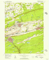
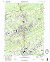
 1976 Pottsville1979 Print · USGSSchuylkill County at the height of the 1970s shows a landscape deeply defined by its industrial heritage and mountain geography. Researchers can trace the layout of anthracite boroughs from Pottsville to New Philadelphia and the path of the Schuylkill River.
 - 1976 Map of Orwigsburg, 1979 Print
 1976 Orwigsburg1979 Print · USGSSchuylkill County agricultural and mountain terrain is captured in the late seventies just as traditional field patterns remained intact. Researchers can trace the exact footprint of settlements like Mckeansburg, Lewistown, and Drehersville.
 - 1976 Map of Shenandoah, 1979 Print
 1976 Shenandoah1979 Print · USGSThe anthracite region of Schuylkill County is seen in the mid-seventies through detailed aerial imagery. Trace the industrial footprint and neighborhood grids of Shenandoah, Mahanoy City, and Frackville as they appeared decades ago.
 - 1976 Map of Delano, 1979 Print
 1976 Delano1979 Print · USGSSchuylkill County's coal country is shown in detail during the mid-1970s, revealing the intersection of mountain ridges and industrial towns. Local historians can trace the footprints of Delano, Tuscarora, and Mary D against the backdrop of Broad Mountain.
 - 1984 Map of Sunbury, 1985 Print
 1984 Sunbury1985 Print · USGSPennsylvania coal country and the Susquehanna valley appear here in the early eighties, showcasing a landscape defined by industrial ridges and river towns. Genealogists and historians can trace rail corridors like Conrail and explore mountain settlements from Mahanoy City to Elizabethville.2 unique versions available
 - 1994 Map of Pottsville, 1995 Print
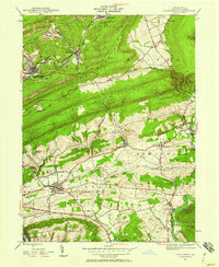
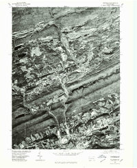
 1994 Pottsville1995 Print · USGSSchuylkill County at the end of the twentieth century shows a landscape shaped by coal and industry. Researchers can trace family roots through the German Cem, locate the Penn State University campus, and see the extent of strip mines near St Clair.
 - 1999 Map of Orwigsburg, 2001 Print
 1999 Orwigsburg2001 Print · USGSSchuylkill County at the end of the millennium reveals a landscape of industrial coal roots and growing communities near the Schuylkill River. Genealogists and local historians can trace locations like Pinedale Sch, Bethel Ch, and the Drive-in Theater.
 - 1999 Map of Delano, 2001 Print
 1999 Delano2001 Print · USGSThe coal and rail networks of the Pennsylvania anthracite region are on display in this late-twentieth-century study of Schuylkill County. Researchers can trace the legacy of hilltop settlements and rail junctions like Delano, Grier City, and East Mahanoy Jct.
 - 1999 Map of Shenandoah, 2002 Print
 1999 Shenandoah2002 Print · USGSSchuylkill County's coal-mining heartland is captured here at the end of the twentieth century, showing the dense urban grid of SHENANDOAH set against the industrial ridges. Researchers can trace the heritage of colliery life at Morea or find family landmarks like Peddlars Grave and Old White Ch.
Showing maps 1-25 of 45
Top cities near Blythe Township
- Hazleton historical maps
- Pottsville historical maps
- Tamaqua historical maps
- Shenandoah historical maps
- Schuylkill Haven historical maps
- Bethel Township historical maps
See more
Top neighborhoods of Blythe Township
- Silver Creek historical maps
- Cumbola historical maps
- Kaska historical maps
- Union Furnace historical maps
Frequently asked questions
- What are the different types of historical maps available for Blythe Township?
- What is the oldest map of Blythe Township?
- Where can I purchase historical maps of Blythe Township for my home or office?
- Where can I download high-res historical maps of Blythe Township?
- Are there historical topographic maps available for Blythe Township?
- Is there historical aerial imagery available for Blythe Township?
- Where are historical maps of Blythe Township sourced from?