2020s Maps of Blythe Township, Pennsylvania
Explore 4 historic maps of Blythe Township from the 2020s. These maps offer a rare glimpse into what life looked like during the 2020s — showing old roads, neighborhoods, homes, and landmarks that have changed or disappeared over time.
Whether you're researching your family's past, planning a metal detecting trip, or studying how Blythe Township's landscape evolved across the 2020s, these high-resolution maps are a powerful tool for exploring the history of this region.
- Focus on a specific era: All maps on this page are from the 2020s, giving you a focused view of this time period.
- See what’s changed: Compare century-old streets, trails, and buildings to today's modern landscape using overlays and satellite layers.
- Research with precision: Use these maps for genealogy, historical research, land use analysis, or educational projects.
- View, download, or print: Maps are fully viewable online in high resolution, and can be downloaded or printed for your own records.
Start exploring Blythe Township's history through authentic maps from the 2020s. This is your window into the past.
Blythe Township, PA maps
(4)- 2023 Map of Shenandoah, 2023 Print
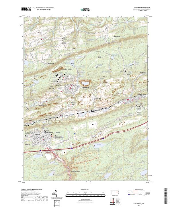 2023 Shenandoah2023 Print · USGSSchuylkill County's coal country is documented here in the early twenty-first century, revealing a landscape shaped by deep ethnic roots. Genealogists can trace family history through a dozen distinct burial grounds, including Old Holy Ghost Russian Orthodox Cem and the Kehillath Israel Hebrew Cem.
 - 2023 Map of Delano, 2023 Print
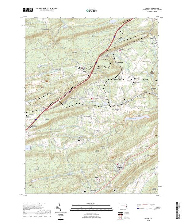 2023 Delano2023 Print · USGSSchuylkill County's industrial valleys and ridges are seen here in recent detail, showing a landscape defined by mining history and tight-knit communities. Family researchers can trace ancestry through Saint Peter's United Church Cem, Hersker Family Cem, and the parish at Brockton.
 - 2023 Map of Pottsville, 2023 Print
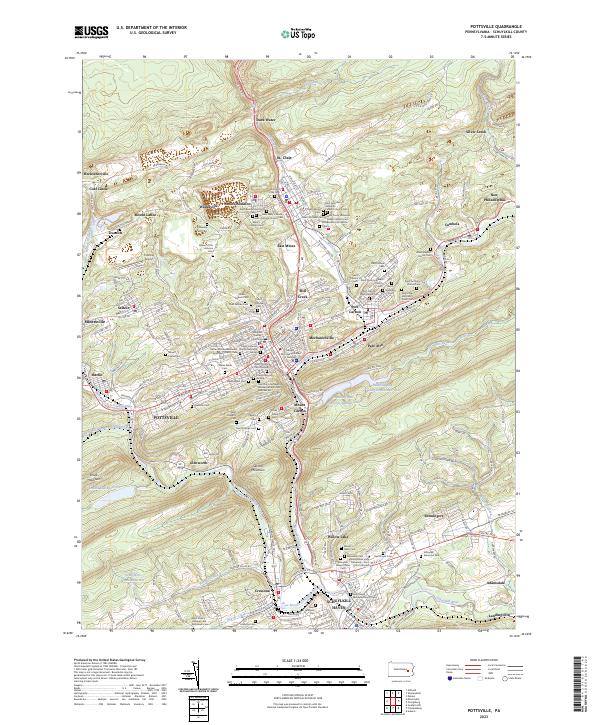 2023 Pottsville2023 Print · USGSSchuylkill County's coal-belt communities and steep ridges are meticulously detailed in this recent study. Researchers can trace ancestral roots through dozens of local sites like Charles Baber Cem, Dark Water, and Saint Casimir's Church.
 - 2023 Map of Orwigsburg, 2023 Print
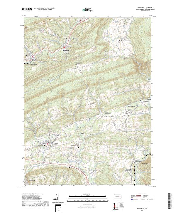 2023 Orwigsburg2023 Print · USGSSchuylkill County at the turn of the twenty-first century reveals a landscape defined by deep valleys and historic borough centers. Researchers can trace family sites at the Old Lutheran Cem or follow the Schuylkill River through Middleport and Brockton.
End of results
Showing maps 1-4 of 4
Top cities near Blythe Township
- Hazleton historical maps
- Pottsville historical maps
- Tamaqua historical maps
- Shenandoah historical maps
- Schuylkill Haven historical maps
- Bethel Township historical maps
See more
Top neighborhoods of Blythe Township
- Silver Creek historical maps
- Cumbola historical maps
- Kaska historical maps
- Union Furnace historical maps
Frequently asked questions
- What are the different types of historical maps available for Blythe Township?
- What is the oldest map of Blythe Township?
- Where can I purchase historical maps of Blythe Township for my home or office?
- Where can I download high-res historical maps of Blythe Township?
- Are there historical topographic maps available for Blythe Township?
- Is there historical aerial imagery available for Blythe Township?
- Where are historical maps of Blythe Township sourced from?