1940s Maps of Cass Township, Pennsylvania
Explore 3 historic maps of Cass Township from the 1940s. These maps offer a rare glimpse into what life looked like during the 1940s — showing old roads, neighborhoods, homes, and landmarks that have changed or disappeared over time.
Whether you're researching your family's past, planning a metal detecting trip, or studying how Cass Township's landscape evolved across the 1940s, these high-resolution maps are a powerful tool for exploring the history of this region.
- Focus on a specific era: All maps on this page are from the 1940s, giving you a focused view of this time period.
- See what’s changed: Compare century-old streets, trails, and buildings to today's modern landscape using overlays and satellite layers.
- Research with precision: Use these maps for genealogy, historical research, land use analysis, or educational projects.
- View, download, or print: Maps are fully viewable online in high resolution, and can be downloaded or printed for your own records.
Start exploring Cass Township's history through authentic maps from the 1940s. This is your window into the past.
Cass Township, PA maps
(3)- 1944 Map of Pottsville
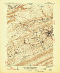
 1944 Pottsville1944 Print · USGSThe anthracite region of Pennsylvania shows its industrial density during the 1940s, with coal-dependent settlements lining the mountain valleys. Genealogists and historians can trace the rail networks of the Reading and Lehigh lines through Pottsville, St Clair, and East Mines.10 unique versions available
 - 1947 Map of Ashland
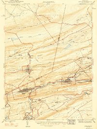 1947 Ashland1947 Print · USGSAnthracite coal country comes into sharp focus during the mid-1940s as the valley towns of Schuylkill and Columbia counties reach their peak development. Genealogists and researchers can trace the street grids of Ashland, find the Miners Hospital, and locate Centralia years before its famous underground fires.3 unique versions available
 - 1947 Map of Minersville
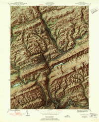
 1947 Minersville1947 Print · USGSAnthracite coal mining and rail infrastructure define this mid-century look at the Schuylkill County landscape. Genealogists and historians can trace the detailed street grids of Minersville and find smaller coal settlements like Heckscherville, New Mines, and Coal Castle.2 unique versions available
End of results
Showing maps 1-3 of 3
Top cities near Cass Township
- Pottsville historical maps
- Mount Carmel historical maps
- Shenandoah historical maps
- Schuylkill Haven historical maps
- Bethel Township historical maps
- Mahanoy City historical maps
See more
Top neighborhoods of Cass Township
- Schaeffer Hill Road historical maps
- Buckley historical maps
- Jonestown historical maps
- Coal Castle historical maps
- Pine Hill historical maps
- Heckscherville historical maps
See more
Frequently asked questions
- What are the different types of historical maps available for Cass Township?
- What is the oldest map of Cass Township?
- Where can I purchase historical maps of Cass Township for my home or office?
- Where can I download high-res historical maps of Cass Township?
- Are there historical topographic maps available for Cass Township?
- Is there historical aerial imagery available for Cass Township?
- Where are historical maps of Cass Township sourced from?