2000s (21st Century) Maps of Beaver Township, Pennsylvania
Explore 4 historic maps of Beaver Township from the 2000s (21st Century). These maps offer a rare glimpse into what life looked like during the 2000s — showing old roads, neighborhoods, homes, and landmarks that have changed or disappeared over time.
Whether you're researching your family's past, planning a metal detecting trip, or studying how Beaver Township's landscape evolved across the 2000s, these high-resolution maps are a powerful tool for exploring the history of this region.
- Focus on a specific era: All maps on this page are from the 2000s, giving you a focused view of this time period.
- See what’s changed: Compare century-old streets, trails, and buildings to today's modern landscape using overlays and satellite layers.
- Research with precision: Use these maps for genealogy, historical research, land use analysis, or educational projects.
- View, download, or print: Maps are fully viewable online in high resolution, and can be downloaded or printed for your own records.
Start exploring Beaver Township's history through authentic maps from the 2000s. This is your window into the past.
Beaver Township, PA maps
(4)- 2023 Map of Beaver Springs, 2023 Print
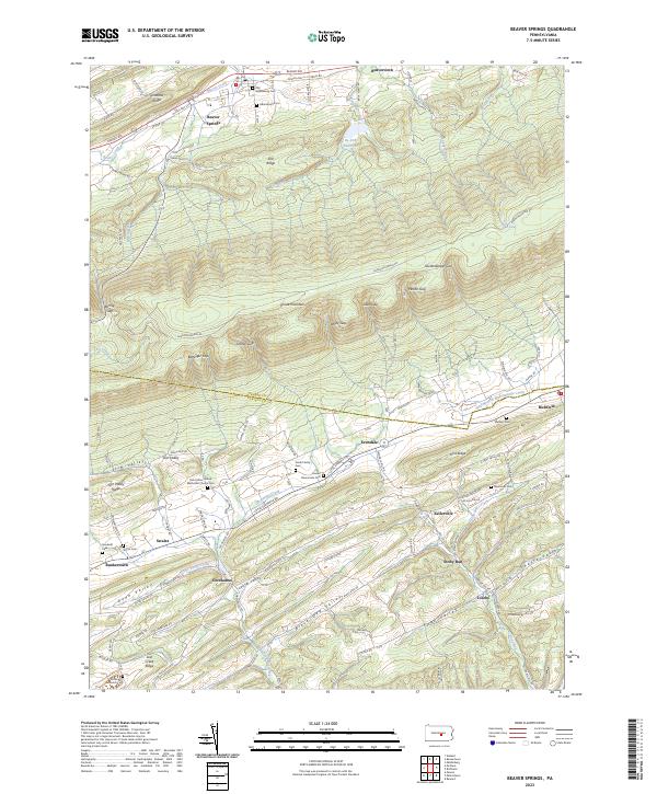 2023 Beaver Springs2023 Print · USGSSnyder and Juniata Counties are mapped here in the early twenty-first century, showing the rural corridor between Shade Mountain and the Mahantango Creek. Researchers can locate numerous family burial grounds like Smith Family Cem and Shelleys Cem near the villages of Evendale and Richfield.
 - 2023 Map of Middleburg, 2023 Print
 2023 Middleburg2023 Print · USGSMiddleburg and its surrounding valleys in the early 2020s remain anchored by traditional crossroads and the Snyder County seat. Genealogists can trace family histories through numerous sites like Hassingers Old Cem, Glendale Cem, and Paxtonville Cem.
 - 2023 Map of Richfield, 2023 Print
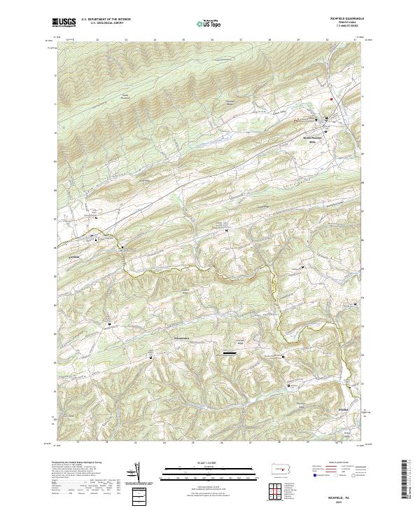 2023 Richfield2023 Print · USGSSpanning the rural border of Juniata and Snyder counties, this recent survey shows the deeply etched valleys and ridges of central Pennsylvania. Genealogists can trace family names through landmarks like Richfield-Union Cem, Saint Peters Cem, and the village of Mount Pleasant Mills.
 - 2023 Map of Beavertown, 2023 Print
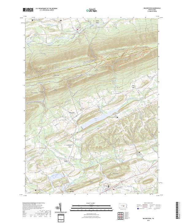 2023 Beavertown2023 Print · USGSSnyder County settlement and the ridges of the Bald Eagle State Forest define this area. Researchers can trace family sites at Saint John's Cem and old routes through Troxelville and Beaver Springs near Walker Lake.
End of results
Showing maps 1-4 of 4
Top cities near Beaver Township
- Mifflinburg historical maps
- Decatur Township historical maps
- Middleburg historical maps
- Beavertown historical maps
- McClure historical maps
- Beaver Springs historical maps
See more
Frequently asked questions
- What are the different types of historical maps available for Beaver Township?
- What is the oldest map of Beaver Township?
- Where can I purchase historical maps of Beaver Township for my home or office?
- Where can I download high-res historical maps of Beaver Township?
- Are there historical topographic maps available for Beaver Township?
- Is there historical aerial imagery available for Beaver Township?
- Where are historical maps of Beaver Township sourced from?