Old Maps of Davidson Township, Pennsylvania
Explore 26 old maps of Davidson Township, spanning from 1927 to today. These high-resolution historic maps reveal how streets, neighborhoods, landmarks, and natural features evolved over time — perfect for genealogy, metal detecting, research, and local history exploration.
What you can do with these maps:
- See how Davidson Township changed over time: Compare historical maps to modern-day views to trace roads, homesites, rail lines & more.
- View detailed metadata: Each map includes creators, publishers, year, scale, and archive source.
- Overlay maps with satellite & LiDAR: Visualize the past alongside modern tools to explore terrain & human change.
- Trusted historical sources: Maps sourced from the USGS, Library of Congress, and other archives.
- Access maps your way: View online, download high-res files, or order prints for personal or research use.
Start exploring old maps of Davidson Township to uncover forgotten places, hidden landmarks, and the deep history beneath your feet.
Davidson Township, PA maps
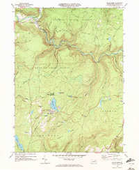
(26)- 1927 Map of Eagles Mere
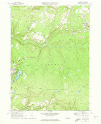
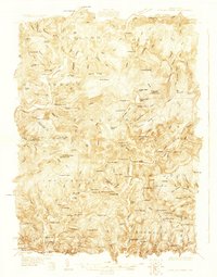 1927 Eagles Mere1927 Print · USGSSullivan and Lycoming Counties were a network of mountain resorts and valley hamlets in the late twenties. Researchers can trace the grounds of the Ogdonia Clubhouse, locate the Mawrglen Post Office, and find remote rural schools like Glidewell Sch.
 - 1932 Map of Eagle Mere
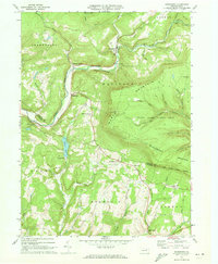
 1932 Eagle Mere1932 Print · USGSSullivan County mountain life comes alive in this early 1930s survey of the resort at Eagles Mere. Genealogists can trace family footprints at Bunker Hill Sch, the Swank Cem, or along the Williamsport and North Branch railroad.4 unique versions available
 - 1934 Map of Laporte
 1934 Laporte1934 Print · USGSSullivan County in the early thirties was a landscape of timber camps and coal towns connected by the Lehigh Valley railroad. Genealogists and local historians can trace family locations through old landmarks like Richards Grove, the Sugarloaf Sch, and Jamison City.3 unique versions available
 - 1953 Map of LaPorte, 1956 Print
 1953 LaPorte1956 Print · USGSSullivan County's plateau country is captured here during the early 1950s, showing a landscape of small coal towns and growing state parks. Researchers can find many rural landmarks, including Painter Mills, Sugarloaf Sch, and the high waters of Ganoga Lake.3 unique versions available
 - 1953 Map of Eagles Mere, 1956 Print
 1953 Eagles Mere1956 Print · USGSThe Sullivan County highlands appear in the early 1950s as a landscape of mountain retreats and valley hamlets. Researchers can trace rural landmarks from Picture Rocks to Eagles Mere Park, including Rock Run Ch and the Mawrglen PO.3 unique versions available
 - 1954 Map of Williamsport
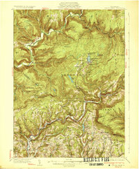
 1954 Williamsport1954 Print · USGSNorth-central Pennsylvania in the mid-fifties is defined by the winding West Branch Susquehanna River and its industrial valley. Local historians can trace the massive Susquehanna Ordnance Depot and the extensive rail networks of the Pennsylvania Railroad.
 - 1960 Map of Williamsport
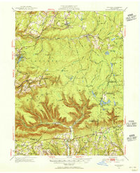
 1960 Williamsport1960 Print · USGSNorth-central Pennsylvania in the mid-twentieth century was a vital corridor of rail and river industry stretching from the New York line to the coal regions. Genealogists can trace the rail networks of the Pennsylvania RR and Lehigh Valley RR connecting towns like Williamsport, Towanda, and Lock Haven.
 - 1962 Map of Williamsport, 1966 Print
 1962 Williamsport1966 Print · USGSNorth-central Pennsylvania was a landscape of industrial river hubs and vast state woodlands in the early sixties. Researchers can trace the path of the Pennsylvania Railroad through Williamsport and explore the remote reaches of Bucktail State Park.5 unique versions available
 - 1965 Map of Williamsport
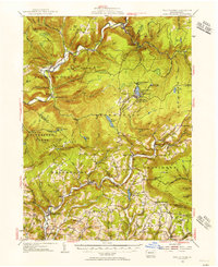
 1965 Williamsport1965 Print · USGSNorth-central Pennsylvania in the mid-1960s is defined by the industrial river towns and vast timberlands of the Allegheny Plateau. Researchers can trace historic rail lines like the Erie Lackawanna and Reading as they thread through Williamsport, Lock Haven, and Jersey Shore.
 - 1966 Map of Williamsport
 1966 Williamsport1966 Print · USGSThe Susquehanna Valley was a hub of transit and industry in the mid-seventies, where the river's West Branch connected major college towns and timberlands. Researchers can trace historical rail lines like the Reading or locate regional landmarks from Jersey Shore to Ricketts Glen State Park.
 - 1969 Map of Eagles Mere, 1972 Print
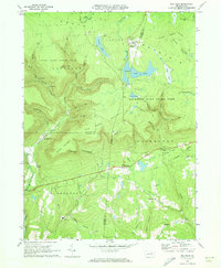
 1969 Eagles Mere1972 Print · USGSSullivan County’s high plateaus and deep creek valleys are captured here during the late sixties. Genealogists and historians can locate the Covered Bridge at Forksville or trace family sites near Eagles Mere Lake and Wrights View.2 unique versions available
 - 1969 Map of Elk Grove, 1973 Print
 1969 Elk Grove1973 Print · USGSSullivan and Columbia counties appear at a quiet moment in the late sixties, showing the small creek-side settlements that define the Endless Mountains. Researchers can trace the Old Railroad Grade or locate family sites near Elk Grove, Central, and Brandon Ch.3 unique versions available
 - 1969 Map of Red Rock, 1973 Print
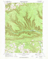
 1969 Red Rock1973 Print · USGSThe high plateau of the Endless Mountains is captured in the late sixties, showing the Cold War presence of the Benton Air Force Station. Genealogists and historians can trace the remote settlements of Jamison City, Central, and Mossville alongside the waterfalls of Ricketts Glen State Park.4 unique versions available
 - 1969 Map of Lopez, 1973 Print
 1969 Lopez1973 Print · USGSSullivan County’s high plateaus and creek valleys are captured here in the late sixties as conservation lands began to surround older industrial sites. Researchers can trace the Old Railroad Grade near Lopez or locate family sites at St Vladimirs Cem and Murray.5 unique versions available
 - 1969 Map of LaPorte, 1973 Print
 1969 LaPorte1973 Print · USGSSullivan County's high plateau country is documented here in the late sixties, showcasing the intersection of mountain recreation and remnant mining industries. Researchers can trace the legacy of local settlements like Mildred, Bernice, and Laporte while identifying old transit routes like the Old Railroad Grade.3 unique versions available
 - 1970 Map of Sonestown, 1973 Print
 1970 Sonestown1973 Print · USGSThe high ridges and deep hollows of Sullivan County are captured here during the 1970s, showcasing a landscape of mountain hamlets and forest preserves. Researchers can trace the Old Railroad Grade through Sonestown or locate rural landmarks like the Covered Bridge and Franklin Ch.3 unique versions available
 - 1984 Map of Williamsport East, 1985 Print
 1984 Williamsport East1985 Print · USGSThe Susquehanna River valley and Allegheny highlands come together in this mid-eighties survey of central Pennsylvania. Trace family roots at Muncy Cem or locate institutional landmarks like Lycoming College and the State Correctional Institution at Retreat.2 unique versions available
 - 1993 Map of Eagles Mere, 1999 Print
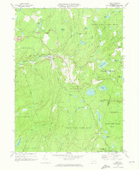
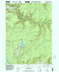 1993 Eagles Mere1999 Print · USGSSullivan County’s high plateau and deep creek valleys are shown here in the 1990s, capturing the balance between wilderness and recreation. You can trace the Loyalsock Trail, locate the Covered Bridge at Forksville, and explore the shoreline of Eagles Mere Lake.
 - 1995 Map of Red Rock, 1998 Print
 1995 Red Rock1998 Print · USGSThe high plateau where Sullivan, Luzerne, and Columbia counties converge was a hub of timbering and mountain recreation in the mid-nineties. Trace the path of the Old Railroad Grade or locate the Covered Bridge near historical settlements like Jamison City and Tri Mills.
 - 1999 Map of Sonestown, 2001 Print
 1999 Sonestown2001 Print · USGSSullivan and Lycoming counties at the close of the century show a landscape of steep valleys and high timberlands. Genealogists can trace family footprints near Franklin Ch, find the Covered Bridge at Sonestown, and follow the Old Railroad Grade.
 - 2023 Map of Lopez, 2023 Print
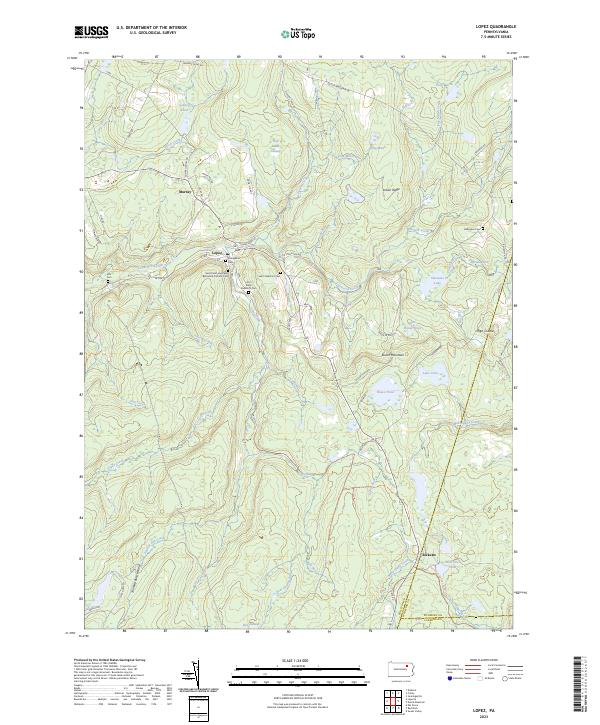 2023 Lopez2023 Print · USGSSullivan County settlement and mountain terrain are captured here in the 2020s, showing the enduring layout of rural mountain towns. Genealogists can trace family sites at Saint Peter and Pauls Byzantine Catholic Cem, Ellis Cem, and the settlement of Lopez.
 - 2023 Map of Sonestown, 2023 Print
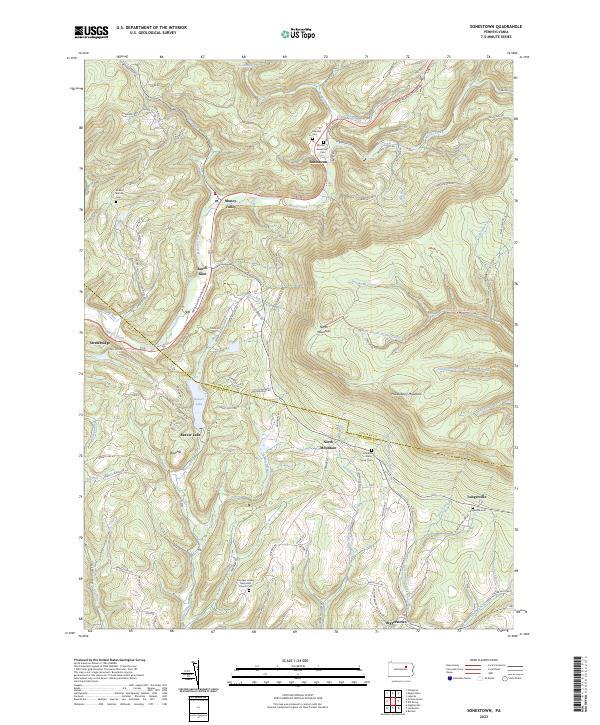 2023 Sonestown2023 Print · USGSSullivan County's high ridges and creek valleys are documented here in the early twenty-first century, showing the enduring rural layout of the region. Researchers can locate family landmarks like the Lungerville Cem and trace the paths through Muncy Valley or along Beaver Lake.
 - 2023 Map of Elk Grove, 2023 Print
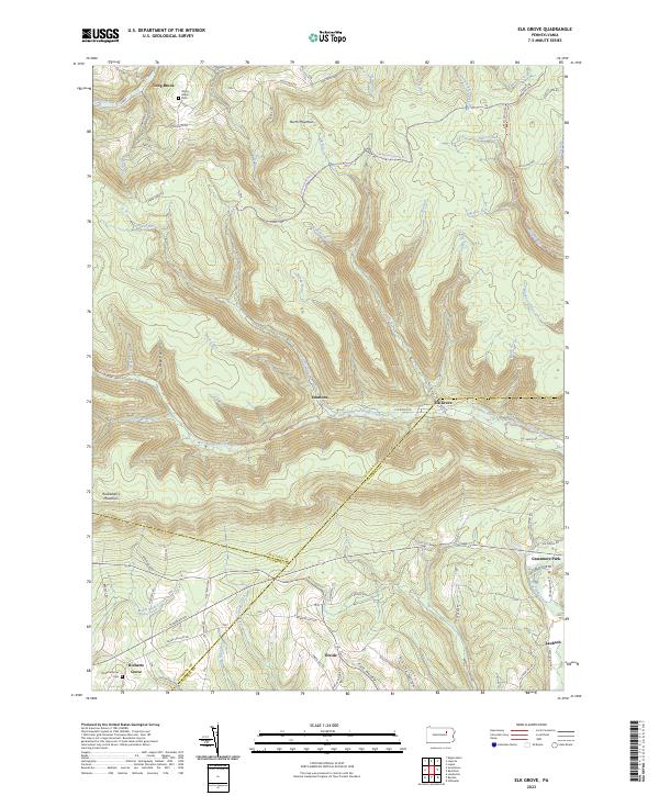 2023 Elk Grove2023 Print · USGSSullivan and Columbia counties meet in this highland region during the early twenty-first century, where the West Branch of Fishing Creek cuts through the plateau. Researchers can trace rural settlement patterns at Elk Grove, Richarts Grove, and Emmons, or locate family sites near York Hollow and Grassmere Park.
 - 2023 Map of Eagles Mere, 2023 Print
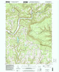
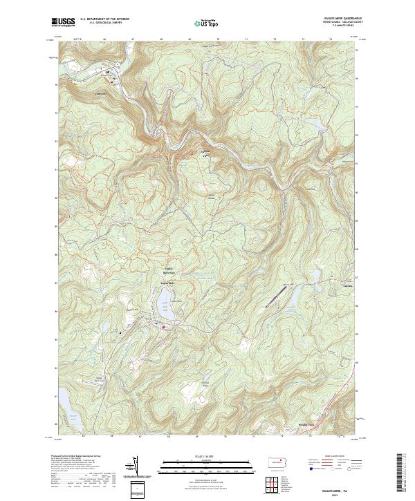 2023 Eagles Mere2023 Print · USGSSullivan County’s high forest plateau is documented here in the early twenty-first century, centered on the historic resort community of Eagles Mere. Genealogists and local historians can trace the town’s residential growth, find the Eagles Mere Cem, and follow the path of the old Conservancy Narrow Gauge Rail-Trl.
 - 2023 Map of Red Rock, 2023 Print
 2023 Red Rock2023 Print · USGSThe high plateau where Sullivan, Luzerne, and Columbia counties converge is documented here in the early twenty-first century. Researchers can trace rural cemeteries like Mossville Cem and the small settlements of Jamison City and Tri Mills.
Showing maps 1-25 of 26
Top cities near Davidson Township
- Greenwood Township historical maps
- Wilmot Township historical maps
- Moreland Township historical maps
- Millville historical maps
- Benton historical maps
- Jackson Township historical maps
See more
Top neighborhoods of Davidson Township
- Emmons historical maps
- Muncy Valley historical maps
- Sonestown historical maps
- Beech Glen historical maps
- Long Brook historical maps
Frequently asked questions
- What are the different types of historical maps available for Davidson Township?
- What is the oldest map of Davidson Township?
- Where can I purchase historical maps of Davidson Township for my home or office?
- Where can I download high-res historical maps of Davidson Township?
- Are there historical topographic maps available for Davidson Township?
- Is there historical aerial imagery available for Davidson Township?
- Where are historical maps of Davidson Township sourced from?