2020s Maps of Davidson Township, Pennsylvania
Explore 6 historic maps of Davidson Township from the 2020s. These maps offer a rare glimpse into what life looked like during the 2020s — showing old roads, neighborhoods, homes, and landmarks that have changed or disappeared over time.
Whether you're researching your family's past, planning a metal detecting trip, or studying how Davidson Township's landscape evolved across the 2020s, these high-resolution maps are a powerful tool for exploring the history of this region.
- Focus on a specific era: All maps on this page are from the 2020s, giving you a focused view of this time period.
- See what’s changed: Compare century-old streets, trails, and buildings to today's modern landscape using overlays and satellite layers.
- Research with precision: Use these maps for genealogy, historical research, land use analysis, or educational projects.
- View, download, or print: Maps are fully viewable online in high resolution, and can be downloaded or printed for your own records.
Start exploring Davidson Township's history through authentic maps from the 2020s. This is your window into the past.
Davidson Township, PA maps
(6)- 2023 Map of Lopez, 2023 Print
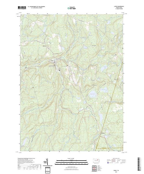 2023 Lopez2023 Print · USGSSullivan County settlement and mountain terrain are captured here in the 2020s, showing the enduring layout of rural mountain towns. Genealogists can trace family sites at Saint Peter and Pauls Byzantine Catholic Cem, Ellis Cem, and the settlement of Lopez.
 - 2023 Map of Sonestown, 2023 Print
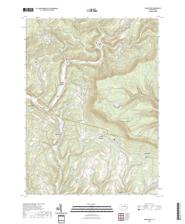 2023 Sonestown2023 Print · USGSSullivan County's high ridges and creek valleys are documented here in the early twenty-first century, showing the enduring rural layout of the region. Researchers can locate family landmarks like the Lungerville Cem and trace the paths through Muncy Valley or along Beaver Lake.
 - 2023 Map of Elk Grove, 2023 Print
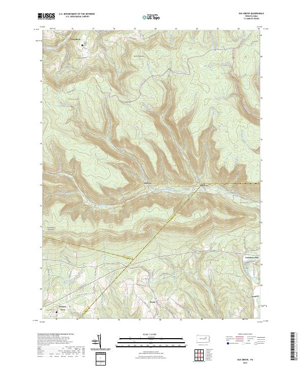 2023 Elk Grove2023 Print · USGSSullivan and Columbia counties meet in this highland region during the early twenty-first century, where the West Branch of Fishing Creek cuts through the plateau. Researchers can trace rural settlement patterns at Elk Grove, Richarts Grove, and Emmons, or locate family sites near York Hollow and Grassmere Park.
 - 2023 Map of Eagles Mere, 2023 Print
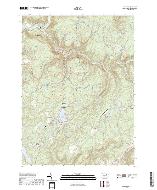 2023 Eagles Mere2023 Print · USGSSullivan County’s high forest plateau is documented here in the early twenty-first century, centered on the historic resort community of Eagles Mere. Genealogists and local historians can trace the town’s residential growth, find the Eagles Mere Cem, and follow the path of the old Conservancy Narrow Gauge Rail-Trl.
 - 2023 Map of Red Rock, 2023 Print
 2023 Red Rock2023 Print · USGSThe high plateau where Sullivan, Luzerne, and Columbia counties converge is documented here in the early twenty-first century. Researchers can trace rural cemeteries like Mossville Cem and the small settlements of Jamison City and Tri Mills.
 - 2023 Map of Laporte, 2023 Print
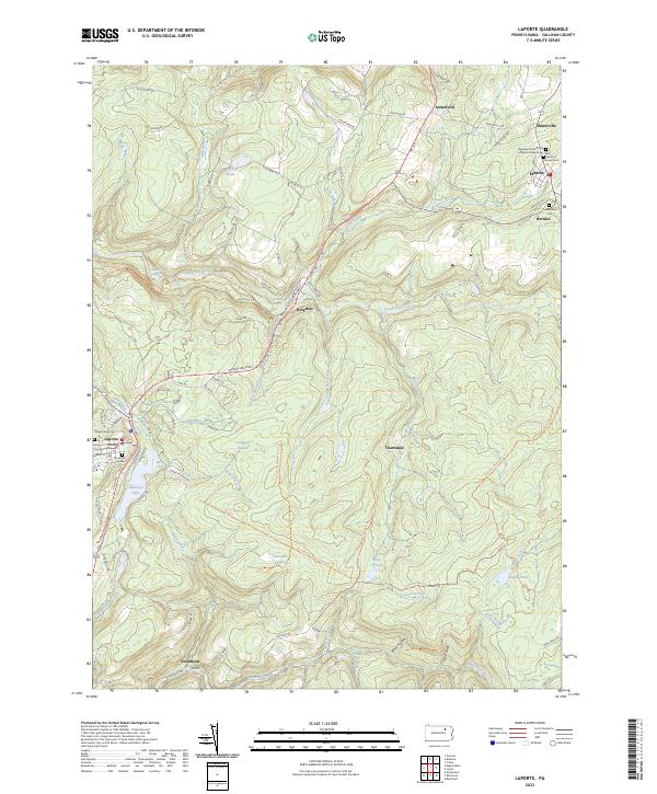 2023 Laporte2023 Print · USGSSullivan County’s high plateaus and historic hamlets are captured in this recent survey of the Laporte area. Genealogists and local historians can locate family sites at the Saint Francis of Assisi Cem or trace the early paths near Mildred and Bernice.
End of results
Showing maps 1-6 of 6
Top cities near Davidson Township
- Greenwood Township historical maps
- Wilmot Township historical maps
- Moreland Township historical maps
- Millville historical maps
- Benton historical maps
- Jackson Township historical maps
See more
Top neighborhoods of Davidson Township
- Emmons historical maps
- Muncy Valley historical maps
- Sonestown historical maps
- Beech Glen historical maps
- Long Brook historical maps
Frequently asked questions
- What are the different types of historical maps available for Davidson Township?
- What is the oldest map of Davidson Township?
- Where can I purchase historical maps of Davidson Township for my home or office?
- Where can I download high-res historical maps of Davidson Township?
- Are there historical topographic maps available for Davidson Township?
- Is there historical aerial imagery available for Davidson Township?
- Where are historical maps of Davidson Township sourced from?