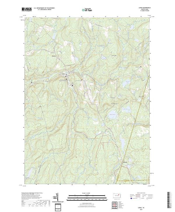
2023 Map of Lopez
USGS Topo · Published 2023About this map
Lopez serves as a central hub for this portion of Sullivan County, situated along the banks of Loyalsock Creek where several mountain roads converge. The settlement pattern reflects a deeply rooted community, evidenced by a dense concentration of religious sites including the Saint Peter and Pauls Byzantine Catholic Cem, Old Saint Vladimir's Cem, and the Evangelical Cem. These landmarks, along with the Po at the town center, suggest a history of immigrant labor and local industry typical of the Pennsylvania anthracite and timber regions.
Find a feature on this map
76 named features on this map. Tap any name to fly to it.
Don’t see what you’re looking for? This feature index may not catch every label — zoom into the map to look around manually.
Map Details
Editions of this 2023 Lopez Map
This is the sole edition of this map. No revisions or reprints were ever made.
Other maps of this area

1891 · Harveys Lake
USGS Topo · 1:62,500

1893 · Harvey Lake
USGS Topo · 1:62,500

1934 · Laporte
USGS Topo · 1:62,500

1943 · Monroeton
USGS Topo · 1:62,500

1945 · Meshoppen
USGS Topo · 1:62,500

1945 · Jenningsville
USGS Topo · 1:24,000

1946 · Dutch Mtn
USGS Topo · 1:24,000

1946 · Sweet Valley
USGS Topo · 1:24,000

1947 · Jenningsville
USGS Topo · 1:31,680
1948 · Dutch Mtn
USGS Topo · 1:24,000