1990s Maps of Davidson Township, Pennsylvania
Explore 3 historic maps of Davidson Township from the 1990s. These maps offer a rare glimpse into what life looked like during the 1990s — showing old roads, neighborhoods, homes, and landmarks that have changed or disappeared over time.
Whether you're researching your family's past, planning a metal detecting trip, or studying how Davidson Township's landscape evolved across the 1990s, these high-resolution maps are a powerful tool for exploring the history of this region.
- Focus on a specific era: All maps on this page are from the 1990s, giving you a focused view of this time period.
- See what’s changed: Compare century-old streets, trails, and buildings to today's modern landscape using overlays and satellite layers.
- Research with precision: Use these maps for genealogy, historical research, land use analysis, or educational projects.
- View, download, or print: Maps are fully viewable online in high resolution, and can be downloaded or printed for your own records.
Start exploring Davidson Township's history through authentic maps from the 1990s. This is your window into the past.
Davidson Township, PA maps
(3)- 1993 Map of Eagles Mere, 1999 Print
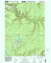 1993 Eagles Mere1999 Print · USGSSullivan County’s high plateau and deep creek valleys are shown here in the 1990s, capturing the balance between wilderness and recreation. You can trace the Loyalsock Trail, locate the Covered Bridge at Forksville, and explore the shoreline of Eagles Mere Lake.
 - 1995 Map of Red Rock, 1998 Print
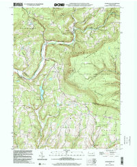
 1995 Red Rock1998 Print · USGSThe high plateau where Sullivan, Luzerne, and Columbia counties converge was a hub of timbering and mountain recreation in the mid-nineties. Trace the path of the Old Railroad Grade or locate the Covered Bridge near historical settlements like Jamison City and Tri Mills.
 - 1999 Map of Sonestown, 2001 Print
 1999 Sonestown2001 Print · USGSSullivan and Lycoming counties at the close of the century show a landscape of steep valleys and high timberlands. Genealogists can trace family footprints near Franklin Ch, find the Covered Bridge at Sonestown, and follow the Old Railroad Grade.
End of results
Showing maps 1-3 of 3
Top cities near Davidson Township
- Greenwood Township historical maps
- Wilmot Township historical maps
- Moreland Township historical maps
- Millville historical maps
- Benton historical maps
- Jackson Township historical maps
See more
Top neighborhoods of Davidson Township
- Emmons historical maps
- Muncy Valley historical maps
- Sonestown historical maps
- Beech Glen historical maps
- Long Brook historical maps
Frequently asked questions
- What are the different types of historical maps available for Davidson Township?
- What is the oldest map of Davidson Township?
- Where can I purchase historical maps of Davidson Township for my home or office?
- Where can I download high-res historical maps of Davidson Township?
- Are there historical topographic maps available for Davidson Township?
- Is there historical aerial imagery available for Davidson Township?
- Where are historical maps of Davidson Township sourced from?