Old Maps of Lawrenceville, Pennsylvania for Metal Detecting
Plan your next treasure hunt with 15 historic maps of Lawrenceville. Find old homesites, ghost towns, trails, and gathering spots that may be lost to time — perfect for identifying promising metal detecting locations.
- Locate forgotten sites: Uncover places like long-lost settlements, abandoned rail lines, or gathering spots.
- Plan better hunts: Use map overlays combined with LiDAR or satellite views to narrow in on historically rich areas.
- Made for detectorists: Thousands of hobbyists use these maps to discover relics, coins, and hidden history.
Use these historic maps to boost your research and find new opportunities beneath the surface of Lawrenceville.
Lawrenceville, PA maps
(15)- 1900 Map of Tioga
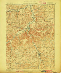
 1900 Tioga1900 Print · USGSTioga County at the turn of the century shows a landscape defined by the busy river corridors and the arrival of major rail networks. Researchers can trace the early footprints of Lawrenceville, Mansfield, and Tioga, or locate rural landmarks like Jackson Summit and Canoe Camp.
 - 1902 Map of Tioga
 1902 Tioga1902 Print · USGSNorthern Tioga County at the turn of the century shows a landscape dominated by the convergence of major rail lines and river valleys. Genealogists can trace family roots in riverside settlements like Canoe Camp or explore vanished rail stops like Tompkins and Hammond.5 unique versions available
 - 1954 Map of Williamsport
 1954 Williamsport1954 Print · USGSNorth-central Pennsylvania in the mid-fifties is defined by the winding West Branch Susquehanna River and its industrial valley. Local historians can trace the massive Susquehanna Ordnance Depot and the extensive rail networks of the Pennsylvania Railroad.
 - 1954 Map of Tioga, 1956 Print
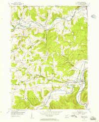 1954 Tioga1956 Print · USGSTioga County's river valleys thrive in the mid-1950s as vital transport corridors for the New York Central Line and Erie RR. Local historians can trace the foundations of Lawrenceville and Tioga, or locate rural landmarks like Tompkins Ch and the Dailey Cem.4 unique versions available
 - 1960 Map of Williamsport
 1960 Williamsport1960 Print · USGSNorth-central Pennsylvania in the mid-twentieth century was a vital corridor of rail and river industry stretching from the New York line to the coal regions. Genealogists can trace the rail networks of the Pennsylvania RR and Lehigh Valley RR connecting towns like Williamsport, Towanda, and Lock Haven.
 - 1962 Map of Williamsport, 1966 Print
 1962 Williamsport1966 Print · USGSNorth-central Pennsylvania was a landscape of industrial river hubs and vast state woodlands in the early sixties. Researchers can trace the path of the Pennsylvania Railroad through Williamsport and explore the remote reaches of Bucktail State Park.5 unique versions available
 - 1965 Map of Williamsport
 1965 Williamsport1965 Print · USGSNorth-central Pennsylvania in the mid-1960s is defined by the industrial river towns and vast timberlands of the Allegheny Plateau. Researchers can trace historic rail lines like the Erie Lackawanna and Reading as they thread through Williamsport, Lock Haven, and Jersey Shore.
 - 1966 Map of Williamsport
 1966 Williamsport1966 Print · USGSThe Susquehanna Valley was a hub of transit and industry in the mid-seventies, where the river's West Branch connected major college towns and timberlands. Researchers can trace historical rail lines like the Reading or locate regional landmarks from Jersey Shore to Ricketts Glen State Park.
 - 1969 Map of Tioga, 1971 Print
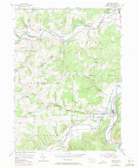 1969 Tioga1971 Print · USGSTioga County, Pennsylvania, is captured here in the late sixties as the river-and-rail economy shaped the borderlands near New York. Genealogists and local historians can trace family plots at Nelson Cem and Tioga Cem, or locate the old Tompkins Ch.
 - 1981 Map of Wellsboro, 1982 Print
 1981 Wellsboro1982 Print · USGSNorthern Pennsylvania in the early eighties shows a landscape of deep river gorges and vast state forests. Trace the rail lines of Conrail and explore old settlements from Coudersport to the Pine Creek Gorge.
 - 2010 Map of Tioga, 2010 Print
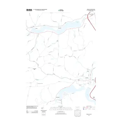
 2010 Tioga2010 Print · USGSCovers Lawrenceville, including Lindley, Tuscarora, and other nearby areas
 - 2013 Map of Tioga, 2013 Print
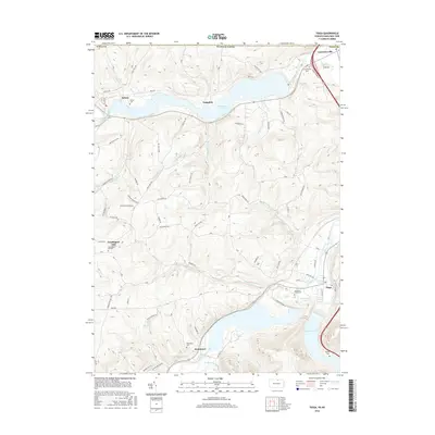
 2013 Tioga2013 Print · USGSCovers Lawrenceville, including Lindley, Tuscarora, and other nearby areas
 - 2016 Map of Tioga, 2016 Print
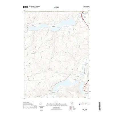
 2016 Tioga2016 Print · USGSCovers Lawrenceville, including Lindley, Tuscarora, and other nearby areas
 - 2019 Map of Tioga, 2019 Print
 2019 Tioga2019 Print · USGSCovers Lawrenceville, including Lindley, Tuscarora, and other nearby areas
 - 2023 Map of Tioga, 2023 Print
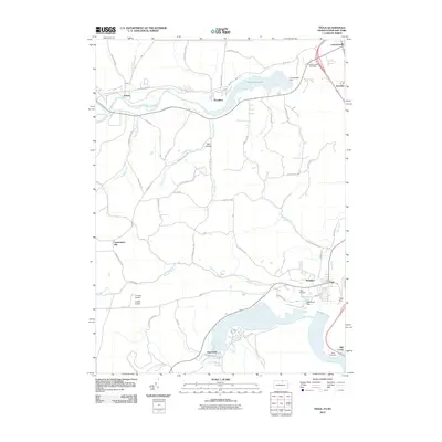
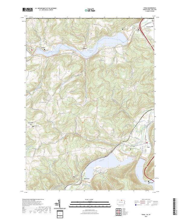 2023 Tioga2023 Print · USGSNorthern Pennsylvania’s river valleys and flood control projects are documented here in the early twenty-first century. Researchers can trace family history at Evergreen Cem and Nelson Cem or follow the Railroad Grade Trail near Hammond.
End of results
Showing maps 1-15 of 15
Top cities near Lawrenceville
- Corning historical maps
- Southport historical maps
- Erwin historical maps
- Big Flats historical maps
- Corning historical maps
- Big Flats historical maps
See more
Frequently asked questions
- What are the different types of historical maps available for Lawrenceville?
- What is the oldest map of Lawrenceville?
- Where can I purchase historical maps of Lawrenceville for my home or office?
- Where can I download high-res historical maps of Lawrenceville?
- Are there historical topographic maps available for Lawrenceville?
- Is there historical aerial imagery available for Lawrenceville?
- Where are historical maps of Lawrenceville sourced from?