Old Maps of Tioga County, Pennsylvania
Explore 128 old maps of Tioga County, spanning from 1895 to today. These high-resolution historic maps reveal how streets, neighborhoods, landmarks, and natural features evolved over time — perfect for genealogy, metal detecting, research, and local history exploration.
What you can do with these maps:
- See how Tioga County changed over time: Compare historical maps to modern-day views to trace roads, homesites, rail lines & more.
- View detailed metadata: Each map includes creators, publishers, year, scale, and archive source.
- Overlay maps with satellite & LiDAR: Visualize the past alongside modern tools to explore terrain & human change.
- Trusted historical sources: Maps sourced from the USGS, Library of Congress, and other archives.
- Access maps your way: View online, download high-res files, or order prints for personal or research use.
Start exploring old maps of Tioga County to uncover forgotten places, hidden landmarks, and the deep history beneath your feet.
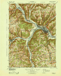
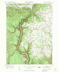
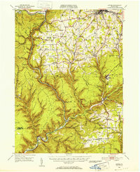
Tioga County, PA maps
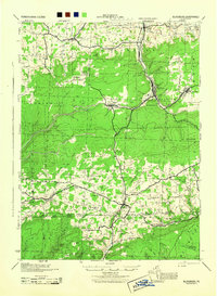
(128)- 1895 Map of Elmira
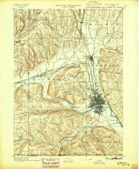 1895 Elmira1895 Print · USGSChemung County and the northern Pennsylvania border appear as a thriving rail hub in the 1890s. Genealogists and local historians can trace the early grids of Elmira, the important rail junctions at State Line Junction, and family-named landmarks like Hawley Hill.10 unique versions available
 - 1899 Map of Gaines, 1960 Print
 1899 Gaines1960 Print · USGSPotter and Tioga Counties are seen here at the end of the nineteenth century, as the logging and rail industries reached into every deep hollow. Genealogists and historians can trace family lands near Harrison Valley, Sabinsville, and the remote Loucks Mills.2 unique versions available
 - 1900 Map of Gaines
 1900 Gaines1900 Print · USGSThe Cowanesque River valley at the turn of the century shows a landscape defined by new rail lines and remote timbering settlements. Genealogists can trace family holdings near Sunderlinville, Harrison Valley, and the rural crossroads of Mixtown and Lansing.5 unique versions available
 - 1900 Map of Tioga
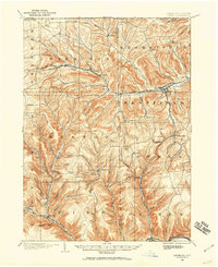
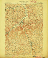
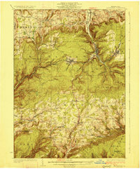
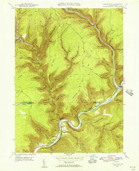
 1900 Tioga1900 Print · USGSTioga County at the turn of the century shows a landscape defined by the busy river corridors and the arrival of major rail networks. Researchers can trace the early footprints of Lawrenceville, Mansfield, and Tioga, or locate rural landmarks like Jackson Summit and Canoe Camp.
 - 1900 Map of Elkland
 1900 Elkland1900 Print · USGSTioga County at the turn of the century is defined by its deep river valleys and the expanding rail networks of the Cowanesque River. Genealogists and local historians can trace the early footprints of Knoxville, Academy Corners, and the rail junction at Stokesdale Junc.5 unique versions available
 - 1902 Map of Tioga
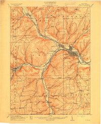
 1902 Tioga1902 Print · USGSNorthern Tioga County at the turn of the century shows a landscape dominated by the convergence of major rail lines and river valleys. Genealogists can trace family roots in riverside settlements like Canoe Camp or explore vanished rail stops like Tompkins and Hammond.5 unique versions available
 - 1905 Map of Watkins Glen
 1905 Watkins Glen1905 Print · USGSThe Finger Lakes and Southern Tier regions are captured at the start of the century, showing a landscape defined by deep glens and heavy rail. Genealogists and historians can trace the paths of the Northern Central RR through Watkins or locate family sites near Burdett and Horseheads.4 unique versions available
 - 1914 Map of Corning
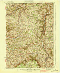
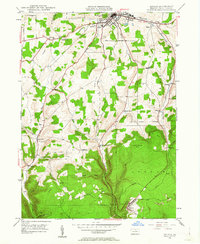
 1914 Corning1914 Print · USGSSteuben County is a thriving rail and river hub during the early twentieth century, centered on the strategic confluence at Painted Post. Genealogists and local historians can locate dozens of neighborhood landmarks, including French's Mill, Lumber City School, and the remote Liberty Pole School.6 unique versions available
 - 1924 Map of Woodhull
 1924 Woodhull1924 Print · USGSSteuben County in the mid-twenties is a landscape of high ridges and school-centered rural districts. Genealogists can trace family names and local hubs from Cameron Mills to Rathbone, including the Eight Square School and the Erie RR line.
 - 1925 Map of Blossburg, 1958 Print
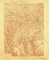
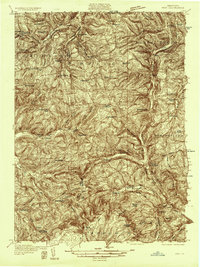
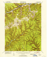
 1925 Blossburg1958 Print · USGSTioga County’s coal and timber country is captured here during the 1920s, when the Tioga River and Erie R R drove the local economy. Researchers can locate dozens of country schoolhouses, rural churches like Burt Church, and early industrial sites such as Blacks Mill.2 unique versions available
 - 1926 Map of Woodhull
 1926 Woodhull1926 Print · USGSSteuben County rural life in the mid-1920s is defined by the Canisteo River valley and a network of hilltop school districts. Researchers can trace family-named landmarks like Kinners Knob or locate vanished local hubs like Hedgesville and Cameron Mills.4 unique versions available
 - 1927 Map of Blossburg
 1927 Blossburg1927 Print · USGSTioga County's coal country and rural townships are captured here in the mid-1920s, showing the height of the mountain rail and mining era. Genealogists can locate family-named sites like Blacks Mill, Hart Church, and vanished schoolhouses such as Culver School.4 unique versions available
 - 1931 Map of Troy
 1931 Troy1931 Print · USGSBradford County’s northern valleys and high ridges appear here in the early 1930s, showing a landscape of small hamlets and cross-country rail lines. Genealogists can locate family landmarks such as Besley Cem, Mitchells Mill, and early schools like Doty Hill Sch.2 unique versions available
 - 1938 Map of Troy
 1938 Troy1938 Print · USGSNorthern Bradford and Tioga Counties are captured here in the late 1930s, showing a landscape of upland farms and railroad hamlets. Genealogists can trace family footprints at Roseville Rutland PO, the Armenia Ch, or the Besley Cem.3 unique versions available
 - 1942 Map of Canton, 1958 Print
 1942 Canton1958 Print · USGSCanton and the surrounding Bradford County highlands are shown here in the early 1940s as a landscape of small valley towns and mountain schools. Genealogists and historians can trace old homesteads and local landmarks like Minnequa, Cowley Sta, and Ward Sch.2 unique versions available
 - 1944 Map of Blossburg
 1944 Blossburg1944 Print · USGSTioga County during the mid-1940s reveals a landscape of industrial coal towns and remote ridge-top schoolhouses. Genealogists and historians can trace family roots through numerous local landmarks, including Blacks Mill, the Erie Railroad, and several rural sites like Nauvoo or Beuter School.
 - 1944 Map of Woodhull
 1944 Woodhull1944 Print · USGSSteuben County rural life during the 1940s is centered on the Erie RR corridor and a network of hill-country farm roads. Researchers can locate dozens of district schoolhouses like Eight Square Sch and Cameron Hill Sch alongside old hamlets such as Cameron Mills and Hedgesville.
 - 1944 Map of Canton
 1944 Canton1944 Print · USGSNorth-central Pennsylvania’s rugged creek valleys and rail corridors are captured here just as the mountain economies were shifting in the early 1940s. Genealogists can trace family footprints at Spencertown and Dogtown, or locate rural landmarks like the Joe Hill Sch and Maple Summit Ch.3 unique versions available
 - 1944 Map of Corning
 1944 Corning1944 Print · USGSSteuben County was a vital rail and river junction during the Second World War. Genealogists and historians can trace an incredible density of rural landmarks, from Frenchs Mill to the many country schoolhouses like Lumber City Sch and Liberty Pole Sch.
 - 1946 Map of Tiadaghton
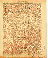
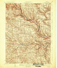
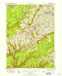
 1946 Tiadaghton1946 Print · USGSTioga County's dramatic canyon country is captured here in the mid-1940s, showing the intersection of industry and rural life. Researchers can trace the New York Central line through Pine Creek Gorge or locate family landmarks like Olmsville Cem and the Middle Ridge Ch.5 unique versions available
 - 1946 Map of Antrim, 1952 Print
 1946 Antrim1952 Print · USGSTioga County in the years following World War II is defined by the deep carving of Pine Creek Gorge and a network of mountain railroads. Genealogists can trace family roots through remote sites like Antrim Cem, Heise Run Sch, and the Cedar Run Ch.2 unique versions available
 - 1946 Map of Cedar Run, 1956 Print
 1946 Cedar Run1956 Print · USGSPine Creek Gorge and the rugged Tioga County highlands are captured here in the mid-1940s as the rail-and-river economy still shaped the valley. Researchers can trace family roots near Blackwell Lloyd PO, the Cedar Run Ch, and the remote settlement of Leetonia.4 unique versions available
 - 1946 Map of Antrim, 1963 Print
 1946 Antrim1963 Print · USGSTioga County in the mid-forties reflects a landscape of small upland settlements and valley railroads near the borough of Wellsboro. Researchers can trace the path of the New York Central rail line past Antrim and locate local landmarks like Heise Run Sch and the County Home.5 unique versions available
 - 1946 Map of Morris, 1965 Print
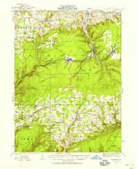
 1946 Morris1965 Print · USGSThe mountain valleys of Tioga County come into focus in the 1940s, centered on the creek-side communities of Morris and Hoytville. Researchers can trace the rural network of family cemeteries like Lewis Cem and upland settlements such as Oregon Hill.3 unique versions available
 - 1947 Map of Galeton, 1953 Print
 1947 Galeton1953 Print · USGSThe Pennsylvania Wilds around Galeton are captured here just after the war, showing a deeply timbered landscape of mountain ridges and narrow hollows. Genealogists can locate family cemeteries like Phoenix Cem and the legendary ruins of Ole Bull Castle.3 unique versions available
Showing maps 1-25 of 128
Top cities of Tioga County
- Mansfield historical maps
- Wellsboro historical maps
- Elkland historical maps
- Blossburg historical maps
- Westfield historical maps
- Osceola Township historical maps
See more
Frequently asked questions
- What are the different types of historical maps available for Tioga County?
- What is the oldest map of Tioga County?
- Where can I purchase historical maps of Tioga County for my home or office?
- Where can I download high-res historical maps of Tioga County?
- Are there historical topographic maps available for Tioga County?
- Is there historical aerial imagery available for Tioga County?
- Where are historical maps of Tioga County sourced from?