2020s Maps of Tioga County, Pennsylvania
Explore 28 historic maps of Tioga County from the 2020s. These maps offer a rare glimpse into what life looked like during the 2020s — showing old roads, neighborhoods, homes, and landmarks that have changed or disappeared over time.
Whether you're researching your family's past, planning a metal detecting trip, or studying how Tioga County's landscape evolved across the 2020s, these high-resolution maps are a powerful tool for exploring the history of this region.
- Focus on a specific era: All maps on this page are from the 2020s, giving you a focused view of this time period.
- See what’s changed: Compare century-old streets, trails, and buildings to today's modern landscape using overlays and satellite layers.
- Research with precision: Use these maps for genealogy, historical research, land use analysis, or educational projects.
- View, download, or print: Maps are fully viewable online in high resolution, and can be downloaded or printed for your own records.
Start exploring Tioga County's history through authentic maps from the 2020s. This is your window into the past.
Tioga County, PA maps
(28)- 2023 Map of Gleason, 2023 Print
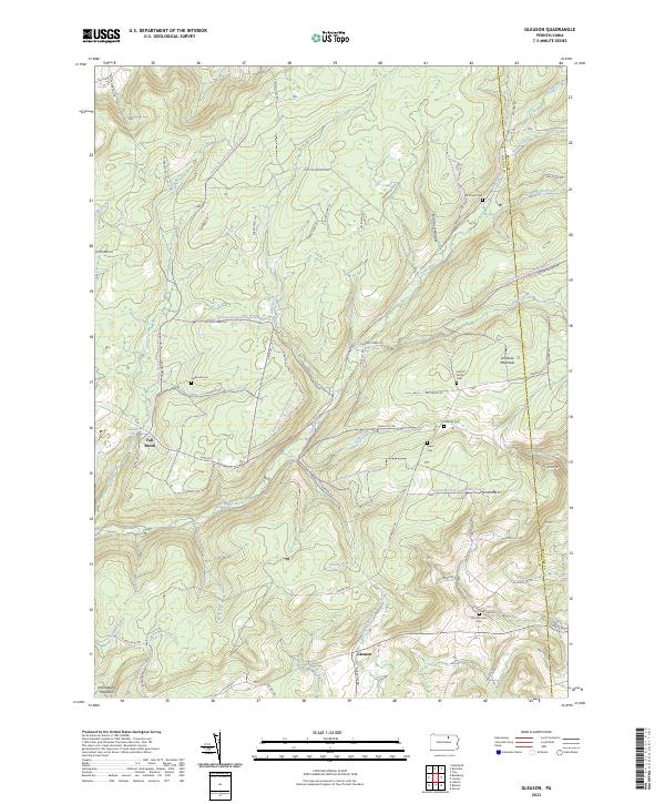 2023 Gleason2023 Print · USGSTioga County is captured in this contemporary survey of the high plateaus and creek valleys along the Bradford County border. Genealogists and local historians can trace family roots through several small burial grounds like North Union Cem, Segur Cem, and Fallbrook Cem.
 - 2023 Map of Ralston, 2023 Print
 2023 Ralston2023 Print · USGSNorthern Lycoming County settlements follow the path of Lycoming Creek in this contemporary survey of the Pennsylvania mountains. Genealogists can locate numerous burial sites such as Ralston Cem, Mcintyre Cem, and Newelltown Cem.
 - 2023 Map of Millerton, 2023 Print
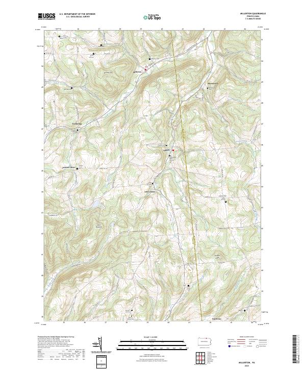 2023 Millerton2023 Print · USGSThe northern Pennsylvania borderlands come into focus in this contemporary survey of the high country between Tioga and Bradford counties. Genealogists can trace family legacies at the Old Daggett Burial Ground, Harris Family Cem, and the small settlement of Jobs Corners.
 - 2023 Map of Keeneyville, 2023 Print
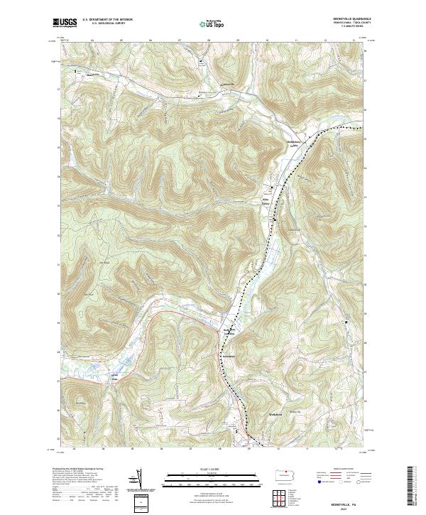 2023 Keeneyville2023 Print · USGSTioga County's valley corridors and plateau heights are documented here in the early twenty-first century, centered on the historic Wellsboro Junction. Researchers can trace old family burial sites like Catlin Hollow Cem and the route of the Pine Creek Rail Trl as it winds toward Stokesdale.
 - 2023 Map of Liberty, 2023 Print
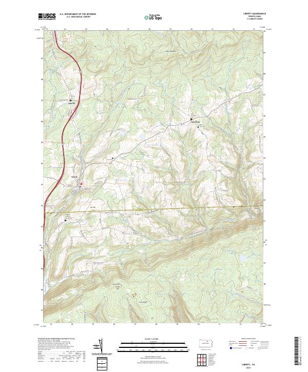 2023 Liberty2023 Print · USGSThe borderlands of Tioga and Lycoming counties remain a rugged rural landscape in the twenty-first century. Genealogists and local researchers can trace family lines through numerous sites like Friedens Lutheran Church Cem, Jew Hill, and the small community of East Point.
 - 2023 Map of Nauvoo, 2023 Print
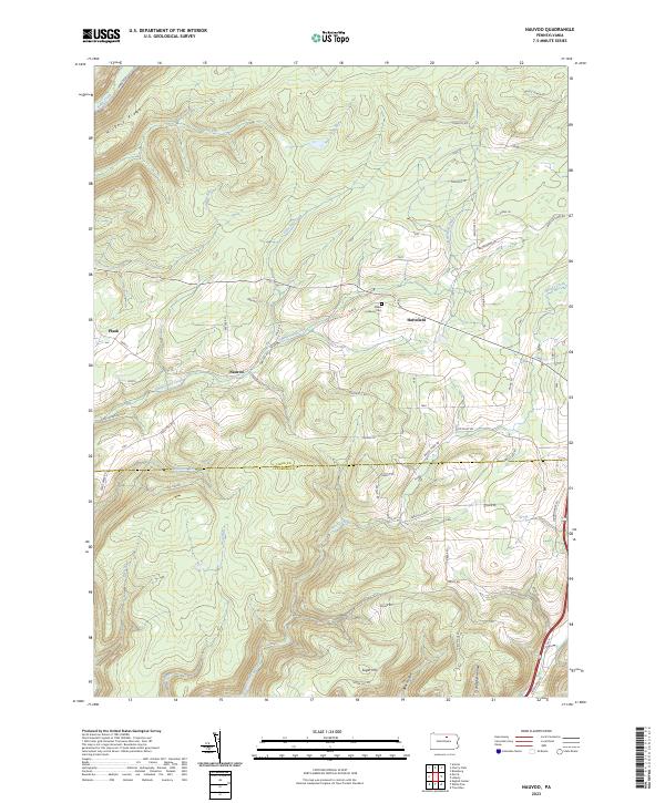 2023 Nauvoo2023 Print · USGSSettlements in the Tioga and Lycoming county borderlands are shown here in modern detail, illustrating a landscape of high ridges and deep hollows. Researchers can trace family sites near Nauvoo, locate the Salem Lutheran Cem, and follow the drainages of Zimmerman Creek and Blacks Creek.
 - 2023 Map of Knoxville, 2023 Print
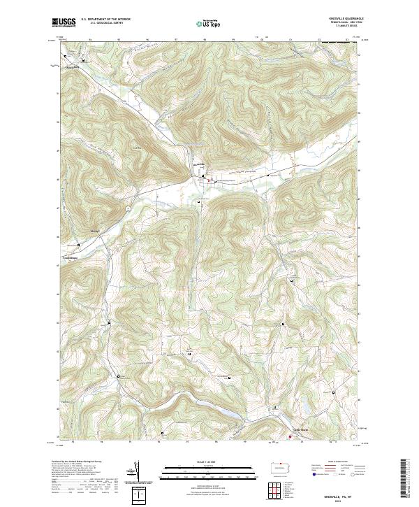 2023 Knoxville2023 Print · USGSKnoxville and the Cowanesque River valley are depicted here in contemporary detail, showing the integration of small settlements within a landscape of steep hollows. Researchers can trace family history through numerous rural burial sites like Quaker Burying Ground and Old Shellman Cem.
 - 2023 Map of Sabinsville, 2023 Print
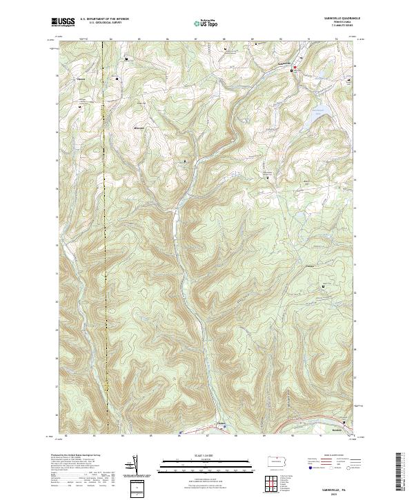 2023 Sabinsville2023 Print · USGSUpper Tioga County and the Potter County line are shown here in modern detail, preserving the locations of many early family burial sites. Genealogists can trace family names at the Rushmore Family Burial Ground, Skinner Cem, and Larrison Cem near Sabinsville.
 - 2023 Map of Cedar Run, 2023 Print
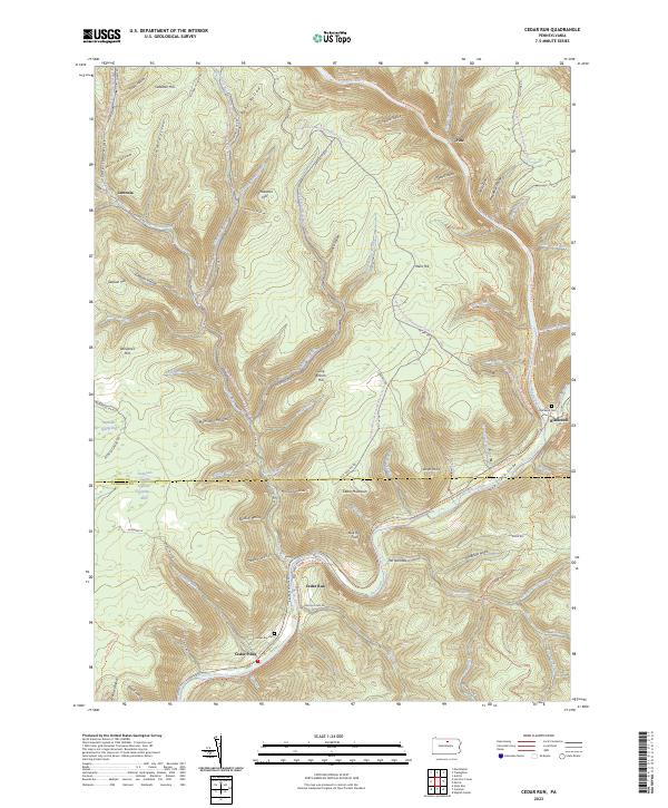 2023 Cedar Run2023 Print · USGSTioga and Lycoming Counties are shown here in the 2020s, centered on the dramatic incision of the Pine Creek Gorge. Modern researchers can trace the historic village sites of Cedar Run and Leetonia alongside the expansive Pine Creek Rail Trl.
 - 2023 Map of Morris, 2023 Print
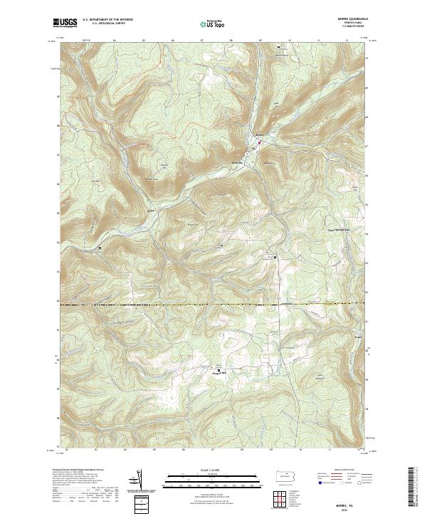 2023 Morris2023 Print · USGSTioga County highlands meet the Lycoming border in the early 2020s, showing the enduring valley settlements along Babb Creek. Genealogists can trace family footprints at Antrim Cem, Mount Pleasant Cem, and the historic crossroads of Oregon Hill.
 - 2023 Map of Elkland, 2023 Print
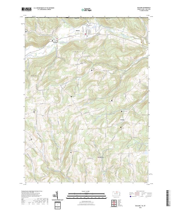 2023 Elkland2023 Print · USGSNorthern Tioga County settlement centers on the Cowanesque River valley in this contemporary survey of the Pennsylvania-New York borderlands. Genealogists and researchers can trace lineage through numerous rural burial sites like Highland Cem and the Peters Cem.
 - 2023 Map of Lee Fire Tower, 2023 Print
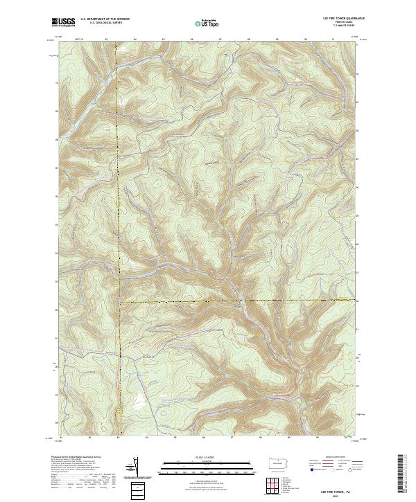 2023 Lee Fire Tower2023 Print · USGSNorthern Pennsylvania’s high forest country is captured here where three counties meet. Trace historic industrial paths through Gas Well Hollow, follow the winding Slate Run Rd, or locate the remote crossing at Francis-Leetonia.
 - 2023 Map of Potter Brook, 2023 Print
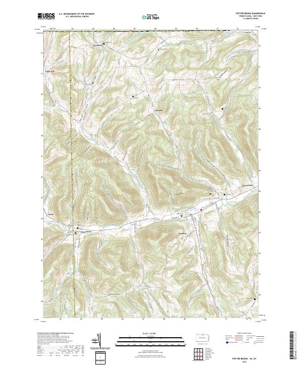 2023 Potter Brook2023 Print · USGSThe Cowanesque River valley in Tioga County serves as a focal point for this contemporary survey of northern Pennsylvania. Researchers can pinpoint historic family plots like Potter Brook Cem and trace the winding paths of Crance Brook and Teed Hollow.
 - 2023 Map of Cherry Flats, 2023 Print
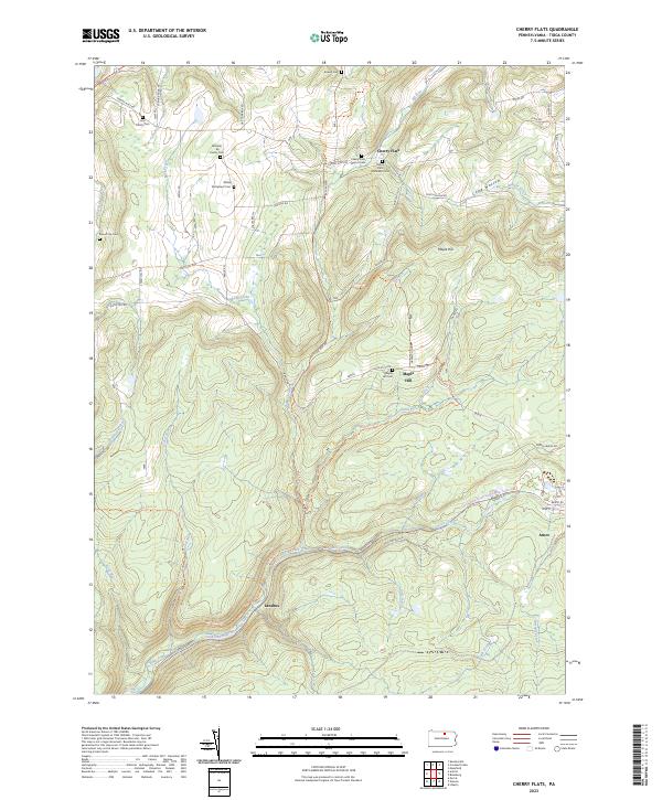 2023 Cherry Flats2023 Print · USGSTioga County's timbered valleys and old settlements are shown here as they appear today, preserving the footprint of early Pennsylvania residents. Researchers can trace family history at the Welsh Settlement Cem, Cherry Flats, or the remote Round Top Cem.
 - 2023 Map of Marshlands, 2023 Print
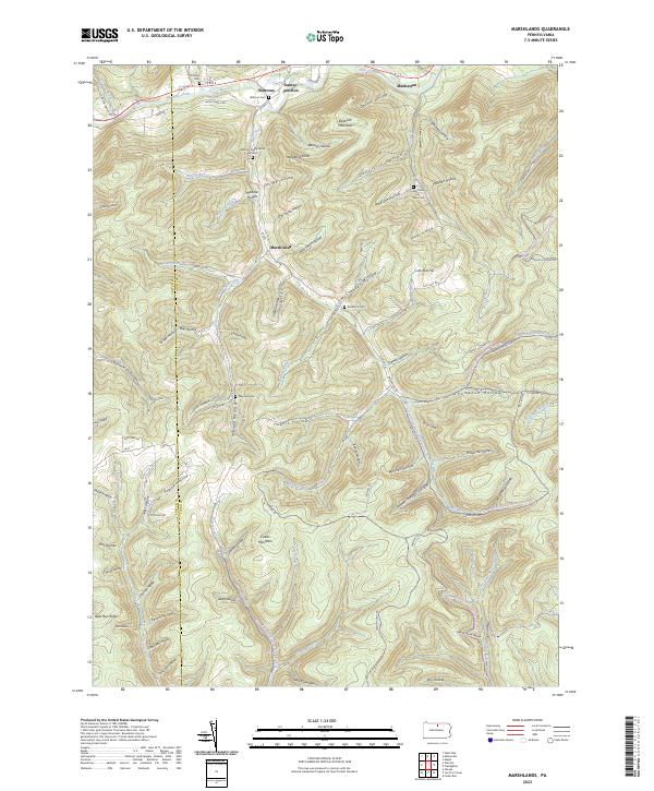 2023 Marshlands2023 Print · USGSThe northern valleys of Tioga County appear here just as modern forestry and recreation patterns have matured. You can trace early family sites at the Watrous Family Burial Ground and find small settlements like Marshlands and Gaines Junction along the creek.
 - 2023 Map of Jackson Summit, 2023 Print
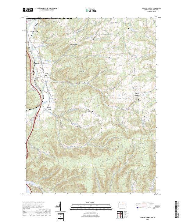 2023 Jackson Summit2023 Print · USGSTioga County's southern borderlands come to life in this detailed view of the Tioga River valley and the Appalachian Throughway. Researchers can trace family history through several rural burial grounds like Maple Ridge Cem and Tower Hill Cem, or explore the old rail-and-road junctions at Tioga Junction and Lawrenceville.
 - 2023 Map of Grover, 2023 Print
 2023 Grover2023 Print · USGSThe high ridges of Lycoming and Bradford Counties come alive in this recent survey of the Endless Mountains region. Researchers can trace family history at Rutty Cem or explore the mountain hamlets of Grover and Ellenton along the Old Railroad Grade Rd.
 - 2023 Map of Roseville, 2023 Print
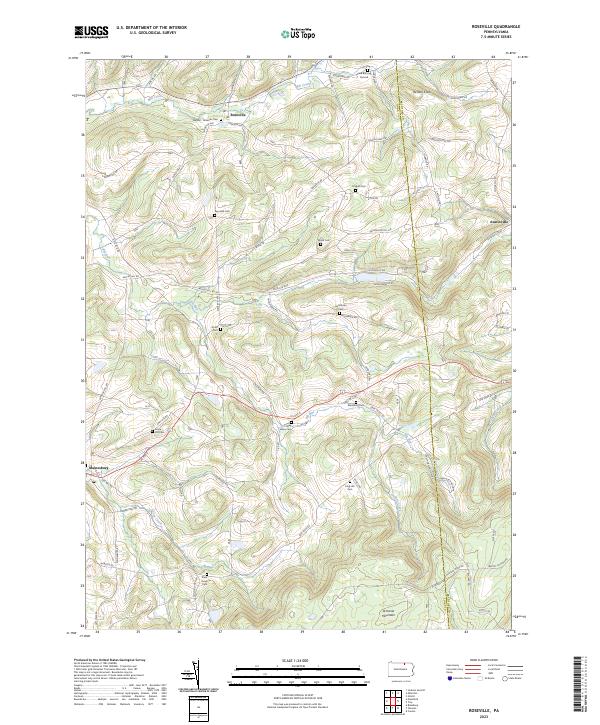 2023 Roseville2023 Print · USGSRoseville and the surrounding Tioga County highlands are captured here in the early twenty-first century. Genealogists can locate family burial sites like Clark Burying Ground, Reynolds Cem, and State Road Cem.
 - 2023 Map of Tioga, 2023 Print
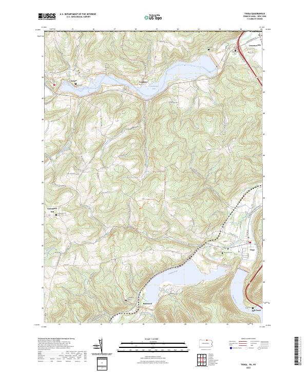 2023 Tioga2023 Print · USGSNorthern Pennsylvania’s river valleys and flood control projects are documented here in the early twenty-first century. Researchers can trace family history at Evergreen Cem and Nelson Cem or follow the Railroad Grade Trail near Hammond.
 - 2023 Map of Blossburg, 2023 Print
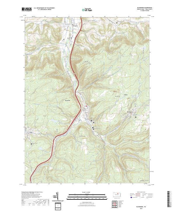 2023 Blossburg2023 Print · USGSTioga County's coal-country settlements are captured here in the contemporary era. Researchers can trace family history through a dense network of local burial sites like Gray Cem, Morris Run Cem, and the Saint Josephs Cem.
 - 2023 Map of Asaph, 2023 Print
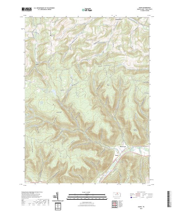 2023 Asaph2023 Print · USGSTioga County's southern ridges and deep hollows are documented here in 2023, showcasing the rural landscapes near the New York border. Genealogists can locate the Lovell Short Farm Cem and trace old family routes near Asaph and Little Marsh.
 - 2023 Map of Mansfield, 2023 Print
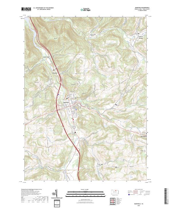 2023 Mansfield2023 Print · USGSTioga County's river valleys and university grounds are captured here in the early twenty-first century. Genealogists and local historians can locate numerous small burial sites like Clark Cem and Ripley Cem or trace the early paths of Corey Creek and Painter Run.
 - 2023 Map of Crooked Creek, 2023 Print
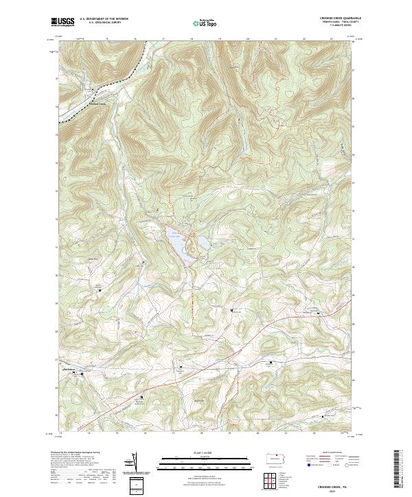 2023 Crooked Creek2023 Print · USGSTioga County's highland valleys and rural cemeteries are well-preserved in this modern survey of the region. Genealogists can locate numerous burial sites like Bullock Cem and Hills Creek Cem, or trace the path of the Mid State Trl.
 - 2023 Map of Antrim, 2023 Print
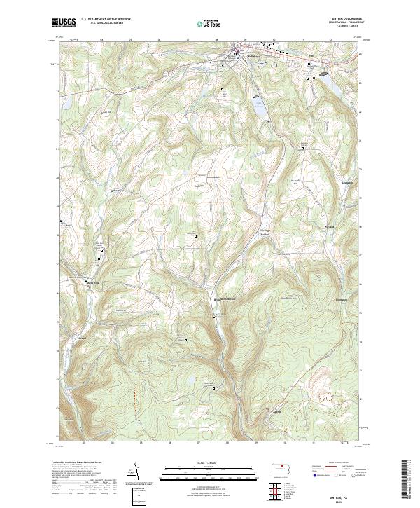 2023 Antrim2023 Print · USGSTioga County settlement and rural family history are preserved in this modern survey of the hills surrounding Wellsboro. Researchers can locate numerous family burial sites including the Knapp Family Burial Ground and Brill Family Cem alongside the historic Stony Fork community.
 - 2023 Map of Tiadaghton, 2023 Print
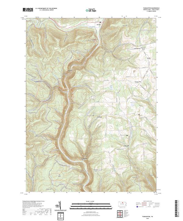 2023 Tiadaghton2023 Print · USGSTioga County's dramatic river terrain is captured here in the 2020s, centering on the canyon country and old crossroads. Local historians can trace the Pine Creek Rail Trl and locate family burial grounds like Kennedy Cem and Bartle Cem.
Showing maps 1-25 of 28
Top cities of Tioga County
- Mansfield historical maps
- Wellsboro historical maps
- Elkland historical maps
- Blossburg historical maps
- Westfield historical maps
- Osceola Township historical maps
See more
Frequently asked questions
- What are the different types of historical maps available for Tioga County?
- What is the oldest map of Tioga County?
- Where can I purchase historical maps of Tioga County for my home or office?
- Where can I download high-res historical maps of Tioga County?
- Are there historical topographic maps available for Tioga County?
- Is there historical aerial imagery available for Tioga County?
- Where are historical maps of Tioga County sourced from?