Old Maps of Ansonia, Shippen Township for Metal Detecting
Plan your next treasure hunt with 16 historic maps of Ansonia. Find old homesites, ghost towns, trails, and gathering spots that may be lost to time — perfect for identifying promising metal detecting locations.
- Locate forgotten sites: Uncover places like long-lost settlements, abandoned rail lines, or gathering spots.
- Plan better hunts: Use map overlays combined with LiDAR or satellite views to narrow in on historically rich areas.
- Made for detectorists: Thousands of hobbyists use these maps to discover relics, coins, and hidden history.
Use these historic maps to boost your research and find new opportunities beneath the surface of Ansonia.
Ansonia, Shippen Township maps
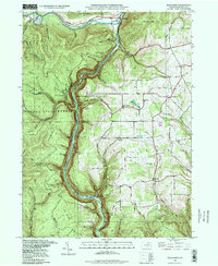
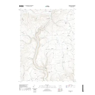
(16)- 1946 Map of Tiadaghton
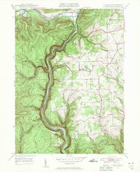 1946 Tiadaghton1946 Print · USGSTioga County's dramatic canyon country is captured here in the mid-1940s, showing the intersection of industry and rural life. Researchers can trace the New York Central line through Pine Creek Gorge or locate family landmarks like Olmsville Cem and the Middle Ridge Ch.5 unique versions available
 - 1946 Map of Antrim, 1952 Print
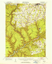 1946 Antrim1952 Print · USGSTioga County in the years following World War II is defined by the deep carving of Pine Creek Gorge and a network of mountain railroads. Genealogists can trace family roots through remote sites like Antrim Cem, Heise Run Sch, and the Cedar Run Ch.2 unique versions available
 - 1948 Map of Tiadaghton
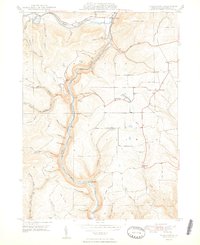 1948 Tiadaghton1948 Print · USGSThe Pennsylvania Grand Canyon region is captured here in the late 1940s, showing the vital rail links through Pine Creek Gorge. Trace family roots at West Branch Cem and explore old rail stops at Owasssee and Tiadaghton.2 unique versions available
 - 1954 Map of Williamsport
 1954 Williamsport1954 Print · USGSNorth-central Pennsylvania in the mid-fifties is defined by the winding West Branch Susquehanna River and its industrial valley. Local historians can trace the massive Susquehanna Ordnance Depot and the extensive rail networks of the Pennsylvania Railroad.
 - 1960 Map of Williamsport
 1960 Williamsport1960 Print · USGSNorth-central Pennsylvania in the mid-twentieth century was a vital corridor of rail and river industry stretching from the New York line to the coal regions. Genealogists can trace the rail networks of the Pennsylvania RR and Lehigh Valley RR connecting towns like Williamsport, Towanda, and Lock Haven.
 - 1962 Map of Williamsport, 1966 Print
 1962 Williamsport1966 Print · USGSNorth-central Pennsylvania was a landscape of industrial river hubs and vast state woodlands in the early sixties. Researchers can trace the path of the Pennsylvania Railroad through Williamsport and explore the remote reaches of Bucktail State Park.5 unique versions available
 - 1965 Map of Williamsport
 1965 Williamsport1965 Print · USGSNorth-central Pennsylvania in the mid-1960s is defined by the industrial river towns and vast timberlands of the Allegheny Plateau. Researchers can trace historic rail lines like the Erie Lackawanna and Reading as they thread through Williamsport, Lock Haven, and Jersey Shore.
 - 1966 Map of Williamsport
 1966 Williamsport1966 Print · USGSThe Susquehanna Valley was a hub of transit and industry in the mid-seventies, where the river's West Branch connected major college towns and timberlands. Researchers can trace historical rail lines like the Reading or locate regional landmarks from Jersey Shore to Ricketts Glen State Park.
 - 1977 Map of Tiadaghton, 1979 Print
 1977 Tiadaghton1979 Print · USGSThe Pine Creek gorge and the agricultural uplands of Tioga County are captured in this late-1970s aerial survey. Researchers can trace rural property lines and the layouts of small settlements such as Dexter, Kennedy, and Olmsville.
 - 1981 Map of Wellsboro, 1982 Print
 1981 Wellsboro1982 Print · USGSNorthern Pennsylvania in the early eighties shows a landscape of deep river gorges and vast state forests. Trace the rail lines of Conrail and explore old settlements from Coudersport to the Pine Creek Gorge.
 - 1994 Map of Tiadaghton, 1998 Print
 1994 Tiadaghton1998 Print · USGSTioga County's breathtaking canyon country comes into focus in the mid-nineties, showing the intersection of state park conservation and rural plateau life. Genealogists and hikers can trace old landmarks such as Middle Ridge Church, West Branch Cemetery, and the dramatic overlooks at Barbour Rock.
 - 2010 Map of Tiadaghton, 2010 Print
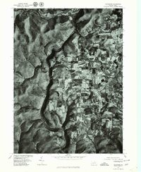
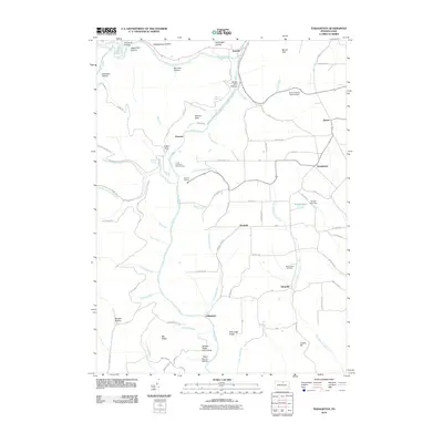 2010 Tiadaghton2010 Print · USGSCovers Ansonia, including Morris Township, Gaines Township, and other nearby areas
 - 2013 Map of Tiadaghton, 2013 Print
 2013 Tiadaghton2013 Print · USGSCovers Ansonia, including Morris Township, Gaines Township, and other nearby areas
 - 2016 Map of Tiadaghton, 2016 Print
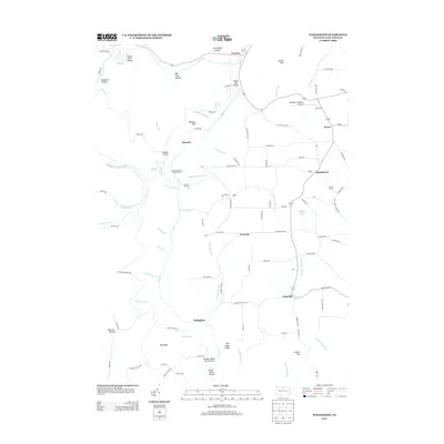
 2016 Tiadaghton2016 Print · USGSCovers Ansonia, including Morris Township, Gaines Township, and other nearby areas
 - 2019 Map of Tiadaghton, 2019 Print
 2019 Tiadaghton2019 Print · USGSCovers Ansonia, including Morris Township, Gaines Township, and other nearby areas
 - 2023 Map of Tiadaghton, 2023 Print
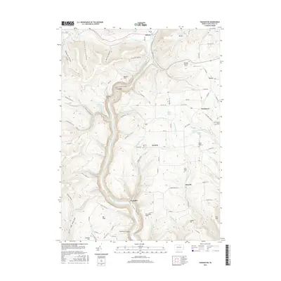
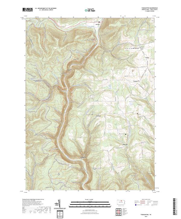 2023 Tiadaghton2023 Print · USGSTioga County's dramatic river terrain is captured here in the 2020s, centering on the canyon country and old crossroads. Local historians can trace the Pine Creek Rail Trl and locate family burial grounds like Kennedy Cem and Bartle Cem.
End of results
Showing maps 1-16 of 16
Top cities near Ansonia
- Wellsboro historical maps
- Galeton historical maps
- Westfield historical maps
- Harrison Township historical maps
- Osceola Township historical maps
- Morris Township historical maps
See more
Frequently asked questions
- What are the different types of historical maps available for Ansonia?
- What is the oldest map of Ansonia?
- Where can I purchase historical maps of Ansonia for my home or office?
- Where can I download high-res historical maps of Ansonia?
- Are there historical topographic maps available for Ansonia?
- Is there historical aerial imagery available for Ansonia?
- Where are historical maps of Ansonia sourced from?