Old Maps of Sullivan Township, Pennsylvania for Hiking & Exploration
Hike through history with 25 historic maps of Sullivan Township. Explore old trails, ghost towns, and forgotten backroads — perfect for outdoor adventurers and local explorers.
- Rediscover forgotten places: Map out old mining camps, roads, and footpaths that no longer exist on modern maps.
- Layer with modern tools: Combine with LiDAR or satellite views to plan hikes through historical terrain.
- Made for exploration: Popular among hikers, overlanders, and local history lovers.
Use these maps to find adventure and explore the hidden past of Sullivan Township.
Sullivan Township, PA maps
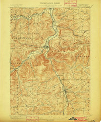
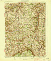
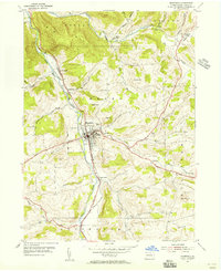
(25)- 1900 Map of Tioga
 1900 Tioga1900 Print · USGSTioga County at the turn of the century shows a landscape defined by the busy river corridors and the arrival of major rail networks. Researchers can trace the early footprints of Lawrenceville, Mansfield, and Tioga, or locate rural landmarks like Jackson Summit and Canoe Camp.
 - 1902 Map of Tioga
 1902 Tioga1902 Print · USGSNorthern Tioga County at the turn of the century shows a landscape dominated by the convergence of major rail lines and river valleys. Genealogists can trace family roots in riverside settlements like Canoe Camp or explore vanished rail stops like Tompkins and Hammond.5 unique versions available
 - 1925 Map of Blossburg, 1958 Print
 1925 Blossburg1958 Print · USGSTioga County’s coal and timber country is captured here during the 1920s, when the Tioga River and Erie R R drove the local economy. Researchers can locate dozens of country schoolhouses, rural churches like Burt Church, and early industrial sites such as Blacks Mill.2 unique versions available
 - 1927 Map of Blossburg
 1927 Blossburg1927 Print · USGSTioga County's coal country and rural townships are captured here in the mid-1920s, showing the height of the mountain rail and mining era. Genealogists can locate family-named sites like Blacks Mill, Hart Church, and vanished schoolhouses such as Culver School.4 unique versions available
 - 1931 Map of Troy
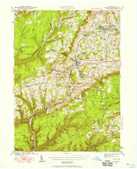
 1931 Troy1931 Print · USGSBradford County’s northern valleys and high ridges appear here in the early 1930s, showing a landscape of small hamlets and cross-country rail lines. Genealogists can locate family landmarks such as Besley Cem, Mitchells Mill, and early schools like Doty Hill Sch.2 unique versions available
 - 1938 Map of Troy
 1938 Troy1938 Print · USGSNorthern Bradford and Tioga Counties are captured here in the late 1930s, showing a landscape of upland farms and railroad hamlets. Genealogists can trace family footprints at Roseville Rutland PO, the Armenia Ch, or the Besley Cem.3 unique versions available
 - 1942 Map of Canton, 1958 Print
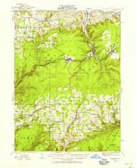
 1942 Canton1958 Print · USGSCanton and the surrounding Bradford County highlands are shown here in the early 1940s as a landscape of small valley towns and mountain schools. Genealogists and historians can trace old homesteads and local landmarks like Minnequa, Cowley Sta, and Ward Sch.2 unique versions available
 - 1944 Map of Blossburg
 1944 Blossburg1944 Print · USGSTioga County during the mid-1940s reveals a landscape of industrial coal towns and remote ridge-top schoolhouses. Genealogists and historians can trace family roots through numerous local landmarks, including Blacks Mill, the Erie Railroad, and several rural sites like Nauvoo or Beuter School.
 - 1944 Map of Canton
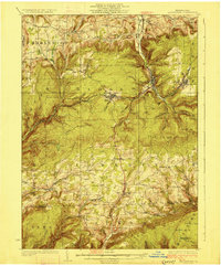
 1944 Canton1944 Print · USGSNorth-central Pennsylvania’s rugged creek valleys and rail corridors are captured here just as the mountain economies were shifting in the early 1940s. Genealogists can trace family footprints at Spencertown and Dogtown, or locate rural landmarks like the Joe Hill Sch and Maple Summit Ch.3 unique versions available
 - 1953 Map of Roseville, 1954 Print
 1953 Roseville1954 Print · USGSTioga and Bradford counties are captured here in the early 1950s, showing a landscape defined by upland farms and quiet crossroads. Researchers can trace ancestral roots at State Road Ch, find early settlements like Austinville, or follow the path of the Roosevelt Highway.2 unique versions available
 - 1954 Map of Williamsport
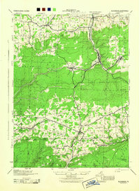
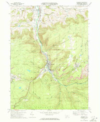
 1954 Williamsport1954 Print · USGSNorth-central Pennsylvania in the mid-fifties is defined by the winding West Branch Susquehanna River and its industrial valley. Local historians can trace the massive Susquehanna Ordnance Depot and the extensive rail networks of the Pennsylvania Railroad.
 - 1954 Map of Mansfield, 1956 Print
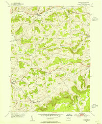
 1954 Mansfield1956 Print · USGSMansfield and the Tioga River valley are captured in the mid-1950s as a hub of education and transport. Researchers can locate the State Teachers College, the path of the Erie RR, and numerous rural burial sites like Oakwood Cem and Whittaker Cem.5 unique versions available
 - 1960 Map of Williamsport
 1960 Williamsport1960 Print · USGSNorth-central Pennsylvania in the mid-twentieth century was a vital corridor of rail and river industry stretching from the New York line to the coal regions. Genealogists can trace the rail networks of the Pennsylvania RR and Lehigh Valley RR connecting towns like Williamsport, Towanda, and Lock Haven.
 - 1962 Map of Williamsport, 1966 Print
 1962 Williamsport1966 Print · USGSNorth-central Pennsylvania was a landscape of industrial river hubs and vast state woodlands in the early sixties. Researchers can trace the path of the Pennsylvania Railroad through Williamsport and explore the remote reaches of Bucktail State Park.5 unique versions available
 - 1965 Map of Williamsport
 1965 Williamsport1965 Print · USGSNorth-central Pennsylvania in the mid-1960s is defined by the industrial river towns and vast timberlands of the Allegheny Plateau. Researchers can trace historic rail lines like the Erie Lackawanna and Reading as they thread through Williamsport, Lock Haven, and Jersey Shore.
 - 1966 Map of Williamsport
 1966 Williamsport1966 Print · USGSThe Susquehanna Valley was a hub of transit and industry in the mid-seventies, where the river's West Branch connected major college towns and timberlands. Researchers can trace historical rail lines like the Reading or locate regional landmarks from Jersey Shore to Ricketts Glen State Park.
 - 1970 Map of Blossburg, 1972 Print
 1970 Blossburg1972 Print · USGSTioga County's coal and rail heritage is on full display in the early 1970s as the Erie Lackawanna winds through the river valley. Researchers can trace the layout of mining towns like Arnot and Morris Run or locate family sites at Frost Settlement Cem and Union Cem.4 unique versions available
 - 1970 Map of Gleason, 1972 Print
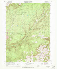 1970 Gleason1972 Print · USGSThe northern Pennsylvania highlands near the Tioga and Bradford County line are captured here in the early 1970s. Local researchers can trace family landmarks like Gleason and Allen, or locate the North Union Cem and the nearby North Union Ch.4 unique versions available
 - 1981 Map of Towanda, 1982 Print
 1981 Towanda1982 Print · USGSThe Susquehanna Valley at the turn of the 1980s reveals a region of mountain forests and busy river towns along the New York border. Researchers can trace the legacy of the CONRAIL lines through Sayre or locate remote landmarks like Armenia Mountain and Mt Pisgah State Park.
 - 1981 Map of Wellsboro, 1982 Print
 1981 Wellsboro1982 Print · USGSNorthern Pennsylvania in the early eighties shows a landscape of deep river gorges and vast state forests. Trace the rail lines of Conrail and explore old settlements from Coudersport to the Pine Creek Gorge.
 - 1999 Map of Mansfield, 2001 Print
 1999 Mansfield2001 Print · USGSNorthern Tioga County's river valley comes to life at the turn of the millennium, centered on the growing borough of Mansfield. Genealogists can trace family plots at Oakwood Cem and Mainesburg Cem or explore the Mansfield University campus.
 - 2023 Map of Gleason, 2023 Print
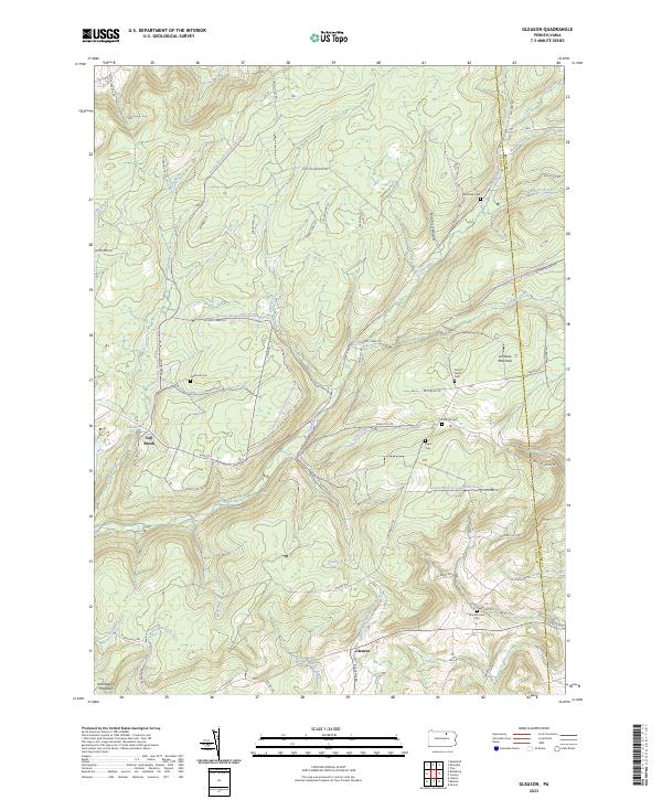 2023 Gleason2023 Print · USGSTioga County is captured in this contemporary survey of the high plateaus and creek valleys along the Bradford County border. Genealogists and local historians can trace family roots through several small burial grounds like North Union Cem, Segur Cem, and Fallbrook Cem.
 - 2023 Map of Roseville, 2023 Print
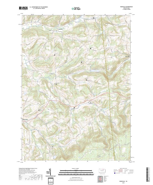 2023 Roseville2023 Print · USGSRoseville and the surrounding Tioga County highlands are captured here in the early twenty-first century. Genealogists can locate family burial sites like Clark Burying Ground, Reynolds Cem, and State Road Cem.
 - 2023 Map of Blossburg, 2023 Print
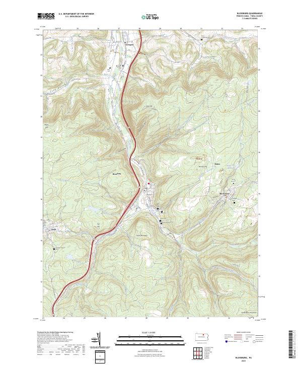 2023 Blossburg2023 Print · USGSTioga County's coal-country settlements are captured here in the contemporary era. Researchers can trace family history through a dense network of local burial sites like Gray Cem, Morris Run Cem, and the Saint Josephs Cem.
 - 2023 Map of Mansfield, 2023 Print
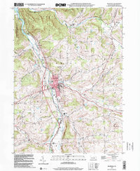
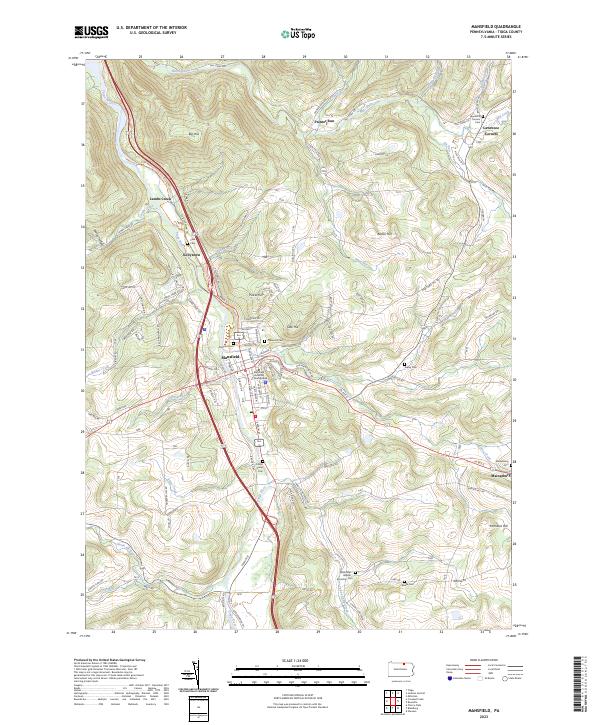 2023 Mansfield2023 Print · USGSTioga County's river valleys and university grounds are captured here in the early twenty-first century. Genealogists and local historians can locate numerous small burial sites like Clark Cem and Ripley Cem or trace the early paths of Corey Creek and Painter Run.
End of results
Showing maps 1-25 of 25
Top cities near Sullivan Township
- Southport historical maps
- Mansfield historical maps
- Caton historical maps
- Lindley historical maps
- Canton historical maps
- Ashland historical maps
See more
Top neighborhoods of Sullivan Township
Frequently asked questions
- What are the different types of historical maps available for Sullivan Township?
- What is the oldest map of Sullivan Township?
- Where can I purchase historical maps of Sullivan Township for my home or office?
- Where can I download high-res historical maps of Sullivan Township?
- Are there historical topographic maps available for Sullivan Township?
- Is there historical aerial imagery available for Sullivan Township?
- Where are historical maps of Sullivan Township sourced from?