Old Maps of Union County, Pennsylvania for Metal Detecting
Plan your next treasure hunt with 113 historic maps of Union County. Find old homesites, ghost towns, trails, and gathering spots that may be lost to time — perfect for identifying promising metal detecting locations.
- Locate forgotten sites: Uncover places like long-lost settlements, abandoned rail lines, or gathering spots.
- Plan better hunts: Use map overlays combined with LiDAR or satellite views to narrow in on historically rich areas.
- Made for detectorists: Thousands of hobbyists use these maps to discover relics, coins, and hidden history.
Use these historic maps to boost your research and find new opportunities beneath the surface of Union County.
Union County, PA maps
(113)- 1893 Map of Sunbury
 1893 Sunbury1893 Print · USGSThe Susquehanna River forks define this late nineteenth-century Pennsylvania landscape during a peak era of rail and canal competition. Researchers can trace historic riverfronts at Sunbury and Northumberland or find old family footprints in Selins Grove, Mazeppa, and Freeburg.6 unique versions available
 - 1921 Map of Williamsport
 1921 Williamsport1921 Print · USGSWilliamsport and the West Branch Susquehanna valley are captured here in the early 1920s, showing a landscape defined by rail corridors and steep mountain ridges. Genealogists can locate family-named schools and social landmarks like the Morgan Valley School, Nippono Park, and Shakespeare Club.
 - 1923 Map of Williamsport
 1923 Williamsport1923 Print · USGSWilliamsport and the Susquehanna riverfront are captured here in the early twenties, showing a region defined by industrial rail lines and steep ridges. You can trace the path of the Pennsylvania Canal (Abandoned) or locate rural landmarks like Nippono Park and the Captain Greene Monument.6 unique versions available
 - 1924 Map of Milton
 1924 Milton1924 Print · USGSNorthumberland and Lycoming counties thrived along the river during the 1920s, dominated by a dense network of mountain ridges and rail corridors. Genealogists can locate dozens of rural landmarks, from the Old Furnace to the Stone Church and Pioneer School.4 unique versions available
 - 1937 Map of Millheim
 1937 Millheim1937 Print · USGSThe Seven Mountains region of central Pennsylvania is shown here in the late thirties, when rural valleys were tied together by narrow gaps. Researchers can locate family landmarks like Wolfs Chapel, Lose Sch, and vanished stopovers such as Wolfs Store.
 - 1938 Map of Mifflinburg
 1938 Mifflinburg1938 Print · USGSCentral Pennsylvania valleys and ridges are captured here in the late thirties, showing the rural networks of Union and Snyder counties. Genealogists can trace family roots through numerous local schools like Gilbert Sch and settlements such as Troxelville or White Springs.
 - 1941 Map of Millheim
 1941 Millheim1941 Print · USGSCentral Pennsylvania's ridge-and-valley landscape is documented here just before the mid-century, showing a network of mountain gaps and small valley settlements. Researchers can locate family landmarks like Wolfs Chapel, the Hironimus Sch, and the BM Sawmill along the banks of Penns Creek.3 unique versions available
 - 1943 Map of Sunbury
 1943 Sunbury1943 Print · USGSDuring the mid-1940s, the Susquehanna River valley functioned as a vital corridor for both higher education and heavy industry. Genealogists can trace family roots through numerous country schools like Ulrich School and landmarks such as Hummels Wharf or the Isle of Que.
 - 1943 Map of Mifflinburg
 1943 Mifflinburg1943 Print · USGSUnion and Snyder County communities are captured here in the years preceding World War II, revealing a landscape of ridge-top forests and valley farms. Genealogists can trace family roots through numerous country landmarks like Moyers Mill, Church of the Brethren, and the Lewis Cemetery.
 - 1944 Map of Williamsport
 1944 Williamsport1944 Print · USGSThe West Branch Susquehanna River valley was a bustling corridor of industry and agriculture during the mid-forties. Researchers can trace the Pennsylvania RR through Linden Station or find rural schools like Riedy School and the Captain Greene Monument.
 - 1950 Map of Harrisburg, 1952 Print
 1950 Harrisburg1952 Print · USGSMid-century Central Pennsylvania comes alive through its dense rail networks and river valley settlements during the post-war industrial era. Genealogists and historians can trace family roots through hubs like Harrisburg, locate Carlisle Barracks, or follow the Pennsylvania RR through the Lebanon Valley.
 - 1953 Map of Mifflinburg, 1955 Print
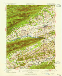 1953 Mifflinburg1955 Print · USGSIn the early fifties, the Union and Snyder county border reveals a landscape of ridge-top forests and valley towns. Genealogists can trace family names at Long Cem or Salem Ch and explore settlements like Mifflinburg and Middleburg.2 unique versions available
 - 1953 Map of Sunbury, 1956 Print
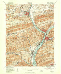 1953 Sunbury1956 Print · USGSThe Susquehanna River Valley in the early fifties shows a bustling corridor of rail, industry, and academia. Genealogists can trace family names at Stoltzfus Cem, explore the grounds of Bucknell University, or locate the historic Joseph Priestley Home.3 unique versions available
 - 1953 Map of Williamsport, 1956 Print
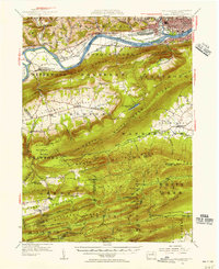 1953 Williamsport1956 Print · USGSThe West Branch Susquehanna River corridor is shown in the early 1950s as a hub of rail and river industry. Genealogists can locate family landmarks from Nippono Park to Elimsport, alongside remote features like the Rauchtown Fire Tower.3 unique versions available
 - 1953 Map of Milton, 1956 Print
 1953 Milton1956 Print · USGSThe Susquehanna Valley thrives during the early fifties, defined by its river-town industries and coal-hauling rail lines. Genealogists can trace family names through country landmarks like Stone Church, Old Furnace, and the U S Military Reservation.2 unique versions available
 - 1954 Map of Williamsport
 1954 Williamsport1954 Print · USGSNorth-central Pennsylvania in the mid-fifties is defined by the winding West Branch Susquehanna River and its industrial valley. Local historians can trace the massive Susquehanna Ordnance Depot and the extensive rail networks of the Pennsylvania Railroad.
 - 1957 Map of Harrisburg
 1957 Harrisburg1957 Print · USGSMid-century Central Pennsylvania comes into focus as a bustling network of rail, river, and mountain ridges. Genealogists and historians can trace the development of the State Capitol and surrounding hubs like Middletown, Columbia, and Pottsville.7 unique versions available
 - 1957 Map of Millheim, 1959 Print
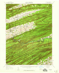 1957 Millheim1959 Print · USGSThe Pennsylvania Ridge-and-Valley landscape comes to life in the late 1950s, showing the intersection of rural agriculture and state forestry. Researchers can trace historic church sites like St Peters Ch or find recreation spots at Poe Valley State Park and Camp Hironimus.3 unique versions available
 - 1960 Map of Williamsport
 1960 Williamsport1960 Print · USGSNorth-central Pennsylvania in the mid-twentieth century was a vital corridor of rail and river industry stretching from the New York line to the coal regions. Genealogists can trace the rail networks of the Pennsylvania RR and Lehigh Valley RR connecting towns like Williamsport, Towanda, and Lock Haven.
 - 1961 Map of Harrisburg
 1961 Harrisburg1961 Print · USGSCentral Pennsylvania is shown at a mid-century peak of industrial and military activity, from the Susquehanna water gaps to the fertile Dutch Country. Genealogists and historians can trace the rail corridors of the Pennsylvania RR and find landmarks like Carlisle Barracks or the Anthracite Coal Fields.2 unique versions available
 - 1962 Map of Williamsport, 1966 Print
 1962 Williamsport1966 Print · USGSNorth-central Pennsylvania was a landscape of industrial river hubs and vast state woodlands in the early sixties. Researchers can trace the path of the Pennsylvania Railroad through Williamsport and explore the remote reaches of Bucktail State Park.5 unique versions available
 - 1964 Map of Harrisburg
 1964 Harrisburg1964 Print · USGSCentral Pennsylvania in the mid-fifties reveals a landscape shaped by ridge-and-valley geology and critical Cold War infrastructure. Researchers can trace the massive Indiantown Gap Military Reservation or the rail corridors of the Pennsylvania RR and Reading RR.
 - 1965 Map of Williamsport
 1965 Williamsport1965 Print · USGSNorth-central Pennsylvania in the mid-1960s is defined by the industrial river towns and vast timberlands of the Allegheny Plateau. Researchers can trace historic rail lines like the Erie Lackawanna and Reading as they thread through Williamsport, Lock Haven, and Jersey Shore.
 - 1965 Map of Mifflinburg, 1966 Print
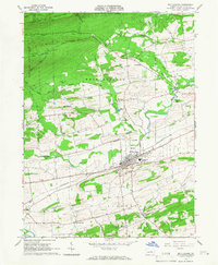 1965 Mifflinburg1966 Print · USGSUnion County during the mid-sixties shows a landscape of productive valleys and forested ridges centered on the town of Mifflinburg. Researchers can trace the Pennsylvania rail corridor and locate rural landmarks like St Peters Ch and the hamlet of Forest Hill.2 unique versions available
 - 1965 Map of Beavertown, 1966 Print
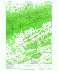 1965 Beavertown1966 Print · USGSSnyder and Union Counties come into focus during the mid-sixties, showcasing a landscape of ridge-and-valley farming and forest. Researchers can locate family landmarks like Cedar Hill Cem, the Covered Bridge at Middle Creek, and the old Messiah Ch.3 unique versions available
Showing maps 1-25 of 113
Top cities of Union County
- Lewisburg historical maps
- White Deer Township historical maps
- Mifflinburg historical maps
- Hartleton historical maps
Frequently asked questions
- What are the different types of historical maps available for Union County?
- What is the oldest map of Union County?
- Where can I purchase historical maps of Union County for my home or office?
- Where can I download high-res historical maps of Union County?
- Are there historical topographic maps available for Union County?
- Is there historical aerial imagery available for Union County?
- Where are historical maps of Union County sourced from?