Old Maps of Union County, Pennsylvania
Explore 47 old maps of Union County, spanning from 1893 to today. These high-resolution historic maps reveal how streets, neighborhoods, landmarks, and natural features evolved over time — perfect for genealogy, metal detecting, research, and local history exploration.
What you can do with these maps:
- See how Union County changed over time: Compare historical maps to modern-day views to trace roads, homesites, rail lines & more.
- View detailed metadata: Each map includes creators, publishers, year, scale, and archive source.
- Overlay maps with satellite & LiDAR: Visualize the past alongside modern tools to explore terrain & human change.
- Trusted historical sources: Maps sourced from the USGS, Library of Congress, and other archives.
- Access maps your way: View online, download high-res files, or order prints for personal or research use.
Start exploring old maps of Union County to uncover forgotten places, hidden landmarks, and the deep history beneath your feet.
Union County, PA maps
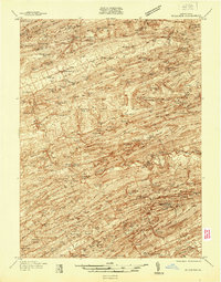
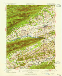
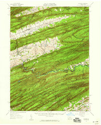
(47)- 1893 Map of Sunbury
 1893 Sunbury1893 Print · USGSCovers Union County, including Sunbury, Lewisburg, and other nearby areas6 unique versions available
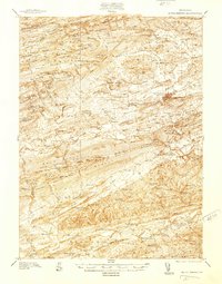
 - 1921 Map of Williamsport
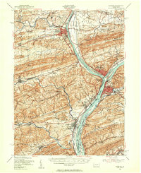
 1921 Williamsport1921 Print · USGSCovers Union County, including Williamsport, White Deer Township, and other nearby areas
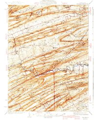
 - 1923 Map of Williamsport
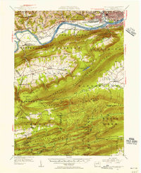
 1923 Williamsport1923 Print · USGSCovers Union County, including Williamsport, White Deer Township, and other nearby areas6 unique versions available
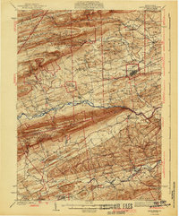
 - 1924 Map of Milton
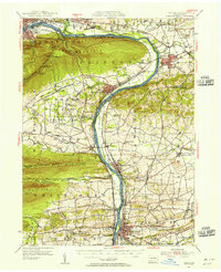
 1924 Milton1924 Print · USGSCovers Union County, including Williamsport, South Williamsport, and other nearby areas4 unique versions available
 - 1937 Map of Millheim
 1937 Millheim1937 Print · USGSCovers Union County, including Decatur Township, Millheim, and other nearby areas
 - 1938 Map of Mifflinburg
 1938 Mifflinburg1938 Print · USGSCovers Union County, including Mifflinburg, Middleburg, and other nearby areas
 - 1941 Map of Millheim
 1941 Millheim1941 Print · USGSCovers Union County, including Decatur Township, Millheim, and other nearby areas3 unique versions available
 - 1943 Map of Sunbury
 1943 Sunbury1943 Print · USGSCovers Union County, including Sunbury, Lewisburg, and other nearby areas
 - 1943 Map of Mifflinburg
 1943 Mifflinburg1943 Print · USGSCovers Union County, including Mifflinburg, Middleburg, and other nearby areas
 - 1944 Map of Williamsport
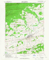
 1944 Williamsport1944 Print · USGSCovers Union County, including Williamsport, White Deer Township, and other nearby areas
 - 1950 Map of Harrisburg, 1952 Print
 1950 Harrisburg1952 Print · USGSCovers Union County, including Lancaster, Harrisburg, and other nearby areas
 - 1953 Map of Mifflinburg, 1955 Print
 1953 Mifflinburg1955 Print · USGSCovers Union County, including Mifflinburg, Middleburg, and other nearby areas2 unique versions available
 - 1953 Map of Sunbury, 1956 Print
 1953 Sunbury1956 Print · USGSCovers Union County, including Sunbury, Lewisburg, and other nearby areas3 unique versions available
 - 1953 Map of Williamsport, 1956 Print
 1953 Williamsport1956 Print · USGSCovers Union County, including Williamsport, White Deer Township, and other nearby areas3 unique versions available
 - 1953 Map of Milton, 1956 Print
 1953 Milton1956 Print · USGSCovers Union County, including Williamsport, South Williamsport, and other nearby areas2 unique versions available
 - 1954 Map of Williamsport
 1954 Williamsport1954 Print · USGSCovers Union County, including Vestal, Williamsport, and other nearby areas
 - 1957 Map of Harrisburg
 1957 Harrisburg1957 Print · USGSCovers Union County, including Lancaster, Harrisburg, and other nearby areas7 unique versions available
 - 1957 Map of Millheim, 1959 Print
 1957 Millheim1959 Print · USGSCovers Union County, including Decatur Township, Millheim, and other nearby areas3 unique versions available
 - 1960 Map of Williamsport
 1960 Williamsport1960 Print · USGSCovers Union County, including Vestal, Williamsport, and other nearby areas
 - 1961 Map of Harrisburg
 1961 Harrisburg1961 Print · USGSCovers Union County, including Lancaster, Harrisburg, and other nearby areas2 unique versions available
 - 1962 Map of Williamsport, 1966 Print
 1962 Williamsport1966 Print · USGSCovers Union County, including Vestal, Williamsport, and other nearby areas5 unique versions available
 - 1964 Map of Harrisburg
 1964 Harrisburg1964 Print · USGSCovers Union County, including Lancaster, Harrisburg, and other nearby areas
 - 1965 Map of Williamsport
 1965 Williamsport1965 Print · USGSCovers Union County, including Vestal, Williamsport, and other nearby areas
 - 1965 Map of Mifflinburg, 1966 Print
 1965 Mifflinburg1966 Print · USGSCovers Union County, including Mifflinburg, Buffalo Township, and other nearby areas2 unique versions available
 - 1965 Map of Beavertown, 1966 Print
 1965 Beavertown1966 Print · USGSCovers Union County, including Beavertown, Lewis Township, and other nearby areas3 unique versions available
Showing maps 1-25 of 47
Top cities of Union County
- Lewisburg historical maps
- White Deer Township historical maps
- Mifflinburg historical maps
- Hartleton historical maps
Frequently asked questions
- What are the different types of historical maps available for Union County?
- What is the oldest map of Union County?
- Where can I purchase historical maps of Union County for my home or office?
- Where can I download high-res historical maps of Union County?
- Are there historical topographic maps available for Union County?
- Is there historical aerial imagery available for Union County?
- Where are historical maps of Union County sourced from?