Old Maps of Warren County, Pennsylvania
Explore 49 old maps of Warren County, spanning from 1906 to today. These high-resolution historic maps reveal how streets, neighborhoods, landmarks, and natural features evolved over time — perfect for genealogy, metal detecting, research, and local history exploration.
What you can do with these maps:
- See how Warren County changed over time: Compare historical maps to modern-day views to trace roads, homesites, rail lines & more.
- View detailed metadata: Each map includes creators, publishers, year, scale, and archive source.
- Overlay maps with satellite & LiDAR: Visualize the past alongside modern tools to explore terrain & human change.
- Trusted historical sources: Maps sourced from the USGS, Library of Congress, and other archives.
- Access maps your way: View online, download high-res files, or order prints for personal or research use.
Start exploring old maps of Warren County to uncover forgotten places, hidden landmarks, and the deep history beneath your feet.
Warren County, PA maps
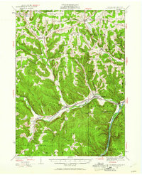
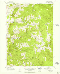
(49)- 1906 Map of Warren
 1906 Warren1906 Print · USGSCovers Warren County, including Warren, Busti, and other nearby areas3 unique versions available
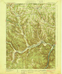
 - 1907 Map of Warren
 1907 Warren1907 Print · USGSCovers Warren County, including Warren, Busti, and other nearby areas
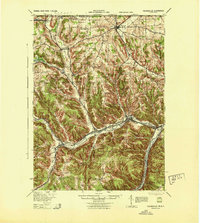
 - 1908 Map of Warren
 1908 Warren1908 Print · USGSCovers Warren County, including Warren, Busti, and other nearby areas3 unique versions available
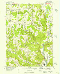
 - 1926 Map of Youngsville, 1961 Print
 1926 Youngsville1961 Print · USGSCovers Warren County, including Busti, Harmony, and other nearby areas
 - 1927 Map of Tidioute
 1927 Tidioute1927 Print · USGSCovers Warren County, including Tidioute, Tionesta, and other nearby areas4 unique versions available
 - 1927 Map of Titusville, 1958 Print
 1927 Titusville1958 Print · USGSCovers Warren County, including Titusville, Cherrytree Township, and other nearby areas3 unique versions available
 - 1929 Map of Corry
 1929 Corry1929 Print · USGSCovers Warren County, including Corry, Harmony, and other nearby areas2 unique versions available
 - 1929 Map of Youngsville
 1929 Youngsville1929 Print · USGSCovers Warren County, including Busti, Harmony, and other nearby areas5 unique versions available
 - 1930 Map of Tidioute
 1930 Tidioute1930 Print · USGSCovers Warren County, including Tidioute, Tionesta, and other nearby areas4 unique versions available
 - 1932 Map of Corry
 1932 Corry1932 Print · USGSCovers Warren County, including Corry, Harmony, and other nearby areas3 unique versions available
 - 1933 Map of Titusville
 1933 Titusville1933 Print · USGSCovers Warren County, including Titusville, Cherrytree Township, and other nearby areas3 unique versions available
 - 1934 Map of Kane
 1934 Kane1934 Print · USGSCovers Warren County, including Kane, Sheffield Township, and other nearby areas3 unique versions available
 - 1935 Map of Sheffield
 1935 Sheffield1935 Print · USGSCovers Warren County, including Sheffield Township, Cherry Grove Township, and other nearby areas2 unique versions available
 - 1936 Map of Kinzua
 1936 Kinzua1936 Print · USGSCovers Warren County, including Lafayette Township, Sheffield Township, and other nearby areas
 - 1939 Map of Kane
 1939 Kane1939 Print · USGSCovers Warren County, including Kane, Sheffield Township, and other nearby areas3 unique versions available
 - 1941 Map of Sheffield
 1941 Sheffield1941 Print · USGSCovers Warren County, including Sheffield Township, Cherry Grove Township, and other nearby areas2 unique versions available
 - 1941 Map of Kinzua
 1941 Kinzua1941 Print · USGSCovers Warren County, including Lafayette Township, Sheffield Township, and other nearby areas3 unique versions available
 - 1943 Map of Youngsville
 1943 Youngsville1943 Print · USGSCovers Warren County, including Busti, Harmony, and other nearby areas
 - 1947 Map of Cherry Grove, 1972 Print
 1947 Cherry Grove1972 Print · USGSCovers Warren County, including Cherry Grove Township, Watson Township, and other nearby areas
 - 1949 Map of Kinzua, 1954 Print
 1949 Kinzua1954 Print · USGSCovers Warren County, including Lafayette Township, Sheffield Township, and other nearby areas4 unique versions available
 - 1954 Map of Russell, 1956 Print
 1954 Russell1956 Print · USGSCovers Warren County, including Busti, Carroll, and other nearby areas4 unique versions available
 - 1954 Map of Scandia, 1956 Print
 1954 Scandia1956 Print · USGSCovers Warren County, including Carroll, South Valley, and other nearby areas3 unique versions available
 - 1954 Map of Clarendon, 1956 Print
 1954 Clarendon1956 Print · USGSCovers Warren County, including Warren, Sheffield Township, and other nearby areas5 unique versions available
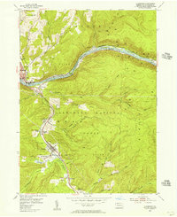
 - 1954 Map of Warren, 1956 Print
 1954 Warren1956 Print · USGSCovers Warren County, including Warren, North Warren, and other nearby areas6 unique versions available
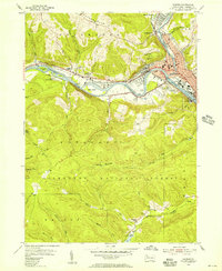
 - 1957 Map of Warren, 1964 Print
 1957 Warren1964 Print · USGSCovers Warren County, including Saint Marys, Sandy Township, and other nearby areas4 unique versions available
Showing maps 1-25 of 49
Top cities of Warren County
- Warren historical maps
- Sheffield Township historical maps
- Youngsville historical maps
- Pittsfield Township historical maps
- Spring Creek Township historical maps
- Tidioute historical maps
See more
Frequently asked questions
- What are the different types of historical maps available for Warren County?
- What is the oldest map of Warren County?
- Where can I purchase historical maps of Warren County for my home or office?
- Where can I download high-res historical maps of Warren County?
- Are there historical topographic maps available for Warren County?
- Is there historical aerial imagery available for Warren County?
- Where are historical maps of Warren County sourced from?